Archive for the ‘Google Earth’ Category

New Pyongyang imagery on Google Earth…

Tuesday, May 11th, 2010

…and it is stunningly clear. 

We can finally see the galss starting to go up on the Ryugyong Hotel:

ryugyong-with-glass-thumb.jpg

Click image for larger version

I also blogged a few weeks ago about new housing construction near the Potongang Gate (see here).  Well this project is nearing completion (at least from the outside).

mansudae-housing-final-thumb.jpg

Click image for larger version

We can also see the new Pyongyang Folk Village taking shape (39° 3’40.12″N, 125°49’28.42″E).  Here is an overview of the facility:

pyongyang-minsok-village-thumb.jpg

Here are the replicas of Pyongyang landmarks under construction:

mini-pyongyang-thumb.jpg

As I mentioned in a previous blog post, there seem to be replicas of different burial mounds, the West Sea Barrage, Monument to Party Founding, Ryugyong Hotel, Mangyongdae Children’s Palace, and much more.  There even appears to be a miniture Korean Penninsula that visitors can walk around.

Share

Kim Jung-rin’s farewell ride

Sunday, May 2nd, 2010

Last week, NK Leadership Watch wrote about the funeral of Kim Jung-rin.  Using a video of the funeral I was able to map out the procession and solve a mystery I have wondered about for some time: Where does the DPRK hold state funerals?

First, below is a map of the likely funeral procession.  It starts in Potonggang District and travels to the Patriotic Martyr’s Cemetery in the north of the city.   It is probably safe to assume that most state funerals these days follow the same route.  I only offer one caveat, however, it is possible state funeral processions drive past Kamsusan Memorial Palace rather than taking the most direct route:

funeral-procession.JPG

Click image for larger version.

Below is an image of the building where the funeral was held.  I am told by a North Korean defector that it is called Sojang Hall (서장구락부). It is managed by the State Funeral Committee.  Its coordinates are  39° 2’13.73″N, 125°44’14.74″E.

state-funeral-hall.JPG

Click image for larger version

I did some  quick research with the indispensable Stalin Search Engine and put together a list of officials who have received state funerals since 1996 (all Central Committee members):  Kim Jung Rin, Hong Song Nam, Pak Song Chol, Yon Hyong Muk, Ri Tu Ik, Ri Jong Ok, Kim Pyong Sik, Jon Mun Sop, Kim Kwang Jin, Choe Kwang.

There is apparently another kind of prestigious funeral in the DPRK called a “People’s Funeral,” however, I can only find one individual who received one: Ri In Mo.  Indeed it appears that the “People’s Funeral” was created specifically to honor him.  Read more in KCNA here, here, and here.

Share

KPA Reconnaissance Bureau (Unit 586) located

Wednesday, April 28th, 2010

UPDATE:  The Reconnaissance Bureau was recently reorganized.  Joeseph Bermudez has all the information on the reorganization.  Check it out here.

ORIGINAL POST: Kim Jong-il recently visited the Reconnaissance General Bureau (formerly Reconnaissance Bureau) which is assigned the military cover designation of 586 and is frequently known as 586th Army Unit.  The bueau was recently accused of ordering the assassination of Hwang Jang-yop (A claim the DPRK denies).  NK Leadership Watch has full video  of the visit, but here are some photos:

kpa-kji-recon-bureau1.JPG

 kpa-kji-recon-bureau2.JPG

Today a  reader contacted me claiming to have located this facility on Google Earth.  I believe this person is correct. Here is the satellite image:

kpa-recon-bureau.JPG

Click on the image for a larger version.  The coordinates are:  39° 6’28.45″N, 125°43’53.86″E.  You can see it in Wikimapia here.

The Korea Herald has more.

My congratulations to the reader for finding this one.

Share

Waste management in the DPRK

Sunday, April 25th, 2010

UPDATE: Lots of additional helpful information in the comments section at the bottom of this post.

ORIGINAL POST: It is not glamorous, but it is interesting–and largely unexplored.

In all the time I have spent visiting or investigating the DPRK I have been curious about how they handle waste management and sanitation.  There is not much written on the subject (other than periodic reports that people collect their solid waste for fertilizer, or that school kids were sent out to collect it during the Arduous March), so I thought I would kick off a discussion about the topic and if any readers can point out more information, I would appreciate it.

Where does the garbage go?
On my second trip to the DPRK, I saw a garbage incinerator next to the Moranbong Middle School.


Click on the image above for a larger version.  The garbage incinerator is in the lower left corner. A satellite image showing its location is here. It is awkwardly placed next to the school and a children’s playground, and it is probably for use by residents of the nearby apartment block.  Maybe this is under the control of the building inminban.  After seeing it, however, I assumed that residents of Pyongyang simply burned their trash in similar facilities all across the city—but I never saw another incinerator in Pyongyang or any other city I visited. Later I was told by some defectors that garbage was collected (for some anyway–I don’t have any details) and that garbage is buried in actual landfills.  Since the DPRK is a poor country, we can expect the level of garbage to be lower than in neighboring countries, but in all the thousands of hours I have spent looking at North Korea on Google Earth, I never saw an easily identifiable landfill…until March of this year.  Below is both the largest (and only) landfill I have identified in the DPRK:

landfill.JPG

The coordinates are  37°57’12.80″N, 125°21’36.11″E in Ongjin (South West).  It is approximately 33 meters in diameter at its widest point.  There is no telling what is in there or how well it is sealed off from the local water table.  If any former residents of Ongjin happen to see this post and can fill in the details, please let me know.

One highly-qualified reader asserts that there is no way this could be a landfill, but has no idea what it could be.  If anyone else has a hypothesis about this location, please let me know.

Sewage Investments:
I have also been cataloging sewage and water treatment facilities across the DPRK.  Not surprisingly, there are few to be found.  The largest facility, however seems to be under construction north of Pyongyang.  It has been under construction since approximately August 2005 and it is still not complete.  It is located at  39° 7’6.80″N, 125°46’20.87″E, and here are some photos of its development:

py-water-treatment.JPG

py-water-treatment-2.JPG

py-water-treatment-3.JPG

Thanks to a tip from Michael we can also see the crumbling of the Phyongchon District (Pyongyang) sewage plant:

py-water-treatment-old.JPG

 py-water-treatment-new.JPG

Kuwait was reported to be lending the DPRK $21m to update its water and sewage facilities. The indispensable Stalin Search engine has more on Kuwait and the DPRK.

So if anyone knows of any papers, etc. on sanitation in the DPRK, please let me know.

Share

Mansudae Street residential construction

Friday, April 16th, 2010

UPDATE: Here is a satellite image of the completed project:

mansudae-housing-final-thumb.jpg

UPDATE: Mansudae Street construction is now visible on Google Earth.  Below I have included before and after pictures.  If you open them in separate browsers, you can click back and forth between images to compare.

mansudae-street-12-2006-thumb.jpg

mansudae-street-1-2009-thumb.jpg

ORIGINAL POST: As capitalist countries are struggling with falling property values and a glut of housing inventories, Pyongyang is experiencing a housing construction boom (previously covered here and here). In North Korea, however, the housing boom is not the result of an “unexpected” asset bubble but rather a deliberate government policy to achieve a “strong and prosperous country (Kangsong Taeguk)” by 2012 — the year the earth is predicted to be destroyed according to the Mayan calendar.

As part of this construction boom, the North Koreans are (re)building a substantial number of housing units on Mansudae Street east of the Potong River Gate and north of the Russian Embassy.  Kim Jong il recently gave an “on-the-spot-guidance” visit there, so using information provided in the coverage of his tour, I was able to map out the areas to be torn down and rebuilt.

First, here is the image from Kim’s visit (courtesy of Daylife and Reuters):

osg-mansudae-construction-10-09.jpg
(click image to enlarge)

Using this and other information, I was able to map out the construction areas in Google Earth.  Here are some pictures to explain the scale of the work (click images to enlarge):

satellite-before.JPG
Construction area

satellite-after.JPG
(red=demolish/rebuild; white=preserved)

Previous real estate posts can be read here.

Previous construction posts can be read here.

If you would like to make an effort at improving on my work, you can download my Google Earth overlay here and use it yourself. Some of the buildings in the construction area are specifically identified in North Korea Uncovered.

UPDATE: Here are some pics of the construction site:

construction09-1.jpgconstruction09-2.jpgconstruction09-3.jpgconstruction09-4.jpgconstruction09-5.jpgconstruction09-6.jpg

Share

Propaganda on ice

Friday, April 16th, 2010

The image below was taken on Jan 27, 2009.  The coordinates are 39° 9’33.50″N, 125°40’35.96″E.  The writing is appx 8.4m tall and 22.7m in width.

kangsong-taeguk-on-ice.jpg

kangsong-on-ice-2.jpg

강성대국 reads “Kangsong Taekuk” which loosely translates to “A strong and prosperous nation”

Share

PSCORE offers Google Earth locations

Friday, April 16th, 2010

PSCORE (People for Successful COrean REunification) is a non-profit, non-religious, non-partisan NGO based in Seoul & Washington, DC. According to their web page, they “strive for mutual understanding and harmony between the two Koreas and aim to provide a platform to discuss topics such as democratization, human rights and social issues.”

pscore-ichon.jpg

Well the team at PSCORE just sent me some North Korea map locations to add to the next version of the Google Earth project.  I am looking forward to sorting these out over the weekend, but just so you don’t have to wait on me, I have posted them on line for you to download yourself. 

Click here to download the PSCORE Google Earth locations.

Click here to learn more about PSCORE.

Share

Monument to the African Renaissance Unveiled

Sunday, April 4th, 2010

Click image for larger version

UPDATE 6:  According to KCNA:

Kim Yong Nam Attends Unveiling Ceremony

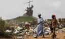
Pyongyang, April 4 (KCNA) — Kim Yong Nam, president of the Presidium of the DPRK Supreme People’s Assembly on an official goodwill visit to Senegal, participated in the ceremony for unveiling the “Monument to Revival of Africa” on Saturday.

The monument represents in a formative artistic way the strong stamina and will of the African people to bring about their bright future by their own efforts while aspiring after independence and building of a new society. It has been successfully built in a short span of time with help of Korean technicians.

Present at the ceremony were Senegalese President Abdoulaye Wade and heads of state and government from at least 20 African countries, representatives of different international and regional organizations, diplomatic envoys of different countries in Dakar and thousands of its citizens.

Incumbent and former presidents of African countries and representatives of international and regional organizations said at the ceremony that this wonderfully-built monument is pride of not only Senegal but also Africa.

They expressed belief that the African people would make greater progress with the conviction of the future.

UPDATE 5: Senegal unveils £17m African Renaissance statue built by North Korea’s Mansudae Overseas Investment Group.  According to the Gaurdian:

Senegal’s vast African Renaissance monument was unveiled yesterday amid criticism that the 49-metre bronze statue is a presidential vanity project and waste of money.

The representation of a man, woman and child emerging from a volcano was inaugurated at a ceremony featuring hundreds of drummers and dancers.

The statue, which cost £17m and is taller than the Statue of Liberty, stands on a hill overlooking the capital, Dakar. It marks Senegal’s 50 years of independence, and the president, Abdoulaye Wade has said he hopes it will become a tourist attraction.

Wade, 83, who is expected to seek another term in office at elections in 2012, said the monument commemorated the entire continent. “It brings to life our common destiny,” Reuters reported him saying at the launch ceremony. “Africa has arrived in the 21st century standing tall and more ready than ever to take its destiny into its hands.”

Wade has faced criticism for spending so much money on the structure when Dakar residents living in its shadow endure regular power blackouts and flooding. He has angered both Senegal’s Christian minority and some within the Muslim majority population.

Wade apologised to the former group after likening the monument to Christ, while some imams have condemned the Soviet realist-style statue as idolatrous. Other have expressed concern at the thigh-length hemline skirt worn by the female figure.

UPDATE 4: According to Access Asia’s Weekly Website Update – 1st April 2010:

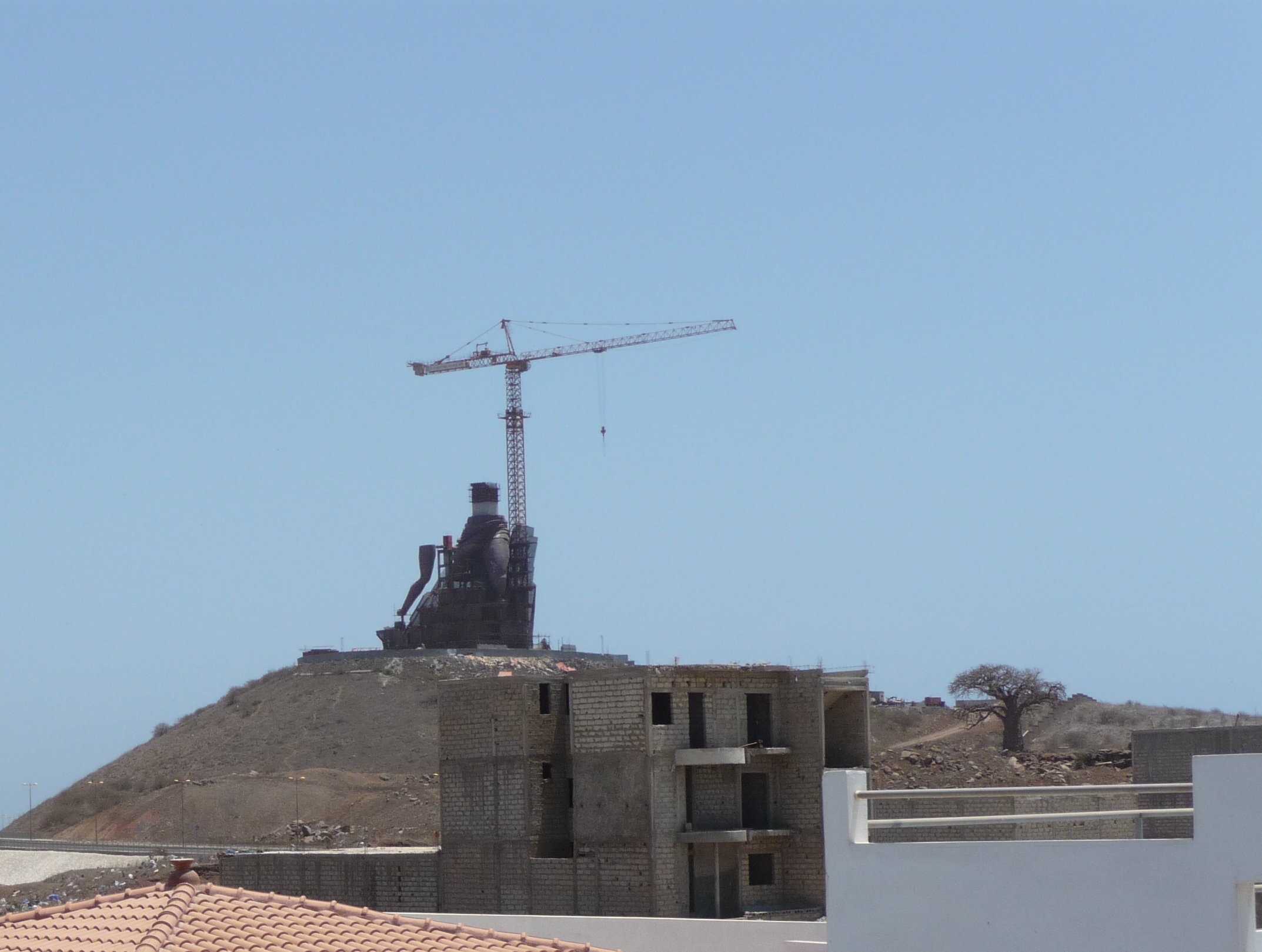
Senegal may not have much to attract tourists, but it does now have something most other potential holiday destinations don’t – a 50 metre high bronze monument crafted by North Koreans. It’s a quick bit of profit for Pyongyang. Hopelessly corrupt and slightly potty Senegalese president Abdoulaye Wade wanted a tall bronze statue – and what he wants, he gets. Actually it’s taller than the Statue of Liberty in the very-difficult-to-get-a-visa-in-these-days United States of America. Called “African Renaissance” it stands on a hill near Dakar International Airport and represents a heroic couple apparently about to launch their child into the sky, for some reason unspecified.

President Wade couldn’t afford the statue so he called in Pyongyang as specialists in providing oversized tat. They did, in return for a prime chunk of real estate in exchange. Pyongyang has since sold the land on, making a tasty profit. Senegal, still mired in poverty, now has Africa’s daftest statue and some dodgy property developers in charge of a chunk of their land – fair swap?

UPDATE 3: Great photos here (h/t Marmot)

UPDATE 2: The Wall Street Journal fills in some more details on the Monument:

This month, workers from Mansudae Overseas Project Group of Companies, a North Korean design firm, were putting the finishing touches on a giant copper sculpture of a family. Senegal President Abdoulaye Wade will inaugurate the African Renaissance Monument in April to mark the 50th anniversary of the country’s independence from France, a ceremony he expects the president of North Korea’s Parliament to attend.

“Only the North Koreans could build my statue,” says Mr. Wade, sitting in a red velvet chair in his palace. Moreover, they offer monuments at a good rate, he says: “I had no money.”

North Korea is mainly known for a totalitarian regime overseeing economic failure. But it has also produced a successful export business—building monuments to freedom and independence. The statues’ selling point: They are big, simple and cheap.

Over the past decade, Mansudae has built dozens of statues and monuments for cash-strapped African countries. Botswana cut the ribbon on a memorial to three tribal chiefs in 2005. Neighboring Namibia boasts a bronze of its founding president wielding an AK-47.

The African Renaissance is Mansudae’s biggest work yet, measuring 164 feet high and crowning two barren hills in Dakar called “Les Mamelles” at the westernmost point of Africa. That makes it taller than either the Statue of Liberty (151 feet) or Rio de Janeiro’s Christ the Redeemer (100 feet). The statue depicts a father holding a baby in his left arm. The man’s right arm is around the waist of the baby’s mother. The three are reaching out to the sky and out to the ocean.

“Its message is about Africa emerging from the darkness, from five centuries of slavery and two centuries of colonialism,” says Mr. Wade.

Africa’s rash of nationalistic monuments, statues and shrines has made Mansudae’s signature aesthetic of socialist realism fashionable. In Benin, for example, a statue of a 19th-century king holds his hand up, symbolically forbidding the French to enter.

Socialist realism is popular “because people can access it easily,” says Mary Jo Arnoldi, curator for African Ethnology at the Smithsonian Institution. It is easy to understand for illiterate populations, she says. “But aesthetically, it’s not going to win any prizes.”

In Senegal, however, the statue has been a beacon of discontent, sparking angry newspaper editorials and protests from religious leaders. The statue’s sultry mother figure, dressed in a wisp of fabric that reveals part of a breast and a bare leg, has offended imams in this majority-Muslim country.

Financing details for the project have been murky, and some taxpayers are outraged by the very idea of it when power outages occur daily and university students strike over rising fees. Mr. Wade had no budget for the African Renaissance, so instead offered a prime chunk of state-owned land in exchange, which North Korea has since resold at a large profit, he says.

However, a panel near the base of the monument lists the official budget as $25 million, though foreign government officials estimate its cost at around $70 million. Mr. Wade says he plans to keep 34% of the profit from entrance fees and merchandise for a personal foundation.

The North Korean role is of less concern, though labor unions do lament that Mansudae got the job when an estimated 49% of the population is unemployed: 150 North Koreans are building the statue, helped by just 50 Senegalese. Mamadou Diouf, the head of the Confederation of Autonomous Unions of Senegal, says the project doesn’t look African.

“If [building the statue] was a priority for our country, it could have been done by Senegalese workers in a manner much more in line with our values,” he says.

A short video related to this story can be seen here.

The monument’s location is here.

UPDATE 1: The Guradian brings us up to date with the monument’s construction:

monument-of-the-african-r-001.jpg

According to the Guardian:

The statue shows a muscular man in a heroic posture, outstretched arms wrapped around his wife and child. Nearly 50 North Korean workers were brought in to build it, because of their expertise with bronze art, and some Senegalese have complained of its communist-era design. It has also drawn criticism from Muslims, who make up 94% of Senegal’s population, because of Islamic prohibitions on representations of the human form.

Abdoulaye Wade, Senegal’s octogenarian president, has compared the work to some of the west’s best-known landmarks, and some Senegalese do regard it as a symbol of pride that has economic spin-offs.

Alassane Cisse, a Senegalese delegate at the world summit on arts and culture in Johannesburg, South Africa, said: “All cities need signatures, but in Dakar we have had only monuments which existed during colonisation. Africa needs its own great monuments like the Eiffel tower and the Statue of Liberty. This symbol of African renaissance will motivate people to rehabilitate and work with Africa.”

He added that the site has exhibition, multimedia and conference rooms, as well as a top-floor viewing platform giving a bird’s eye view of Dakar. “It will be a cultural place. Around the monument there will be a theatre and shops. Many tourists will visit there, so the economic effects will benefit the population.”

But the president has sparked anger by maintaining that he is entitled to 35% of any tourist revenues it generates, because he owns the “intellectual rights”.

Critics say the £17m could have been used for more pressing concerns. Djiby Diakhate, a sociologist at Dakar’s Cheikh Anta Diop university, told the Associated Press: “Senegal is going through a profound crisis. Our economy is dying. People are struggling to eat. We should be spending money helping people survive.”

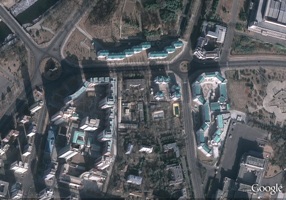
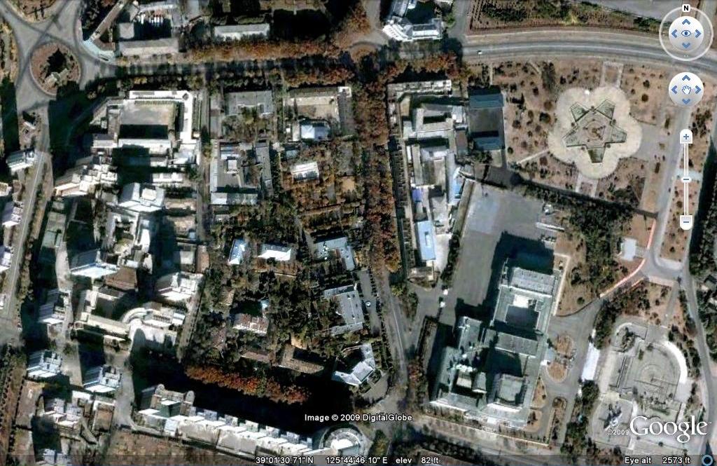
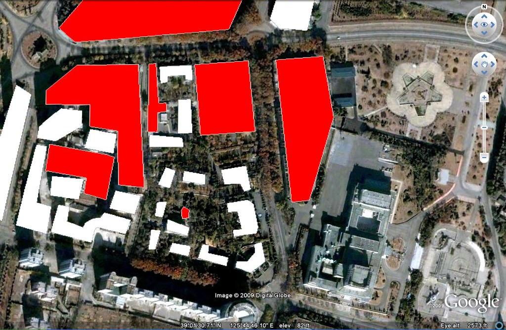
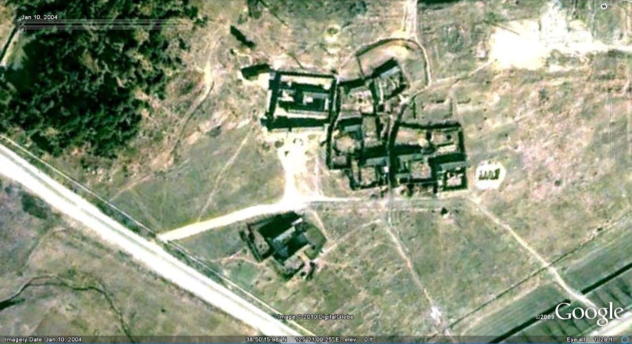
ORIGINAL POST: As some readers may be aware, I have been tracking down monuments and buildings constructed by North Korea’s Mansude Overseas Project Group.  To date, I have tracked down quite a few (see North Korea Uncovered for the full list).

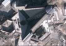
One such find is the “Monument to the African Renaissance” in Dakar, Senegal.  See this Voice of America story for background.  Well, a friend of mine recently visited Dakar and snapped this photo of the monument’s construction:

african-renaissance.JPG

Click on image for larger version

I believe we can see a leg on the lower left.  The majority of the construction so far seems to be support.

Note to readers: if you are aware of any other North Korean-built (or operated) buildings/monuments/businesses/restaurants in your country, please let me know. I do not believe a comprehensive list of these projects exists, so getting this information together now will certainly be valuable to future historians. How is that for motivation?

Share

Friday Fun

Thursday, February 4th, 2010

1. Alejandro Cao de Benos, head of the Korean Friendship Association,  did an interview for an Italian publication (Page 1, Page 2).  Josh is posting a translation: part 1, part 2, part 3, part 4.

2. Flower of Reunification: North Korean propaganda film about Im Suk Yong.  Lots of great footage of the 1989 World Festival of Youth and Students in Pyongyang.  Part 1, Part 2, Part 3, Part 4, Part 5, Part 6, Part 7.

3. North Korea has launched a new propaganda campaign aiming to increase living standards.  See the new paintings in the Choson Ilbo here.

 4. Ice skating: Pyongyang might have the DPRK’s only indoor ice skating rink (as far as I know), but ice skating–particularly on frozen rivers and lakes–seems to be pretty popular in the DPRK.  Scenes like the one below (Hyangsan) can be easily found in North Korea on Google Earth:

hyangsan-ice-skating.JPG

5. Reunification fruit.

6. According to Google’s international dailing chart, North Korea and Cuba are the most expensive places to call!

7. North East Asia Matters posts interview with former member of KJI pleasure squad.

Share

Google Earth as a historical document

Monday, January 25th, 2010

As I continue to make updates to the North Korea Google Earth project, I have begun mulling over the idea of Google Earth as a historical document. Being new, I believe it is underused by the academy, but it really is amazing what Google Earth captures in its historical imagery that would be lost forever–were it not saved in this software.  Here are a few minor examples from North Korea:

Sometimes the Propaganda goes away:

3-23-2006-propaganda.JPG 10-5-2007-propaganda.JPG

12-10-2001-propaganda1.JPG 11-12-2006-d-propaganda.JPG

4-28-2002-propaganda.JPG 12-26-2008-propaganda.JPG

3-10-2002-propaganda.JPG 11-12-2006-b-propaganda.JPG

11-12-2006-c-propaganda.JPG 12-28-2006-propaganda.JPG

1-8-2007-propaganda.JPG 12-16-2007-propaganda.JPG 

Hoeryong market: Hoeryong has undergone significant changes in the time between 2002 and 2008 (when the Google Earth images were taken).  It is well worth checking out all of the changes, but I point out below how the market has been moved farther from the town center and displaced a high school.  It looks like a new building is going up where the market used to be:

hoeryong-4-28-2002.JPG hoeryong-12-26-2008.JPG

Other Market expansions: despite the regime’s crack down on market activity in the last few years, we can see how these markets have grown (in number and scale) on Google Earth:

6-16-2003-market-a.JPG 9-29-2008-market-a.JPG

This market in Pyongyang was closed and moved to a better facility

6-5-2004-py-mkt-c.JPG 4-7-2005-py-mkt-c.JPG

This street market in Songrim also got a recent upgrade:

11-12-2006-songrim-market.JPG 4-17-2009-songrim-market.JPG

Here is a previous post on a Sinuiju market upgrade.

Here is a previous post on Haeju’s upgraded markets.

Villages removed: Some entire villages have been torn down.

10-9-2004-villages.JPG 11-12-2006-village.JPG

Environmental impact of new projects:Such as dam construction…

9-29-2004-dam.JPG 10-5-2007-dam.JPG

There are plenty of pictures of dam construction which you can easily access.  The dam below flooded a former air force training area:

5-4-2004-kpaf-flood.JPG 9-29-2008-kpaf-flood.JPG

Historical restoration: Kim Ung So House (North of Nampo).

1-10-2004-restoration.JPG 3-2-2005-restoration.JPG 10-2-2006-restoration.JPG

Seeing through the camoflauge: POL storage

4-7-2005-camo.JPG 9-29-2008-camo.JPG

Some of this was picked up in an RFA article here.

Share