Archive for the ‘Golf’ Category
Tuesday, November 29th, 2011
UPDATE 2: A recent tourist who visited Yanggak Island in Pyongyang sent in this photo near the construction site:
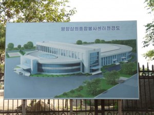
삼의종합봉센터
UPDATE 1 (2012-7-17): It looks like the progress on this Chinese-funded health complex on Yangak Island is continuing. I found this recent photo taken by a tourist:
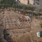
ORIGINAL POST (2011-11-29):
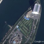
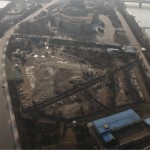
Pictured above (L) is a Google Earth satellite image of the Yanggakdo Golf Club as of 2010-10-6. Pictured to the right is the course as it looks “today”. It has been removed. It looks like something new is being constructed in its place!
Although this nine-hole course has been destroyed, there are still several golf options available in the DPRK if you get the chance:
Pyongyang Golf Course (18 holes):
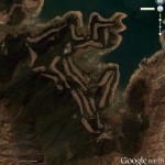
Google Earth: 38.893709°, 125.435921°
Kumgangsan Golf course (18 holes):
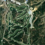
Google Earth: 38.712574°, 128.213298°
KEDO Driving Range:
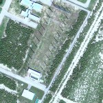
Google Earth: 40.045135°, 128.322831°
Pyongyang Driving Range:
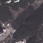
Google Earth: 39.011826°, 125.694263°
And this three-hole course at an exclusive leadership compound (Wonhung-ri, Samsok-guyok, Pyongyang):
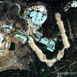
Google Earth: 39.110016°, 125.996765°
Posted in Construction, Golf, Sports | 4 Comments »
Sunday, January 16th, 2011
UPDATE 2: Apparently female graduates of the DPRK’s most prestigious university can look forward to careers as….Golf Caddies. According to the Choson Ilbo:
He said there are about 30 female caddies at the complex in their 20s or 30s, many of them graduates of the prestigious Kim Il-sung University. “Caddies were beautiful and considerate,” he said. “After I finished playing golf, I came out of the shower at the club house, and there was a woman dressed in traditional Korean costume holding a towel. I instantly wondered whether there was another service waiting for me, but there was no 19th hole.”
UPDATE 1: Simon adds some interesting information in the comments section below. Also, here are two additional stories about a golf tournament held back in 2004: story one, story two.
ORIGINAL POST:
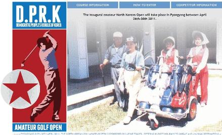
Click image to visit the official web page
According to the Choson Ilbo:
North Korea will host its first ever amateur golf tournament for foreign visitors. London-based Lupine Travel on Thursday announced that together with China Youth Travel Service of Dandong, it is organizing the North Korean Amateur Open for golfers from around the world in Pyongyang from April 26 to 30.
Lupine Travel, which specializes in tour packages to unique destinations, is currently offering a five-day tour to the North through the website www.northkoreanopen.com.
According to the website, any amateur golfer who hits an average of 90 can take part. The package costs 999 euros, and includes visas, tournament entry, return train travel from China into North Korea, meals and accommodation.
Pyongyang Golf Complex, located near Taicheng Lake some 27 km from the capital, is the only golf course in the country for North Koreans. The Korea LPGA Pyongyang Open was held there in August 2005.
“The 18-hole, par 72 course covers 120 hectares with 45 hectares of green and is 7 km long. The course can service up to 100 competitors at a time and includes a service area covering 2700 square meters; including shops, restaurants, conference facilities and a sauna,” the website said. “When Kim Jong-Il opened the course in 1991, he shot a world record 38 under par on his first ever round of golf (including 11 holes in one).”
The Wall Street Journal’s Korea Real Time also covered the announcement.
North Korea has four golf facilities and one driving range. Only three golf facilities are in operation and only two open to “the public”. Here are satellite images of all four (the last image was taken when the golf course was under construction): Pyongyang Country Club, Yangak Golf Course, Sosan Driving Range, elite three-hole range, and Kumgangsan (under construction in the image).
Posted in Education, Golf, Sports, Uncategorized | 1 Comment »
Thursday, June 25th, 2009
 North Korea Uncovered version 18 is available. This Google Earth overlay maps North Korea’s agriculture, aviation, cultural locations, markets, manufacturing facilities, railroad, energy infrastructure, politics, sports venues, military establishments, religious facilities, leisure destinations, and national parks.
This project has now been downloaded over 140,000 times since launching in April 2007 and received much media attention last month following a Wall Street Journal article highlighting the work.
Note: Kimchaek City is now in high resolution for the first time. Information on this city is pretty scarce. Contributions welcome.
Additions to this version include: New image overlays in Nampo (infrastructure update), Haeju (infrastructure update, apricot trees), Kanggye (infrastructure update, wood processing factory), Kimchaek (infrastructure update). Also, river dredges (h/t Christopher Del Riesgo), the Handure Plain, Musudan update, Nuclear Test Site revamp (h/t Ogle Earth), The International School of Berne (Kim Jong un school), Ongjin Shallow Sea Farms, Monument to “Horizon of the Handure Plain”, Unhung Youth Power Station, Hwangnyong Fortress Wall, Kim Ung so House, Tomb of Kim Ung so, Chungnyol Shrine, Onchon Public Library, Onchon Public bathhouse, Anbyon Youth Power Stations.
Posted in Agriculture, Alcohol, Architecture, Art, Automobiles, Aviation, Banking, Coal, Communications, Construction, Dams/hydro, Education, Electricity, Energy, Environmental protection, Film, Football (soccer), Forestry, Gambling, Gasoline, General markets (FMR: Farmers Market), Golf, Google Earth, Health care, Hoteling, Hwanggumphyong and Wihwado Economic Zones (Sinuiju), Intranet, Kaesong Industrial Complex (KIC), Mass games, Mt. Kumgang Tourist Special Zone, Nuclear, Oil, Pyongyang Metro, Railways, Rason Economic and Trade Zone (Rajin-Sonbong), Religion, Restaurants, Sea shipping, Sports, Tourism, Transportation, Wind | 4 Comments »
Wednesday, March 11th, 2009
North Korea Uncovered v.16
Download it here
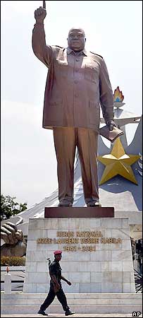
The most recent version of North Korea Uncovered (North Korea Google Earth) has been published. Since being launched, this project has been continuously expanded and to date has been downloaded over 32,000 times.
Pictured to the left is a statue of Laurent Kabila of the Democratic Republic of Congo. This statue, as well as many others identified in this version of the project, was built by the North Koreans. According to a visitor:
From the neck down, the Kabila monument looks strangely like Kim Jong Il: baggy uniform, creased pants, the raised arm, a little book in his left hand. From the neck up, the statue is the thick, grim bald mug of Laurent Kabila (his son Joseph is the current president). “The body was made in North Korea,” explains my driver Felix. In other words, the body is Kim Jong Il’s, but with a fat, scowling Kabila head simply welded on.
This is particularly interesting because there are no known pictures of a Kim Jong il statue. The only KJI statue that is reported to exist is in front of the National Security Agency in Pyongyang. If a Kim Jong il statue does in fact exist, it might look something like this.
Thanks again to the anonymous contributors, readers, and fans of this project for your helpful advice and location information. This project would not be successful without your contributions.
Version 16 contains the following additions: Rakwon Machine Complex, Sinuiju Cosmetics Factory, Manpo Restaurant, Worker’s Party No. 3 Building (including Central Committee and Guidance Dept.), Pukchang Aluminum Factory, Pusan-ri Aluminum Factory, Pukchung Machine Complex, Mirim Block Factory, Pyongyang General Textile Factory, Chonnae Cement Factory, Pyongsu Rx Joint Venture, Tongbong Cooperative Farm, Chusang Cooperative Farm, Hoeryong Essential Foodstuff Factory, Kim Ki-song Hoeryong First Middle School , Mirim War University, electricity grid expansion, Tonghae Satellite Launching Ground (TSLG)” is also known as the “Musudan-ri Launching Station,” rebuilt electricity grid, Kumchang-ri suspected underground nuclear site, Wangjaesan Grand Monument, Phothae Revolutionary Site, Naedong Revolutionary Site, Kunja Revolutionary Site, Junggang Revolutionary Site, Phophyong Revolutionary Site, Samdung Revolutionary Site, Phyongsan Granite Mine, Songjin Iron and Steel Complex (Kimchaek), Swedish, German and British embassy building, Taehongdan Potato Processing Factory, Pyongyang Muyseum of Film and Theatrical Arts, Overseas Monuments built by DPRK: Rice Museum (Muzium Padi) in Malaysia, Statue de Patrice Lumumba (Kinshasa, DR Congo), National Heroes Acre (Windhoek, Namibia), Derg Monument (Addis Ababa, Ethiopia), National Heroes Acre (Harare, Zimbabwe), New State House (Windhoek, Namibia), Three Dikgosi (Chiefs) Monument (Gaborone, Botswana), 1st of May Square Statue of Agostinho Neto (Luanda, Angola), Momunment Heroinas Angolas (Luanda, Angola), Monument to the Martyrs of Kifangondo Battle (Luanda, Angola), Place de l’étoile rouge, (Porto Novo, Benin), Statue of King Béhanzin (Abomey, Benin), Monument to the African Renaissance (Dakar, Senegal), Monument to Laurent Kabila [pictured above] (Kinshasa, DR Congo).
Posted in Agriculture, Architecture, Art, Automobiles, Aviation, Banking, Coal, Communications, Computing/IT, Construction, Dams/hydro, Education, Electricity, Energy, Environmental protection, Figure skating, Film, Finance, Fiscal & monetary policy, Food, Football (soccer), Forestry, Gambling, Gasoline, General markets (FMR: Farmers Market), Golf, Google Earth, Health care, Hoteling, Hwanggumphyong and Wihwado Economic Zones (Sinuiju), Intranet, Kaesong Industrial Complex (KIC), Leisure, Library, Light Industry, Mansudae Overseas Development Group, Manufacturing, Mass games, Military, Mining/Minerals, Mt. Kumgang Tourist Special Zone, Music, Nuclear, Oil, Pyongyang Metro, Railways, Rason Economic and Trade Zone (Rajin-Sonbong), Real estate, Religion, Restaurants, Sea shipping, Special Economic Zones (Established before 2013), Sports, Telephones, Television, Tourism, Transportation, Water, Wind | 10 Comments »
Thursday, October 2nd, 2008
North Korea Uncovered: Version 12
Download it here
 About this Project: This map covers North Korea’s agriculture, aviation, cultural locations, markets, manufacturing facilities, energy infrastructure, political facilities, sports venues, military establishments, religious facilities, leisure destinations, national parks, shipping, mining, and railway infrastructure. It is continually expanding and undergoing revisions. This is the 12th version.
Additions include: Tongch’ang-dong launch facility overlay (thanks to Mr. Bermudez), Yongbyon overlay with destroyed cooling tower (thanks to Jung Min Noh), “The Barn” (where the Pueblo crew were kept), Kim Chaek Taehung Fishing Enterprise, Hamhung University of education, Haeju Zoo, Pyongyang: Kim il Sung Institute of Politics, Polish Embassy, Munsu Diplomatic Store, Munsu Gas Station, Munsu Friendship Restaurant, Mongolian Embassy, Nigerian Embassy, UN World Food Program Building, CONCERN House, Czech Republic Embassy, Rungnang Cinema, Pyongyang University of Science and Technology, Pyongyang Number 3 Hospital, Electric Machines Facotry, Bonghuajinlyoso, Second National Academy of Sciences, Central Committee Building, Party Administration Building, Central Statistics Bureau, Willow Capital Food House, Thongounjong Pleasure Ground, Onpho spa, Phipa Resort Hotel, Sunoni Chemical Complex (east coast refinery), Ponghwa Chemical complex (west coast refinery), Songbon Port Revolutionary Monument, Hoeryong People’s Library, Pyongyang Monument to the anti Japanese martyrs, tideland reclamation project on Taegye Island. Additionally the electricity grid was expanded and the thermal power plants have been better organized. Additional thanks to Ryan for his pointers.
I hope this map will increase interest in North Korea. There is still plenty more to learn, and I look forward to receiving your contributions to this project.
Version 12 available: Download it here
Posted in Agriculture, Animation, Architecture, Art, Automobiles, Aviation, Banking, Cell phones, Coal, Communications, Computing/IT, Construction, Copper, Dams/hydro, Education, Electricity, Energy, Environmental protection, Film, Finance, Fiscal & monetary policy, Food, Football (soccer), Foreign direct investment, Forestry, Gambling, Gasoline, General markets (FMR: Farmers Market), Gold, Golf, Google Earth, Health care, Hoteling, Hwanggumphyong and Wihwado Economic Zones (Sinuiju), International trade, Joint Ventures, Kaesong Industrial Complex (KIC), Leisure, Library, Light Industry, Lumber, Manufacturing, Mass games, Military, Mining/Minerals, Mt. Kumgang Tourist Special Zone, Music, Nuclear, Pyongyang Metro, Railways, Rason Economic and Trade Zone (Rajin-Sonbong), Real estate, Religion, Restaurants, Sea shipping, Special Economic Zones (Established before 2013), Sports, Television, Tourism, Transportation, Wind | 1 Comment »
Thursday, August 14th, 2008
The most authoritative map of North Korea on Google Earth
Download it here
 This map covers North Korea’s agriculture, aviation, cultural locations, markets, manufacturing facilities, railroad, energy infrastructure, politics, sports venues, military establishments, religious facilities, leisure destinations, and national parks. It is continually expanding and undergoing revisions. This is the eleventh version.
Additions include: Mt. Paegun’s Ryonghung Temple and resort homes, Pyongyang’s Chongryu Restaurant, Swiss Development Agency (former UNDP office), Iranian Embassy, White Tiger Art Studio, KITC Store, Kumgangsan Store, Pyongyang Fried Chicken Restaurant, Kilju’s Pulp Factory (Paper), Kim Chaek Steel Mill, Chongjin Munitions Factory, Poogin Coal Mine, Ryongwun-ri cooperative farm, Thonggun Pavilion (Uiju), Chinju Temple (Yongbyon), Kim il Sung Revolutionary Museum (Pyongsong), Hamhung Zoo, Rajin electrified perimeter fence, Pyongsong market (North Korea’s largest), Sakju Recreation Center, Hoeryong Maternity Hospital, Sariwon Suwon reservoir (alleged site of US massacre), Sinpyong Resting Place, 700 Ridges Pavilion, Academy of Science, Hamhung Museum of the Revolutionary Activities of Comrade Kim Il Sung, South Hamgyong House of Culture, Hamhung Royal Villa, Pork Chop Hill, and Pyongyang’s Olympic torch route. Additional thanks go to Martyn Williams for expanding the electricity grid, particularly in Samjiyon, and various others who have contributed time improving this project since its launch.
Disclaimer: I cannot vouch for the authenticity of many locations since I have not seen or been to them, but great efforts have been made to check for authenticity. These efforts include pouring over books, maps, conducting interviews, and keeping up with other peoples’ discoveries. In many cases, I have posted sources, though not for all. This is a thorough compilation of lots of material, but I will leave it up to the reader to make up their own minds as to what they see. I cannot catch everything and I welcome contributions. Additionally, this file is getting large and may take some time to load.
Posted in Advertising, Agriculture, Architecture, Art, Automobiles, Aviation, Banking, Biotech, Cell phones, Central Broadcasting Station, Coal, Committee for Cultural Relations with Foreign Countries, Communications, Computing/IT, Construction, Dams/hydro, Demographics, Domestic publication, Education, Electricity, Energy, Environmental protection, Film, Finance, Food, Football (soccer), Foreign direct investment, Forestry, Gambling, Gasoline, General markets (FMR: Farmers Market), Golf, Google Earth, Health care, Hoteling, Hwanggumphyong and Wihwado Economic Zones (Sinuiju), Intranet, Joint Ventures, Kaesong Industrial Complex (KIC), Kim Il Sung University, Korean Buddhist Association, Labor conditions/wages, Leisure, Library, Light Industry, Lumber, Mansu Art Studio, Manufacturing, Mass games, Maternity Hospital, Military, Mining/Minerals, Ministry of foreign Affairs, Ministry of Foreign Trade, Ministry of People’s Armed Forces, Ministry of Post and Telecommunications, Ministry of Public Health, Mt. Kumgang Tourist Special Zone, Musan Mine, Nuclear, Oil, Phoenix Commerical Ventures, Pyongyang Embroidery Institute, Pyongyang Film Studio, Pyongyang International Information Center of New Techn, Pyongyang International Trade Fair, Pyongyang Metro, Pyongyang University of Medicine, Radio, Railways, Rason Economic and Trade Zone (Rajin-Sonbong), Real estate, Religion, Restaurants, Sea shipping, Sports, Steel, Supreme Peoples Assembly, Tourism, Transportation, Wind | 6 Comments »
Wednesday, May 28th, 2008
UPDATE: The Kumgangsan Golf Course is located here (Wikimapia), though it is still under construction in these dated images.
ORIGINAL POST: The DPRK’s golf facilities are all easily recognizable from Google Earth: There is the 18 hole course half-way between Pyongyang and Nampo; there is a smaller 9-hole course next to the Yangakdo Hotel; there is a driving range in the Sosan sports district; and there is even a three hole course east of town just south of the Ponghwa Barrage on the Taedong River (This area could be the Ponghwa Executive Apartments mentioned in Kim il Song’s North Korea).
According to Yonhap, the DPRK has successfully expanded their number of golf holes by 60%–increasing them from 30 to 48:
The “Kumgang Ananti Golf and Spa Resort,” including a 18-hole golf course, will open to the public Wednesday after nearly four years of construction, Emerson Pacific Group, a Seoul-based leisure firm, said.
Built on about 1.7 million square meters of land, the resort also has a spa, a hotel and restaurants that provide nice sea and mountain views, according to Kim Min-jeong, a publicity official of the company.
The golf course has already drawn media attention over its 929-meter number three hole, the world’s longest.
The facility, however, will be operated on a membership-only basis for the time being, Kim said, adding that the company plans to open the facility to individual tourists around next year.
Emerson Pacific is waiting for Pyongyang to give the company permission to employ about 200 North Koreans, including 60 caddies, at the resort, the official said.
Read the full story here:
Golf course to open at North Korea’s Mt. Geumgang
Yonhap
5/27/2008
Posted in Golf, Google Earth, Mt. Kumgang Tourist Special Zone, Special Economic Zones (Established before 2013), Sports, Tourism | 1 Comment »
Friday, December 14th, 2007
The most authoritative map of North Korea on Google Earth
North Korea Uncovered v.7
Download it here
 This map covers North Korea’s agriculture, aviation, cultural locations, manufacturing facilities, railroad, energy infrastructure, politics, sports venues, military establishments, religious facilities, leisure destinations, and national parks. It is continually expanding and undergoing revisions. This is the sixth version.
Additions to the latest version of “North Korea Uncovered” include: A Korean War folder featuring overlays of US attacks on the Sui Ho Dam, Yalu Bridge, and Nakwon Munitians Plant (before/after), plus other locations such as the Hoeryong Revolutionary Site, Ponghwa Revolutionary Site, Taechon reactor (overlay), Pyongyang Railway Museum, Kwangmyong Salt Works, Woljong Temple, Sansong Revolutionary Site, Jongbansan Fort and park, Jangsan Cape, Yongbyon House of Culture, Chongsokjong, Lake Yonpung, Nortern Limit Line (NLL), Sinuiju Old Fort Walls, Pyongyang open air market, and confirmed Pyongyang Intranet nodes.
Disclaimer: I cannot vouch for the authenticity of many locations since I have not seen or been to them, but great efforts have been made to check for authenticity. These efforts include pouring over books, maps, conducting interviews, and keeping up with other peoples’ discoveries. In many cases, I have posted sources, though not for all. This is a thorough compilation of lots of material, but I will leave it up to the reader to make up their own minds as to what they see. I cannot catch everything and I welcome contributions.
Posted in Architecture, Art, Automobiles, Aviation, Cell phones, Civil society, Coal, Committee for Cultural Relations with Foreign Countries, Communications, Computing/IT, Construction, Dams/hydro, Department Store No. 1, Education, Electricity, Email, Energy, Film, Finance, Football (soccer), Forestry, Gambling, General markets (FMR: Farmers Market), Golf, Google Earth, Hana Electronics Company, Health care, Hoteling, Hwanggumphyong and Wihwado Economic Zones (Sinuiju), Hyesan Youth Cooper Mine, International Aid, Internet, Intranet, Juche, Kaesong Industrial Complex (KIC), Kim Chaek University of Technology, Kim Il Sung University, Korea Computer Center (KCC), Korean Buddhist Association, Korean People's Army, Light Industry, Lumber, Mansudae creative Company (art studio), Manufacturing, Mass games, Maternity Hospital, Military, Mining/Minerals, Ministry of foreign Affairs, Ministry of Foreign Trade, Mt. Kumgang Tourist Special Zone, Musan Mine, Nuclear, Pyongyang Embroidery Institute, Pyongyang Film Studio, Pyongyang Informatics Center (PIC), Pyongyang International Information Center of New Techn, Pyongyang International Trade Fair, Pyongyang Metro, Pyongyang University of Medicine, Radio, Railways, Rason Economic and Trade Zone (Rajin-Sonbong), Real estate, Religion, Restaurants, Sea shipping, Sports, Television, Transportation, Wind | Comments Closed
Sunday, November 11th, 2007
The most authoritative map of North Korea on Google Earth
North Korea Uncovered: Version 6
Download it here
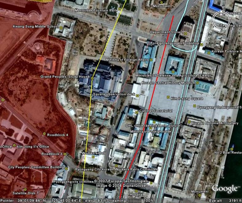 This map covers North Korea’s agriculture, aviation, cultural locations, manufacturing facilities, railroad, energy infrastructure, politics, sports venues, military establishments, religious facilities, leisure destinations, and national parks. It is continually expanding and undergoing revisions. This is the sixth version.
Additions to the newest version of North Korea Uncovered include: Alleged Syrian nuclear site (before and after bombing), Majon beach resort, electricity grid expansion, Runga Island in Pyongyang, Mt. Ryongak, Yongbyon historical fort walls, Suyang Fort walls and waterfall in Haeju, Kaechon-Lake Taesong water project, Paekma-Cholsan waterway, Yachts (3), and Hyesan Youth Copper Mine.
Disclaimer: I cannot vouch for the authenticity of many locations since I have not seen or been to them, but great efforts have been made to check for authenticity. These efforts include pouring over books, maps, conducting interviews, and keeping up with other peoples’ discoveries. In many cases, I have posted sources, though not for all. This is a thorough compilation of lots of material, but I will leave it up to the reader to make up their own minds as to what they see. I cannot catch everything and I welcome contributions.
Posted in Advertising, Agriculture, Architecture, Automobiles, Aviation, Banking, Black markets, Committee for Cultural Relations with Foreign Countries, Communications, Computing/IT, Dams/hydro, Department Store No. 1, Economic reform, Education, Electricity, Energy, Environmental protection, Film, Finance, Fiscal & monetary policy, Football (soccer), Forestry, Gambling, Gasoline, General markets (FMR: Farmers Market), Golf, Google Earth, Hana Electronics Company, Health care, Hoteling, Hwanggumphyong and Wihwado Economic Zones (Sinuiju), Hyesan Youth Cooper Mine, Kaesong Industrial Complex (KIC), Kim Il Sung University, Korea Computer Center (KCC), Library, Light Industry, Mansudae creative Company (art studio), Manufacturing, Mass games, Maternity Hospital, Military, Mining/Minerals, Ministry of Culture, Ministry of Foreign Trade, Mt. Kumgang Tourist Special Zone, Musan Mine, Music, Nuclear, Pyongyang Embroidery Institute, Pyongyang Film Studio, Pyongyang Informatics Center (PIC), Pyongyang International Information Center of New Techn, Pyongyang International Trade Fair, Pyongyang Metro, Railways, Rason Economic and Trade Zone (Rajin-Sonbong), Real estate, Religion, Restaurants, Sea shipping, Special Economic Zones (Established before 2013), Sports, Steel, Supreme Peoples Assembly, Television, Tourism, Transportation, Water, Wind | Comments Closed
Saturday, October 6th, 2007
Version 5: Download it here (on Google Earth)
This map covers North Korea’s agriculture, aviation, cultural locations, manufacturing facilities, railroad, energy infrastructure, politics, sports venues, military establishments, religious facilities, leisure destinations, and national parks. It is continually expanding and undergoing revisions. This is the fifth version.
Additions to the latest version of “North Korea Uncovered” include updates to new Google Earth overlays of Sinchon, UNESCO sites, Railroads, canals, and the DMZ, in addition to Kim Jong Suk college of eduation (Hyesan), a huge expansion of the electricity grid (with a little help from Martyn Williams) plus a few more parks, antiaircraft sites, dams, mines, canals, etc.
Disclaimer: I cannot vouch for the authenticity of many locations since I have not seen or been to them, but great efforts have been made to check for authenticity. These efforts include pouring over books, maps, conducting interviews, and keeping up with other peoples’ discoveries. In many cases, I have posted sources, though not for all. This is a thorough compilation of lots of material, but I will leave it up to the reader to make up their own minds as to what they see. I cannot catch everything and I welcome contributions.
I hope this map will increase interest in North Korea. There is still plenty more to learn, and I look forward to receiving your additions to this project.
Posted in 1990s Famine, Advertising, Agriculture, Architecture, Arduous March, Art, Automobiles, Aviation, Banking, Civil society, Coal, Communications, Computing/IT, Cosmetics, Dams/hydro, DPRK organizations, Economic reform, Education, Electricity, Energy, Environmental protection, Film, Finance, Fiscal & monetary policy, Football (soccer), Foreign direct investment, Forestry, Gambling, Gasoline, General markets (FMR: Farmers Market), Golf, Google Earth, Health care, Hoteling, Hwanggumphyong and Wihwado Economic Zones (Sinuiju), Illicit activities, Juche, Kaesong Industrial Complex (KIC), Labor conditions/wages, Leisure, Library, Light Industry, Manufacturing, Mass games, Military, Mining/Minerals, Mt. Kumgang Tourist Special Zone, Music, Nuclear, Political economy, Pyongyang International Trade Fair, Pyongyang Metro, Radio, Railways, Rason Economic and Trade Zone (Rajin-Sonbong), Real estate, Religion, Restaurants, Sea shipping, Special Economic Zones (Established before 2013), Television, Tourism, Transportation, Water, Worker's Party | 2 Comments »


