…and it is stunningly clear.
We can finally see the galss starting to go up on the Ryugyong Hotel:
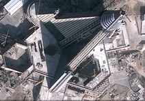
Click image for larger version
I also blogged a few weeks ago about new housing construction near the Potongang Gate (see here). Well this project is nearing completion (at least from the outside).
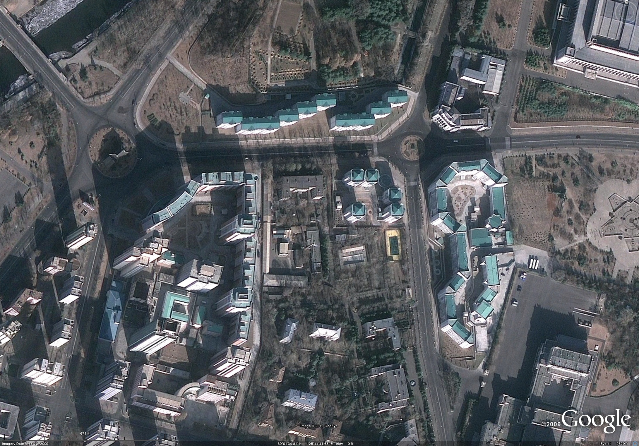
Click image for larger version
We can also see the new Pyongyang Folk Village taking shape (39° 3’40.12″N, 125°49’28.42″E). Here is an overview of the facility:
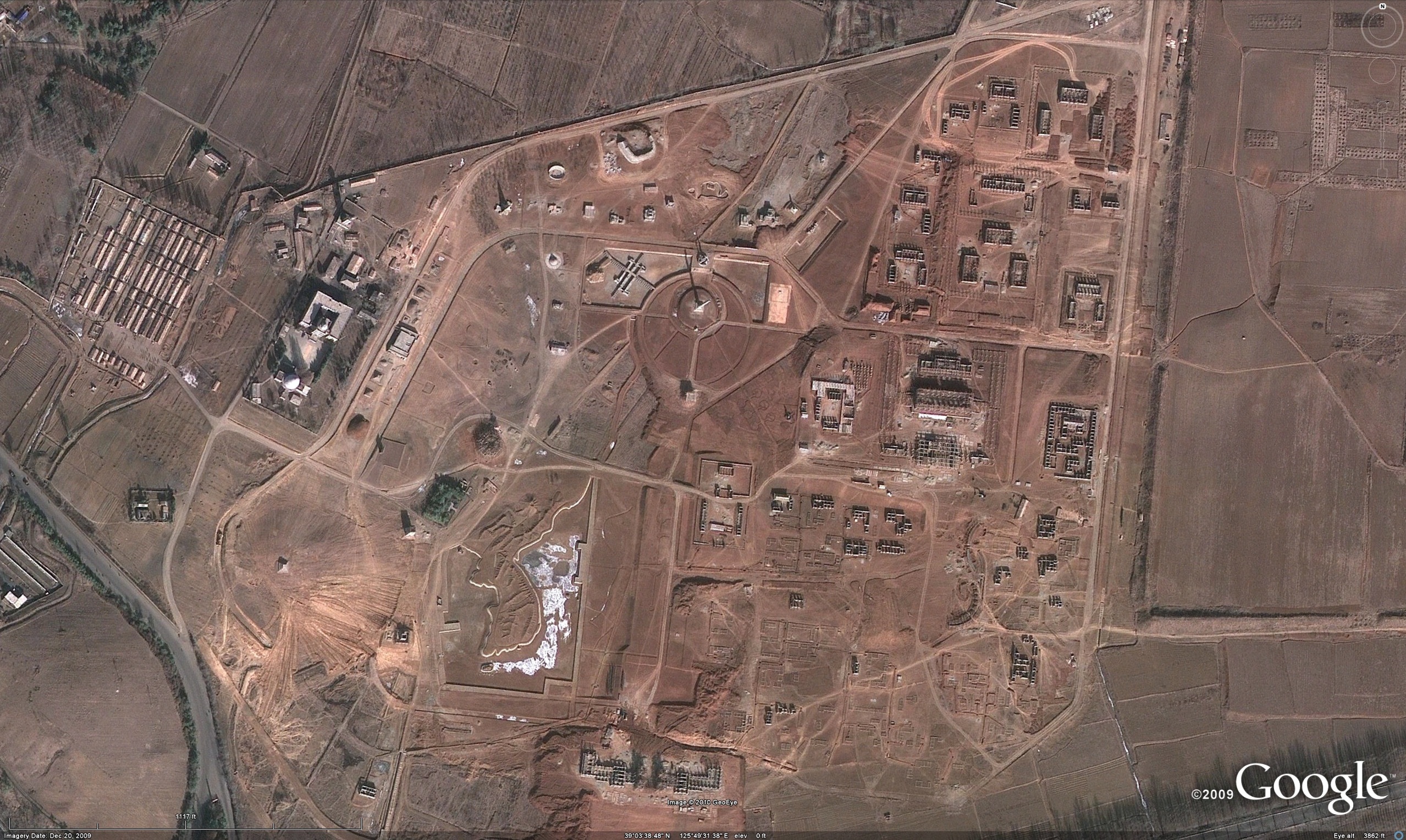
Here are the replicas of Pyongyang landmarks under construction:
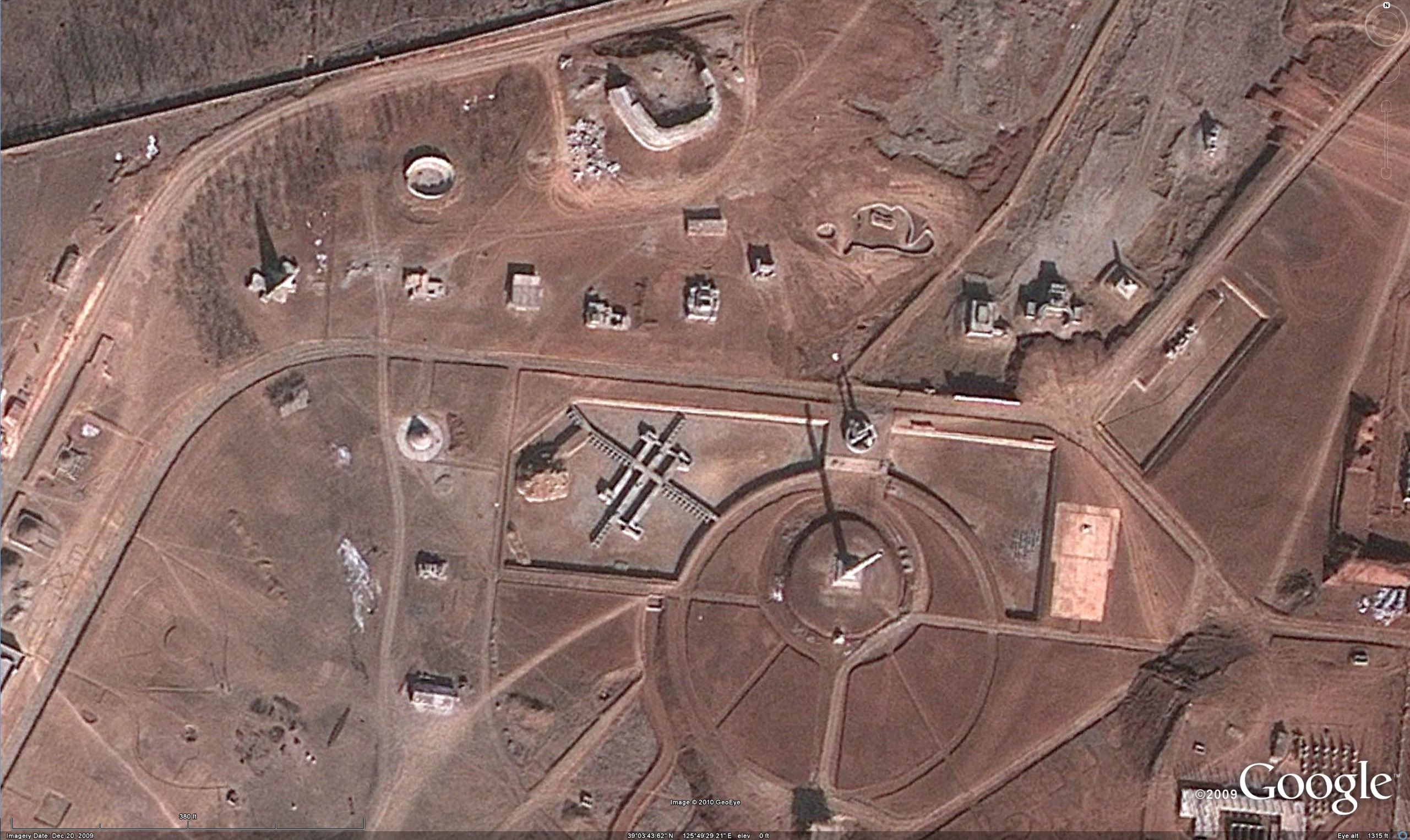
As I mentioned in a previous blog post, there seem to be replicas of different burial mounds, the West Sea Barrage, Monument to Party Founding, Ryugyong Hotel, Mangyongdae Children’s Palace, and much more. There even appears to be a miniture Korean Penninsula that visitors can walk around.

I wonder if that is the same crane on top that was there for the last 20 years?
Hmm these photos still seem pretty old… The hotel was mostly glassed up when I was there in August last year, but in these shots only the top part. wonder how google determines when to update, and why they use old pics?
Any one spot a vehicle anywhere? Guessing its around 8:00 AM, I can’t find a car, truck, bus, or bicycle.
Gerry,
The image was taken on December 20, 2009. In addition to being winter (when everything is in short supply), this photo was taken on a Sunday, when only military vehicles and vehicles assigned to foreigners are allowed on Pyongyang’s roads.
Loved going through!
This is the coolest thing ever!!! Thanks for sharing .