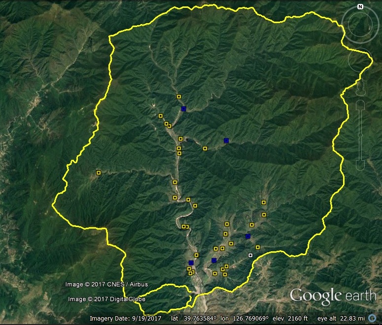
UPDATE 3 (2017-11-16): Google Earth Satellite imagery dated 2017-9-19 indicates that the vast majority of housing in Yodok Prison Camp (Kwanliso No. 15) shows signs of being demolished, deteriorated or uninhabited. There is also significant deterioration of economic units in the camp. However, only minor changes to the security and administrative infrastructure, so it is too soon to say the camp is closed.
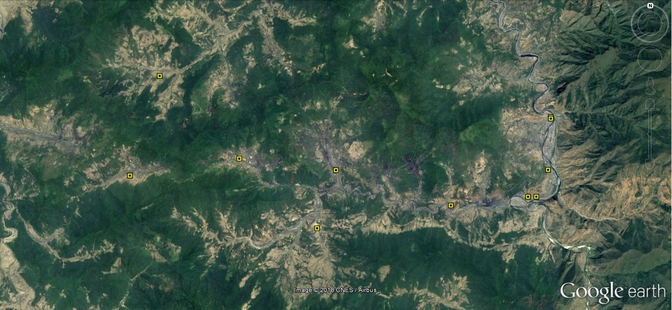
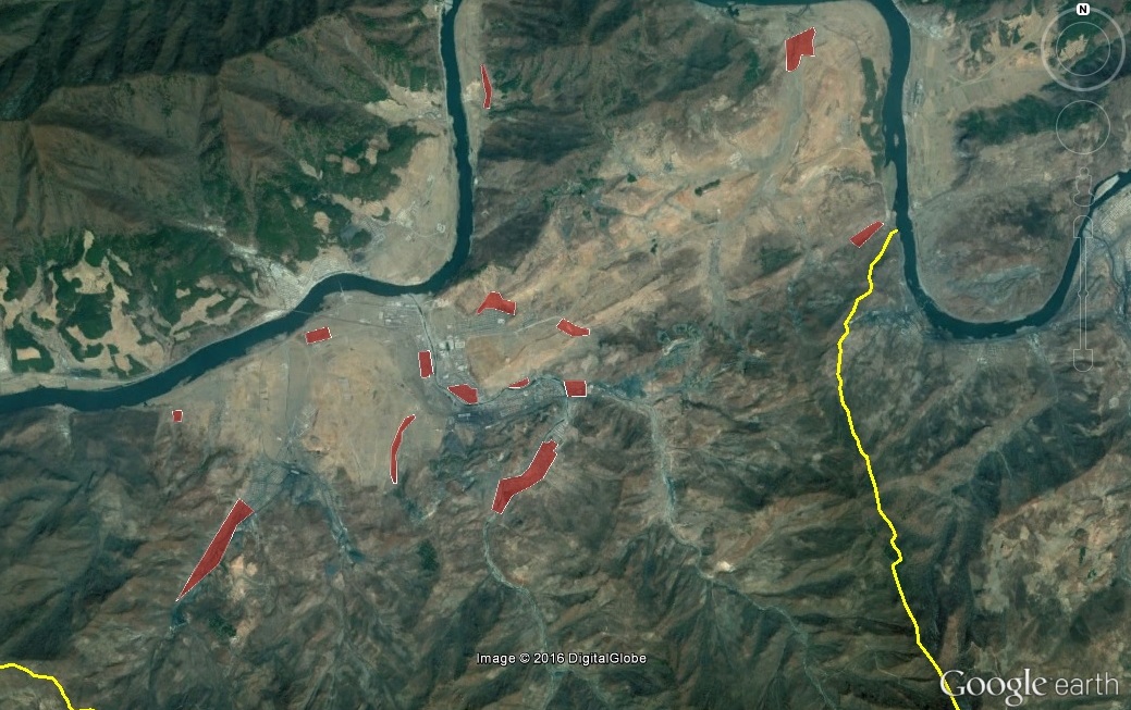
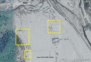
Below is an overview of the areas inside Camp 15 where I have observed razed or deteriorating facilities in the September 2017 imagery. Yellow pegs indicate razed/deteriorated housing. Blue pegs indicate deteriorated economic infrastructure. The single white peg is the demolished security facility.

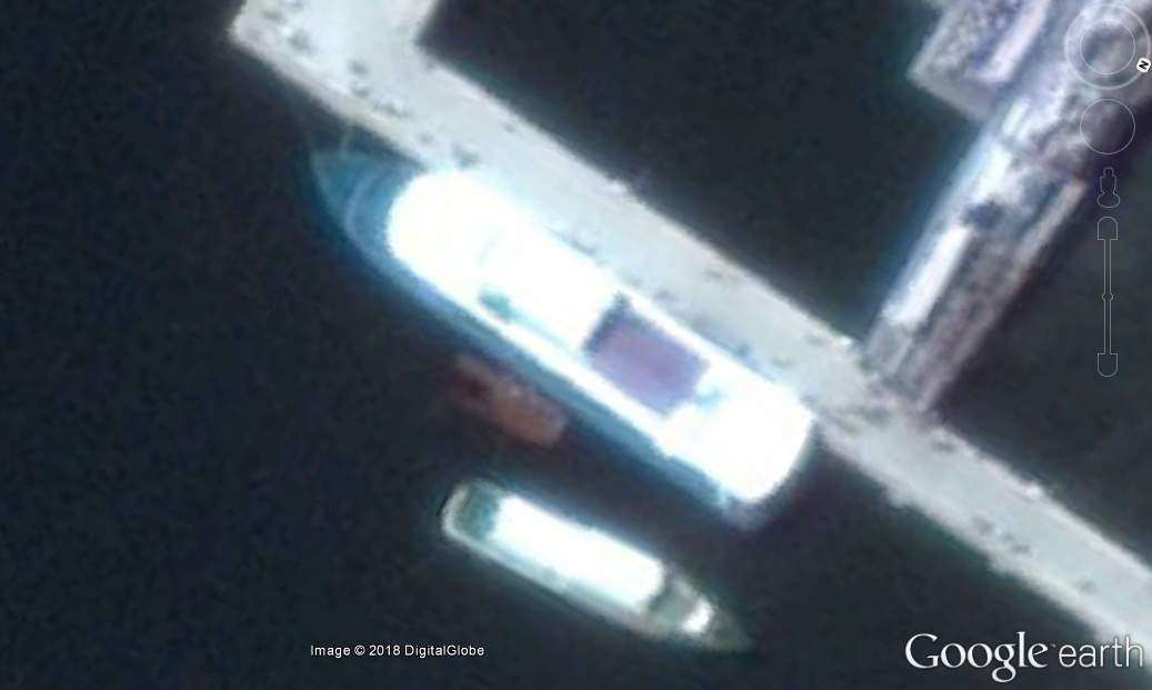
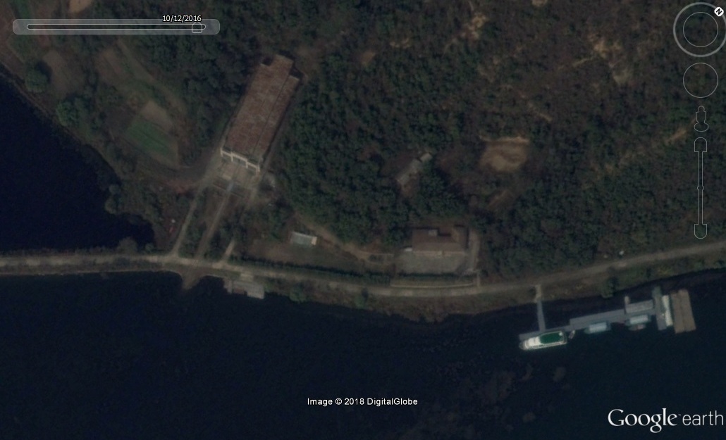
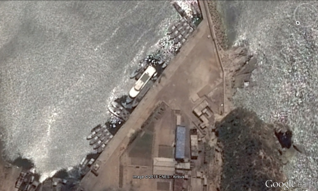
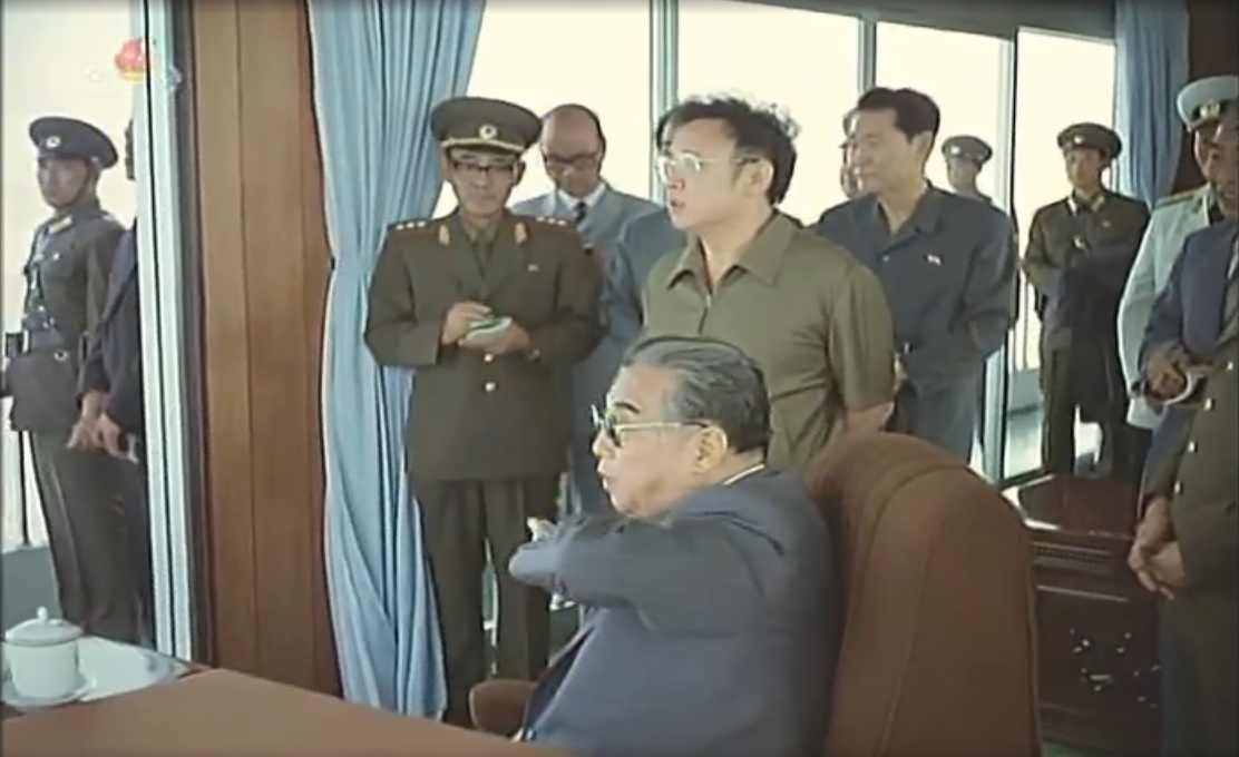
I provided some images to Radio Free Asia for the Korean media and I add one here:
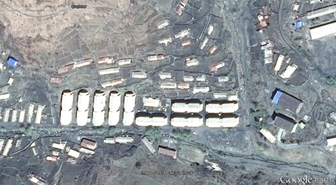
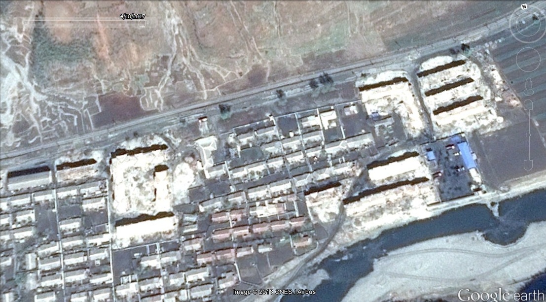
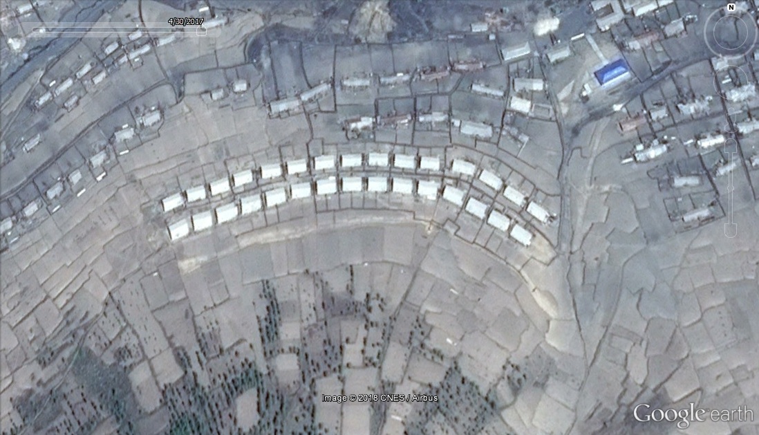
UPDATE 2 (2017-4-27): More prisoner housing in Yodok is being razed.
In September 2015, Joseph Bermudez and the Committee for Human Rights in North Korea reported that the “Revolutionizing Zone” of Yodok Prison Camp (Camp 15) had been torn down as of October 2014.
The “Revolutioninzing Zone” was for prisoners judged to be worthy of re-education through labor, and thus eligible for release. It is because there were prisoners who were released, and who later defected, that we know so much about the camp.
Based on new Google Earth imagery, it appears that additional housing inside the camp security perimeter has also been torn down sometime between June 2, 2016 and February 19, 2017.
Here is an overview of the areas where housing has been razed:
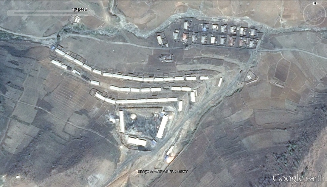
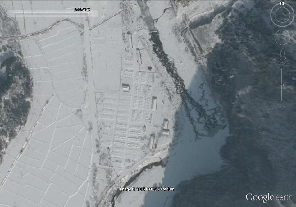
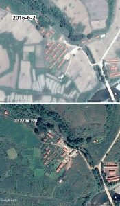
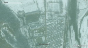
First let’s look at the housing in the “Total Control Zone” (39.699346°, 126.849473°):
Google Earth: Image date 2016-6-2
Google Earth: Image date 2017-2-19
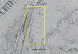
In the above images, we can see that 38 housing units have been razed, and only seven buildings remain standing. I presume that the remaining buildings still serve an economic or administrative function.
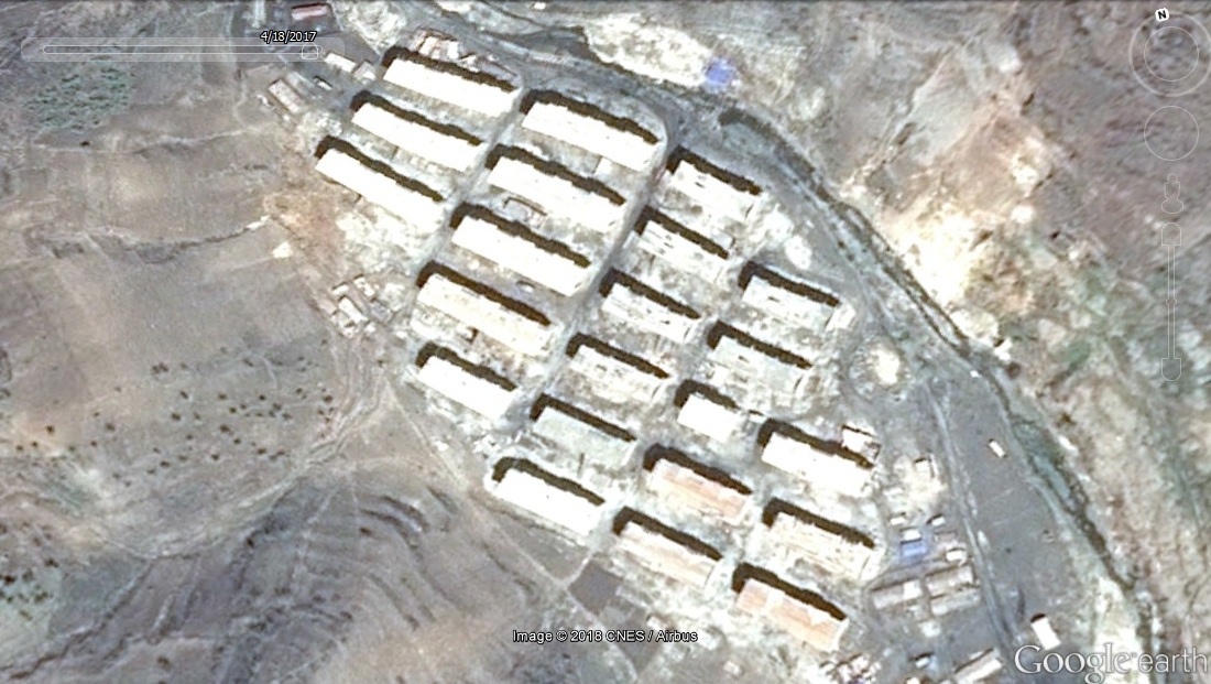
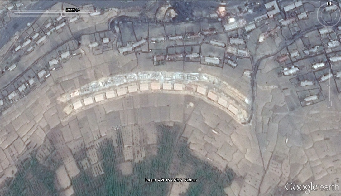
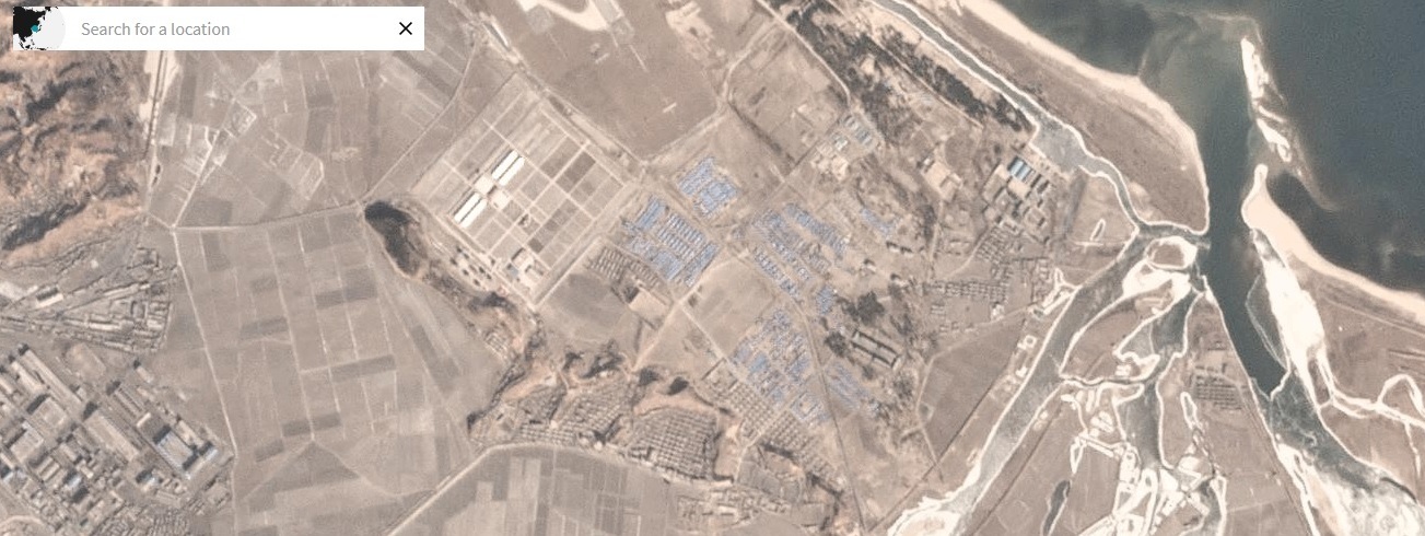
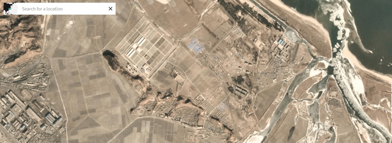
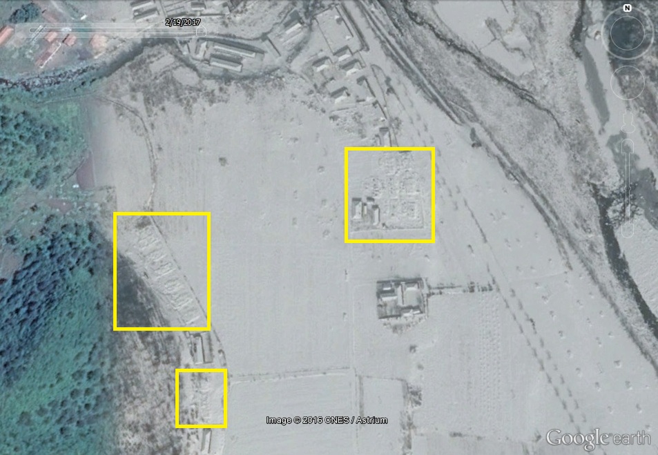
Here is a second site where housing was razed between 2016-6-2 and 2017-2-19 ( 39.686860°, 126.844236°):
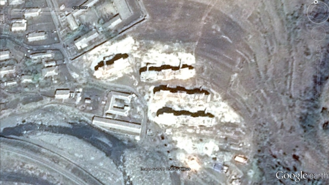
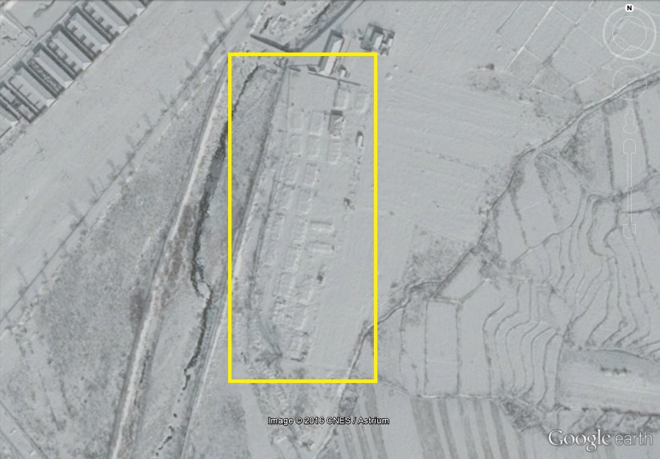
Here is a third site where housing was razed between 2016-6-2 and 2017-2-19 ( 39.704151°, 126.872365°):
What does this mean? Using this Google Earth imagery alone, it is still hard to say exactly what is happening in the camp. The new imagery only covers the eastern-half of the camp, so there may be changes on the western-half of the camp (such as the construction of new housing) that may offset the housing losses we have observed here.
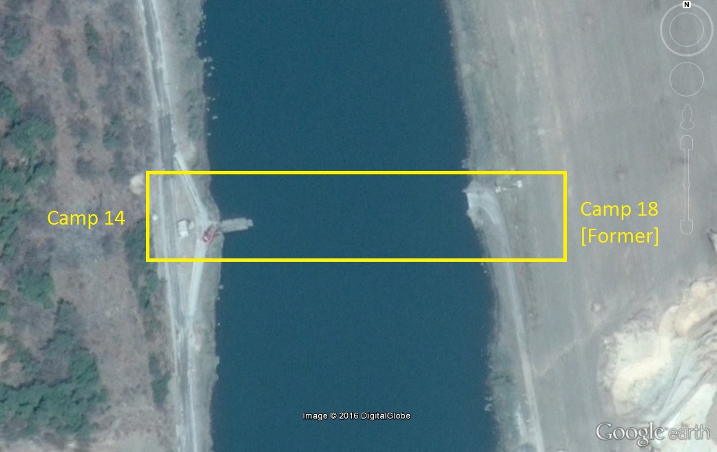
Is this good news for the prisoners? I cannot say. If the housing was torn down, and new housing was not built to replace it, it is possible prisoners were executed or transferred into pre-existing housing, leading to cramped, less-sanitary conditions. Some prisoners may have been released, but they could just as easily have been transferred to the new prison camp that was opened up on the site of the closed Camp 18.
Is the camp being closed? This rumor has been floating around for several years. The theory that North Korea desires to close the camp at some date in the future is consistent with the observations we have seen–in that a process of gradual reduction in prisoners and prisoner housing is taking place over time. However, we still do not know if new housing has been built on areas that are not covered by recent satellite imagery, and we do not know if the camp’s closure will lead to an outcome that the prisoners would find welfare-enhancing (Are they being executed, transferred, or released?). As far as I can tell, the administrative portion of the camp, near the southern entrance (and the security perimeter) have seen no substantive changes over this same period.
As always, we need more imagery and more testimony.
This has been reported in Radio Free Asia.
UPDATE 1 (2015-2-17): HRNK has published a report on Camp 15 that confirms some of the information on this web page and adds more.
ORIGINAL POST (2014-12-9): I do not really focus in human rights issues. The only real exception to this is that I keep up with new satellite imagery of incarceration facilities when pictures are released on services like Google Earth.
In the past couple of years, we have seen interesting developments in the camps. No.’s 18 and 22 were closed, and are being converted into ordinary villages and coal mines. I was also the first to write about the expansion of Camp 14 and Camp 25. There have also been minor changes to Camp 16, and I was able to point out exports from the camp that are possibly used for generating hard currency.
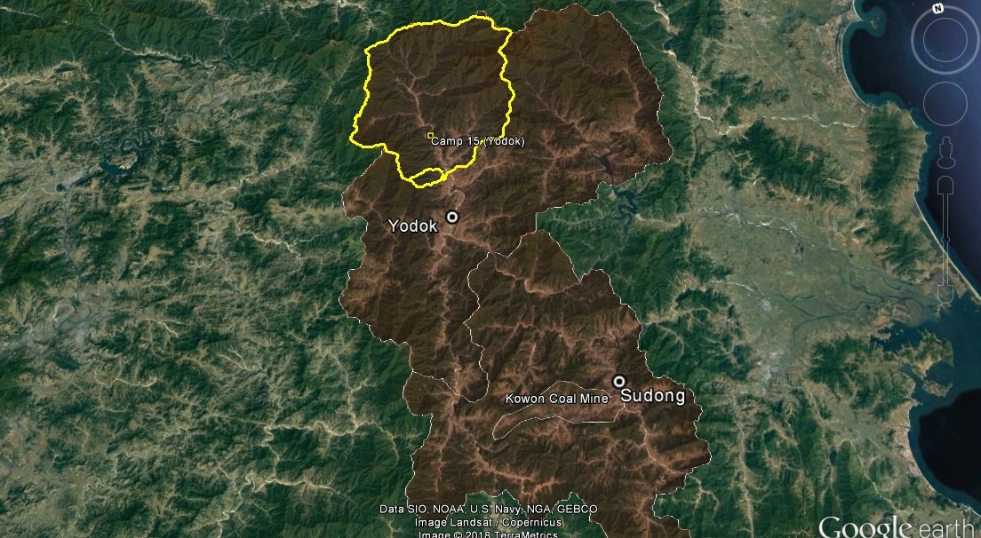
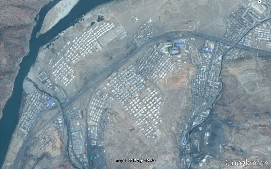
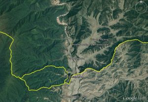
So now we turn our heads to Camp 15, AKA Yodok. This was the most “well known” of the prison camps before Shin Dong-hyok’s book on Camp 14 was published. Yodok was the subject of Kang Chol-hwan’s The Aquariums of Pyongyang, and it even inspired a musical.
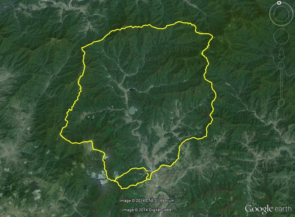
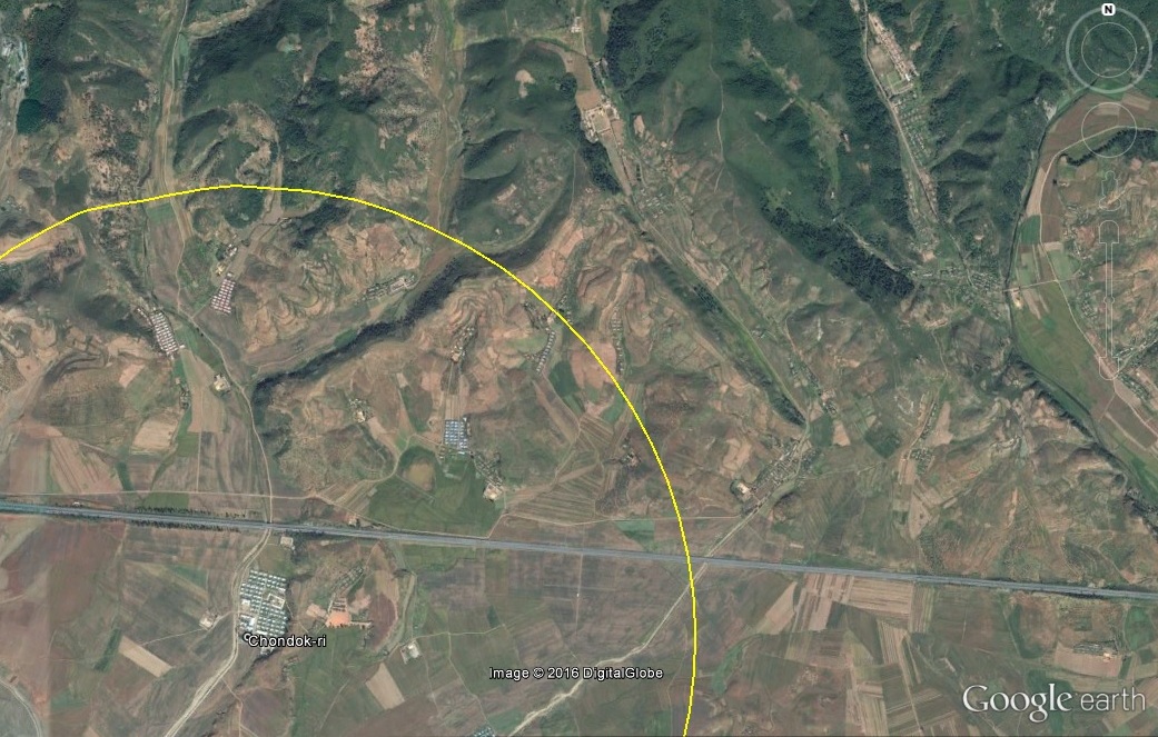
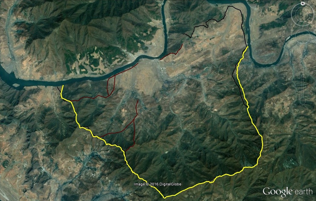
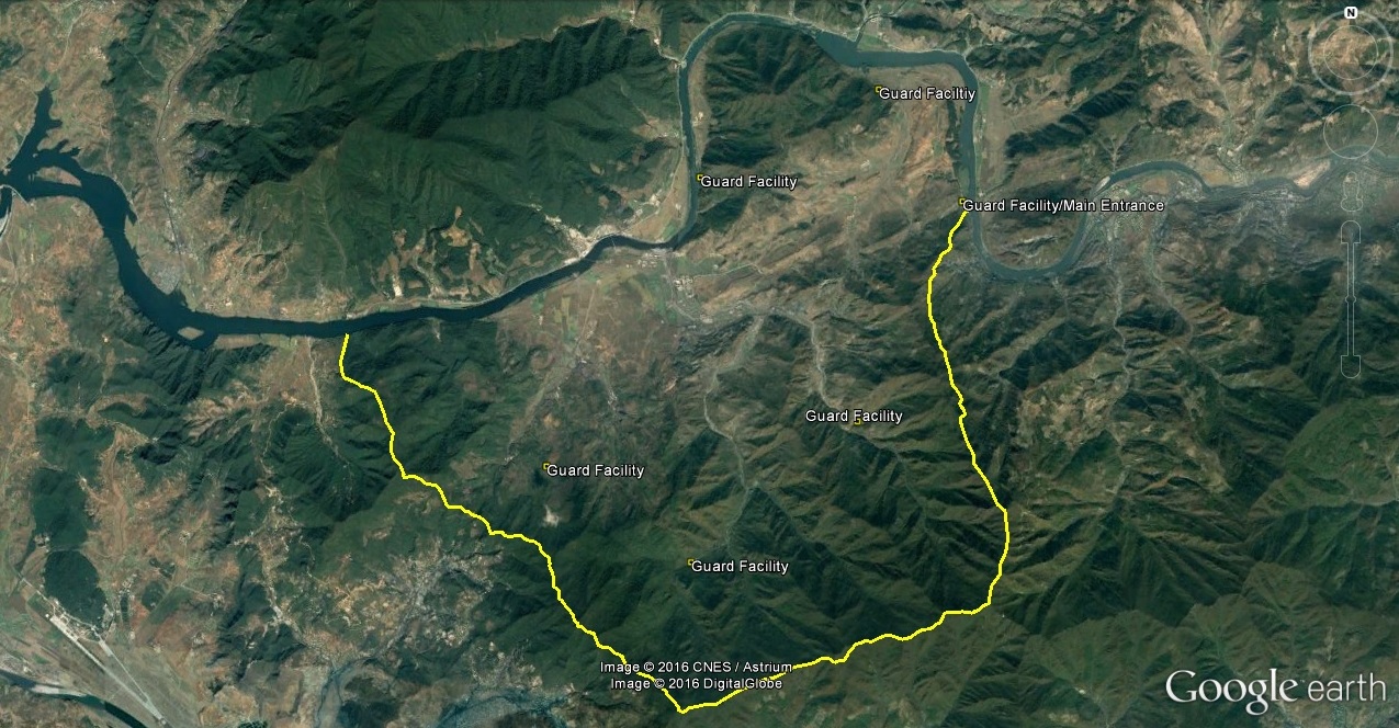
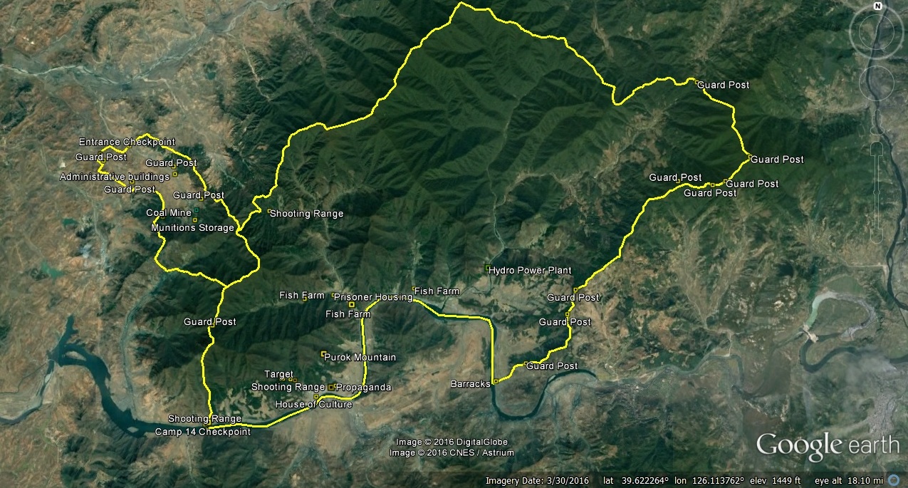
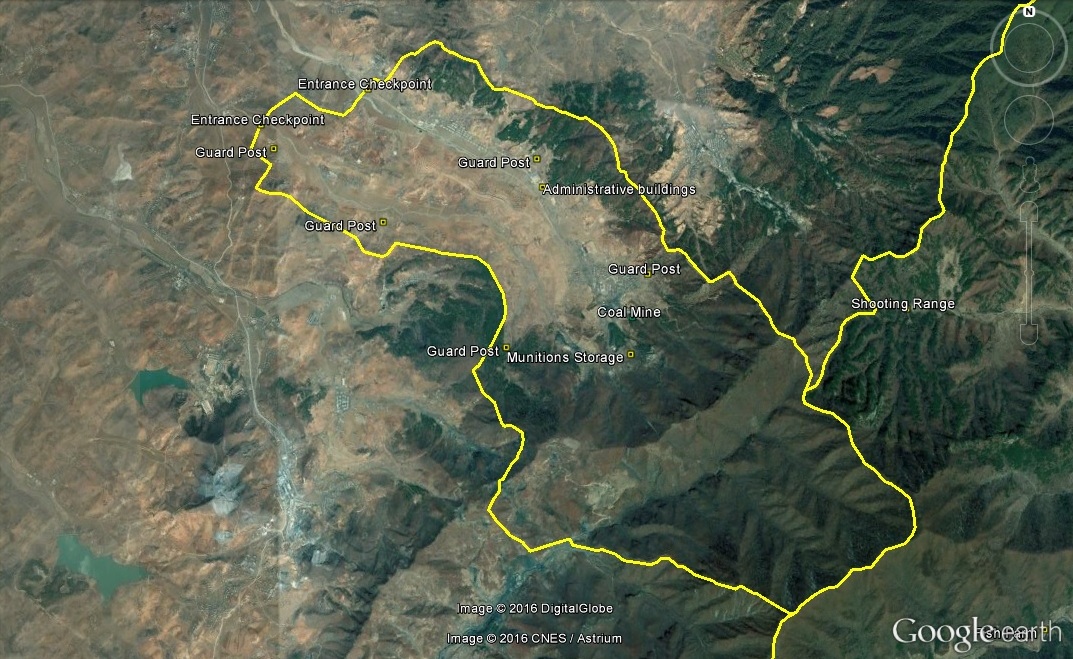
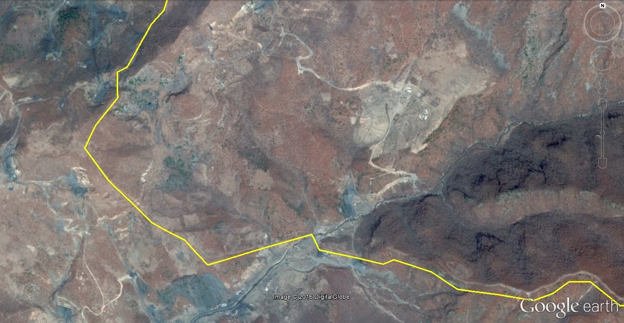
Camp 15 is an enormous facility in Yodok County, South Hamgyong Province. It borders Maengsan County, Nyongwon County and Taehung County in South Phyongan Province. The camp is over 22km from north to south and over 20km from east to west. There are two entrances to the camp. The main entrance is on the south side, just north of kuup-ri (구읍리) and approximately six kilometers from the town of Yodok (요덕). There is a secondary entrance on the north end of the camp on Paek-san that borders with Nyongwon County. According to North Korean sources, there are four villages (리) officially listed within the camp perimeter: Ryongphyong-ri (룡평리), Phyongjon-ri (평전리), Ripsok-ri (립석리) and Taesuk-ri (대숙리).
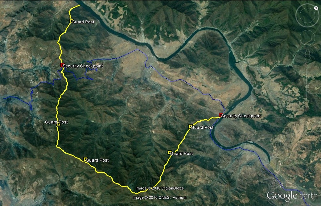
HRNK’s Hidden Gulag describes the camp security perimeter this way:
The whole encampment is surrounded by a barbed-wire fence measuring 3 to 4 meters (10 to 13 feet) in height. In some areas there are walls 2 to 3 meters (7 to 10 feet) tall, topped with electrical wire. Along the fence there are watchtowers measuring 7 to 8 meters (23 to 26 feet) in height, set at 1-kilometer (0.62-mile) intervals, and patrolled by 1,000 guards armed with automatic rifles and hand grenades. Additionally, there are teams with guard dogs. Inside the camp, each village has two guards on duty at all times.
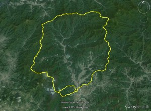
Pictured above: The borders of Camp 15, AKA, Yodok.
On November 8, the Daily NK published a story claiming that the camp had been closed and torn down:
“That political prison camp that used to be in Yodeok County in South Hamkyung has already been broken up. There’s not a trace of it left,” the source, who is with the military in the northerly province, claimed in conversation with Daily NK on the 7th. However, the disbanding of Camp 15 does not seem to have brought liberty for many of its inmates. According to the same source, “The political prisoners who were there have been divided up and moved to camps 14 and 16.”
I have viewed satellite imagery from as recent as October 20, 2014, and based on that evidence, I am unsure of the present status of the camp. Mines have been closed along with Sorimchon District, but guard housing has increased, as have security units. I also saw no change in the security perimeter.
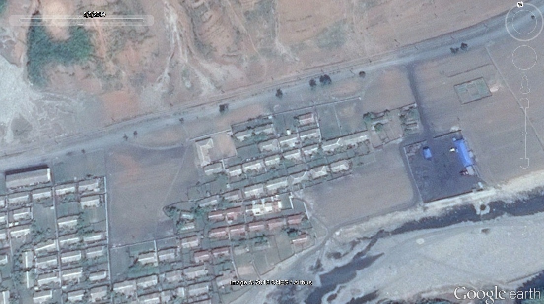
Below is a list of changes with before and after images that can be seen on Google Earth. Although the latest Google Earth imagery is dated 2014-5-5, I did not see anything on imagery from October 20, 2014 that added to this analysis.
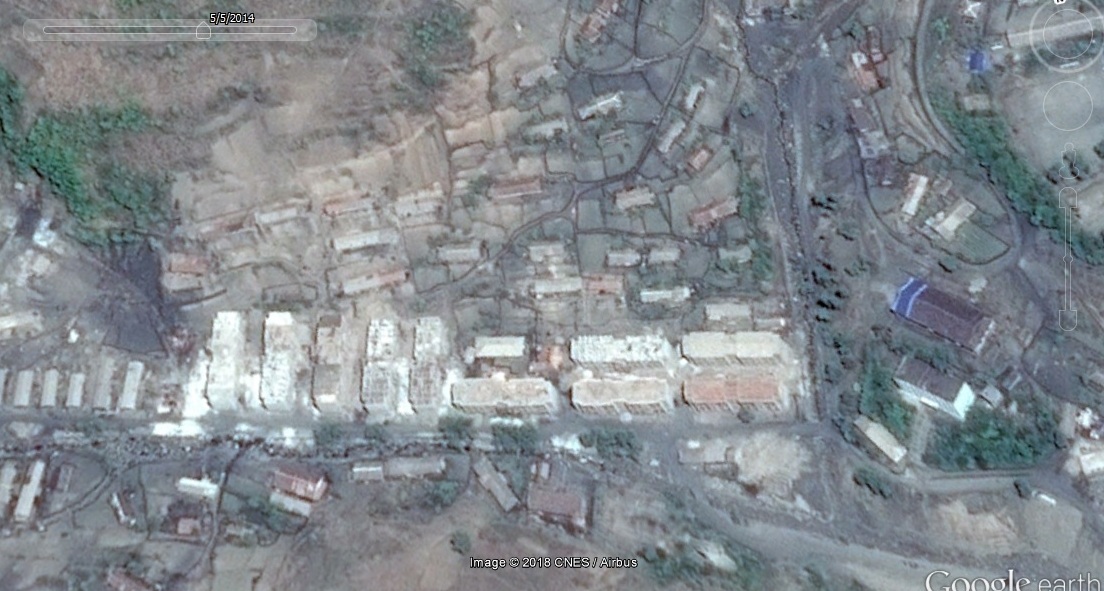
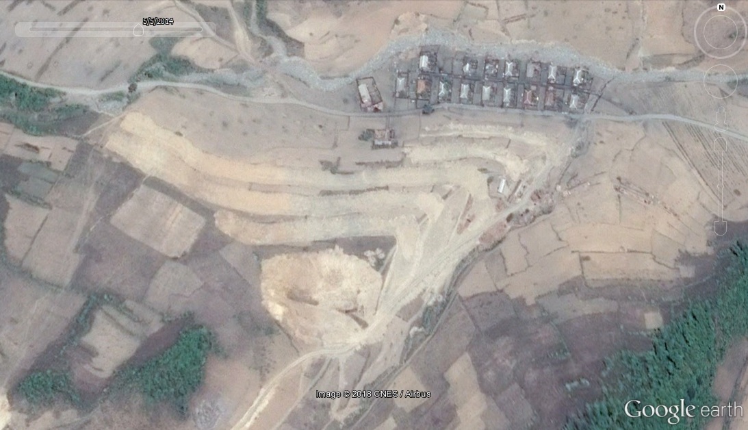
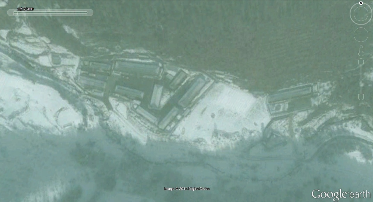
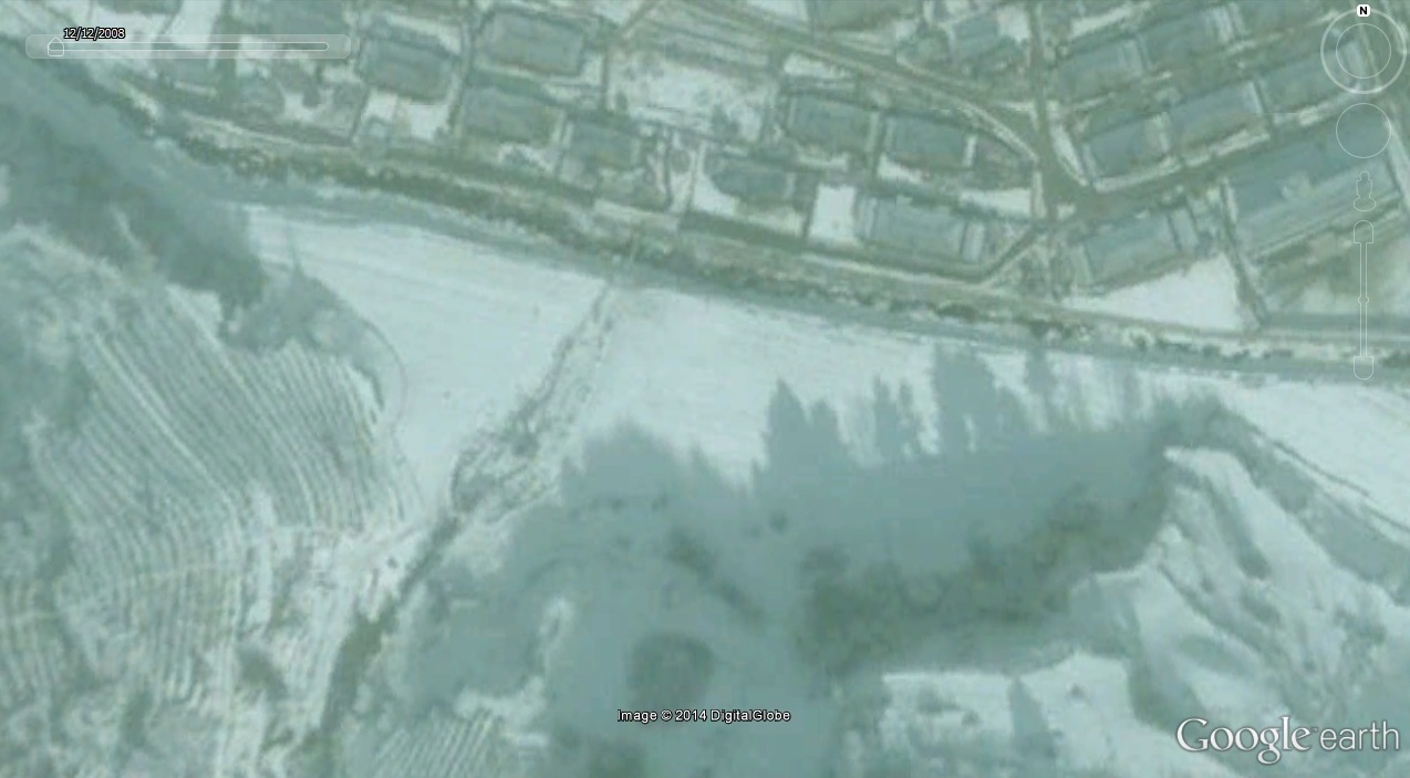
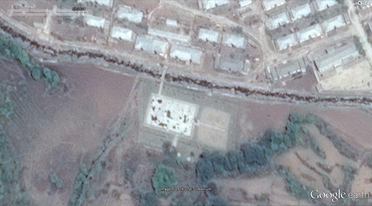
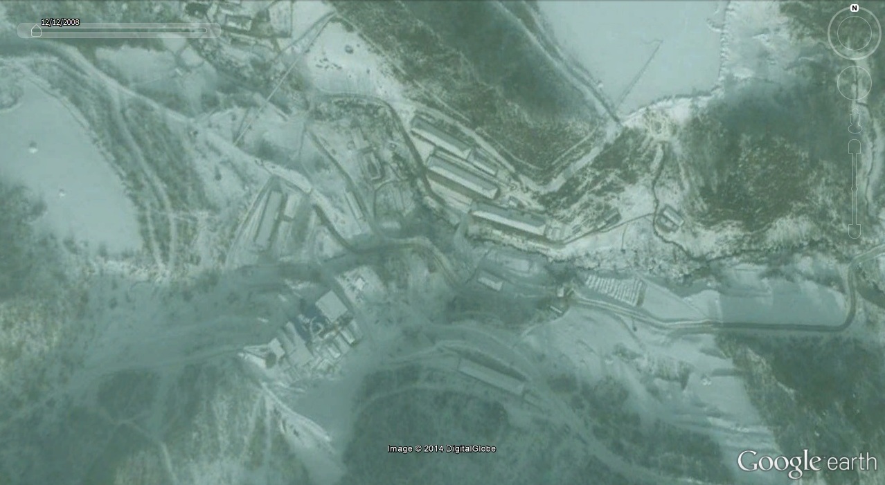
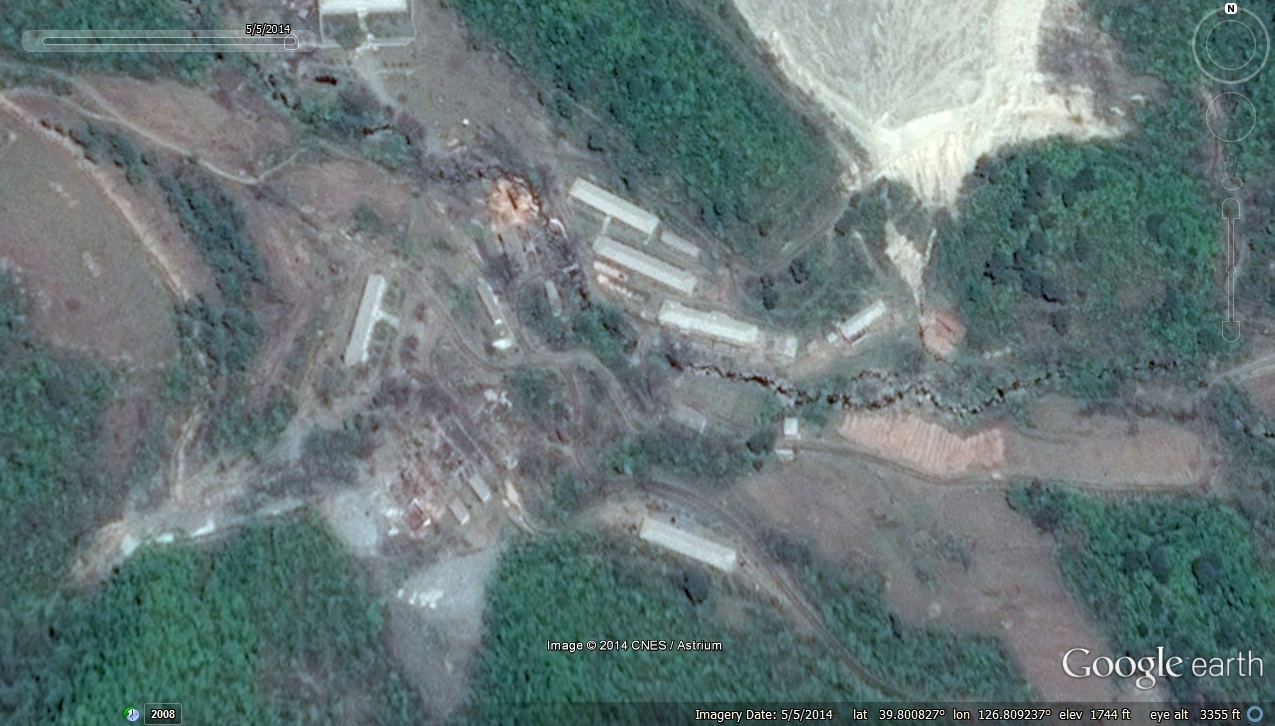
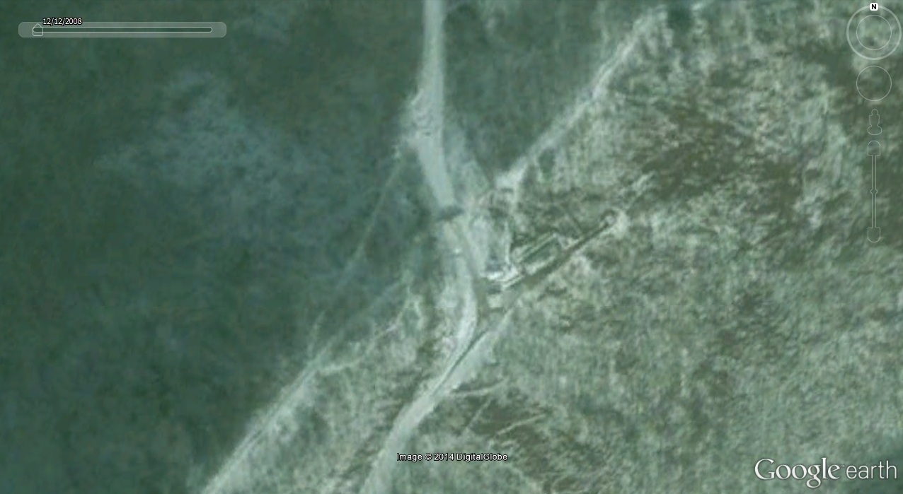
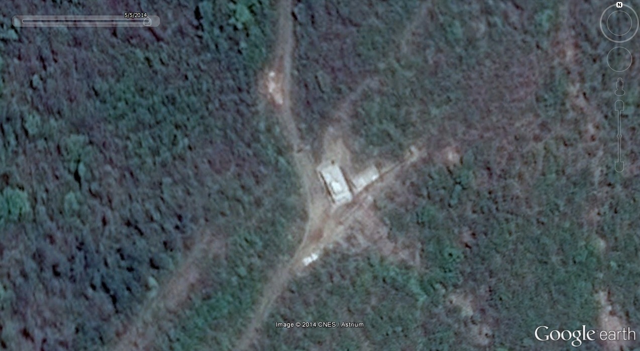
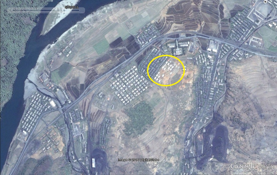
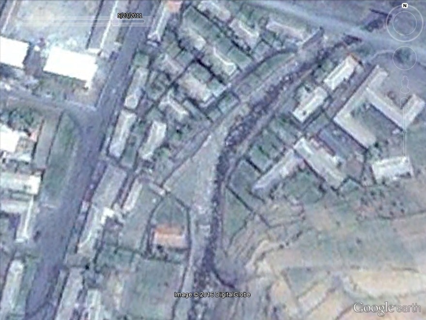
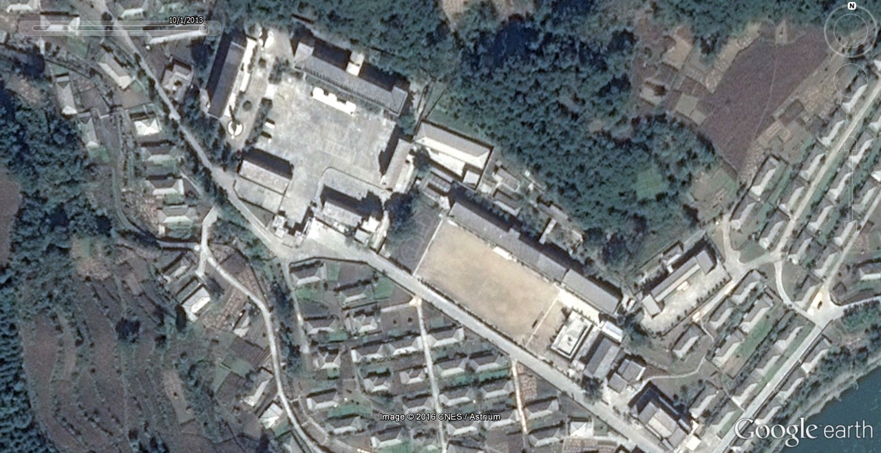
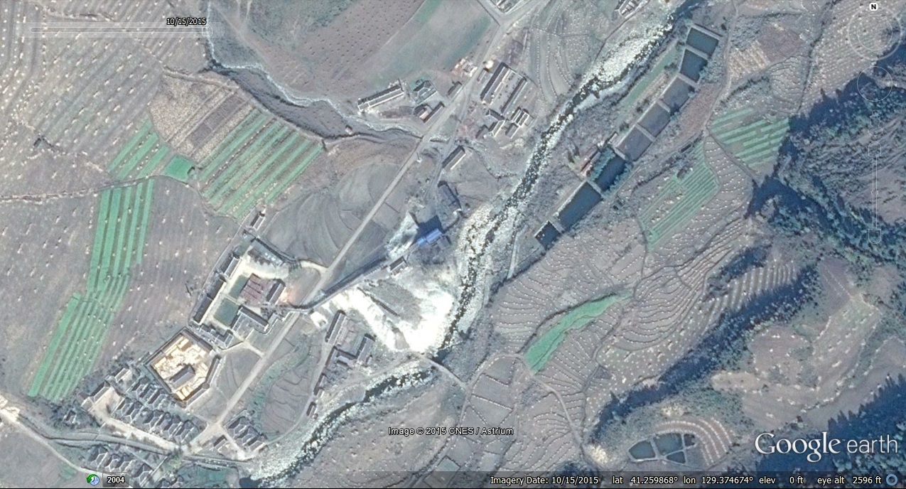
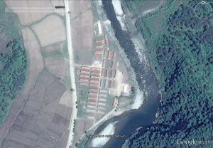
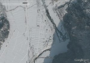
1. “Sorimchon District (aka Kumchon-ri)” has mostly been torn down:

Image Date (Google Earth): 2008-12-12
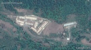
Image Date (Google Earth): 2014-5-5
This area was first described (in English) in the second version of HRNK’s Hidden Gulag (See pages: 56, 64, 66, and 68. On Page 69 is a map, and on page 199 is a labeled satellite image).
Sometime between 2008-12-12 and 2014-5-5 most of these buildings were destroyed. The only remaining building is thought to be the Ministry for State Security (MSS, SSD, NSA) office.
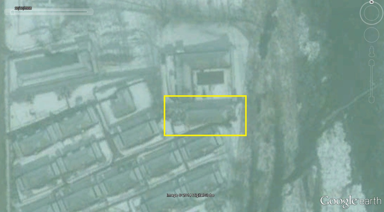
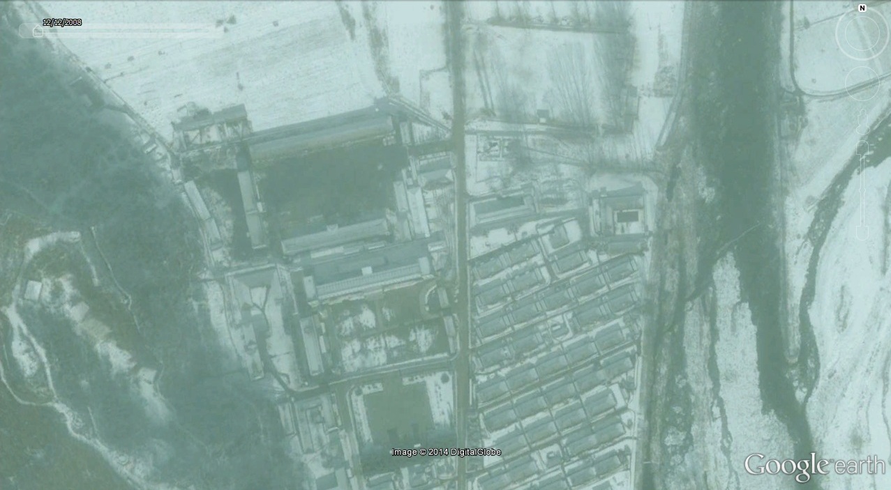
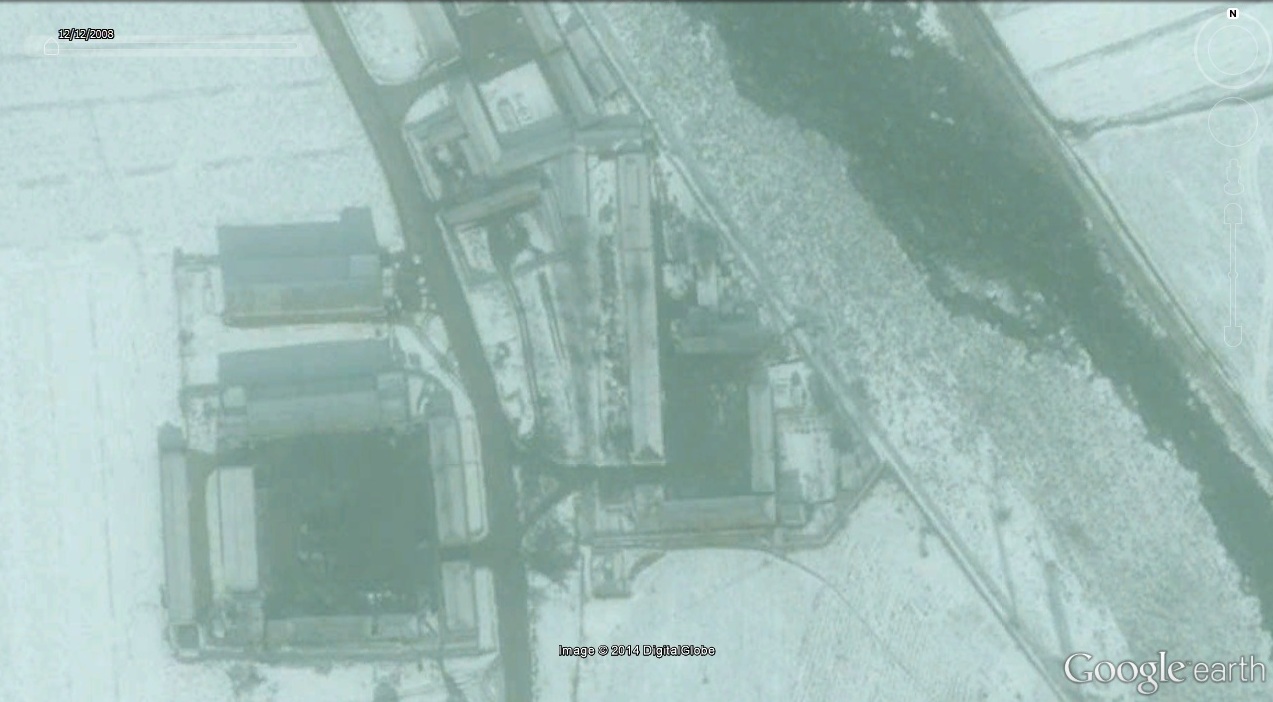
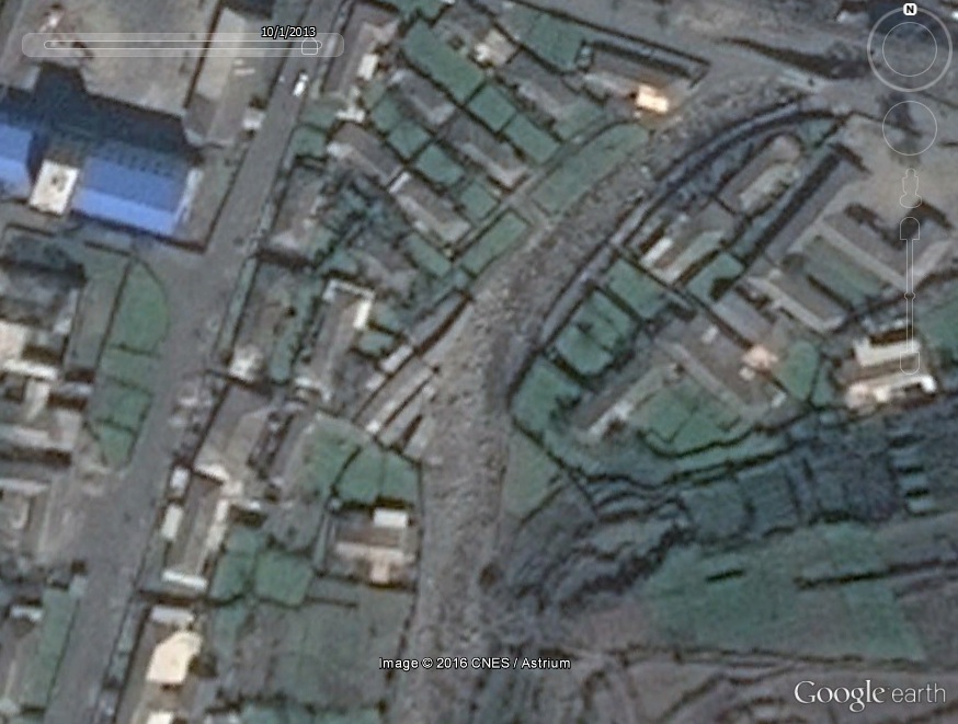
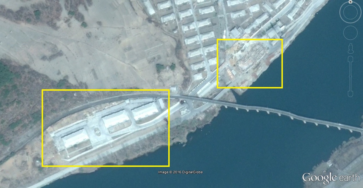
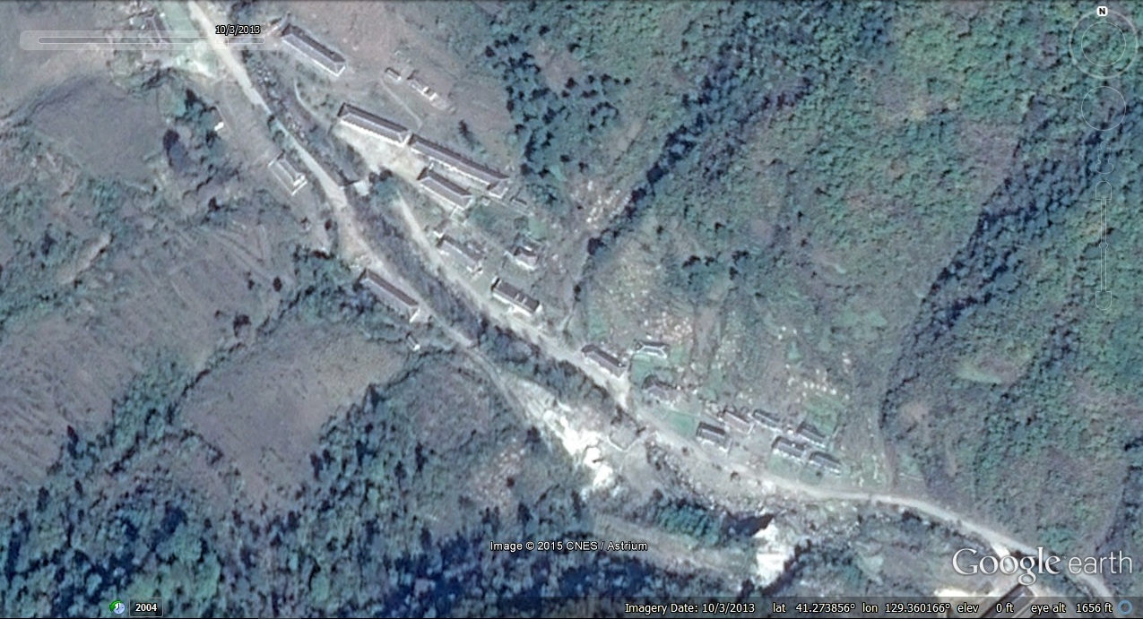
2. A building identified by HRNK in 2003 as a “holding cell” in Knup-ri area was torn down and replaced by additional guard housing (this probably happened sometime around 2008-12-12). Hidden Gulag refers to “Knup-ri” but I believe this actually refers to “Kuup-ri”, which is the name of the village that lies just outside the camp’s perimeter:

Image Date (Google Earth): 2008-12-12
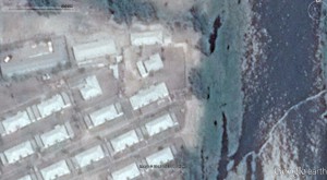
Image date (Google Earth): 2014-5-5
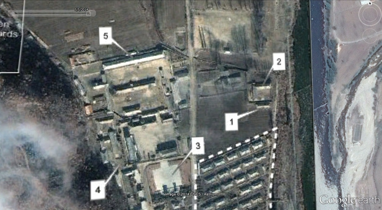
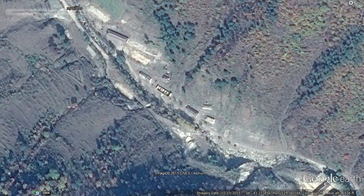
But between 2002 and 2008, this area saw a significant increase in guard housing:

All of this housing remained as of October 20, 2014.
3. In the Knup-ri guard housing area, a new park or cemetery appears to be under construction:
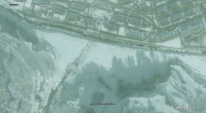
Image Date (Google Earth): 2008-12-12

Image Date (Google Earth): 2014-5-5
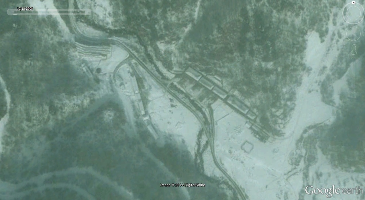
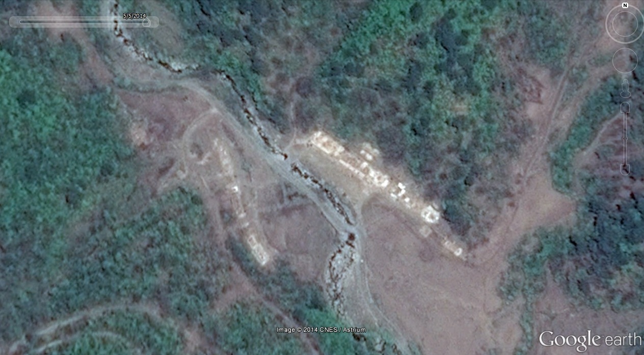
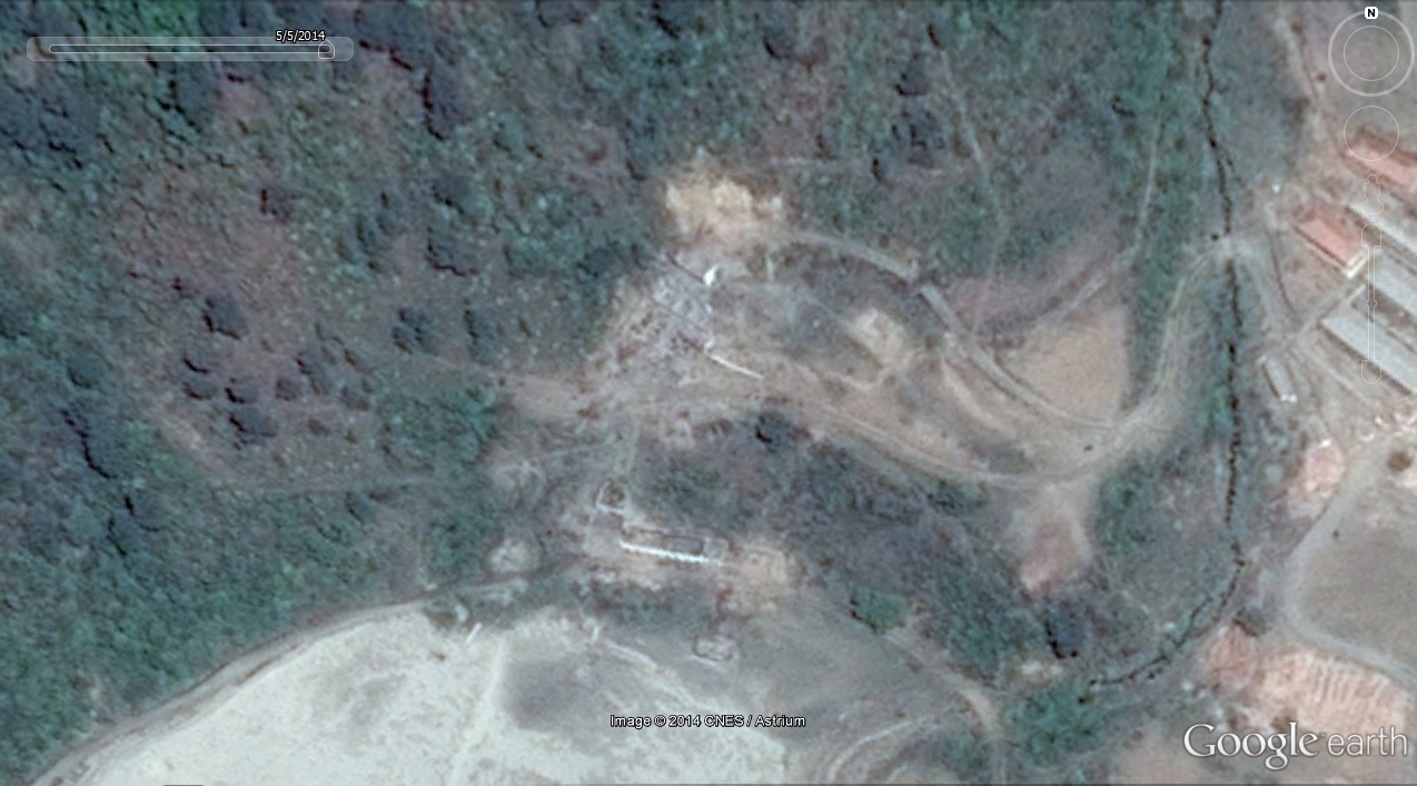
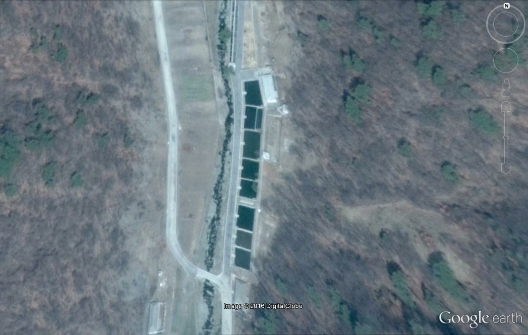
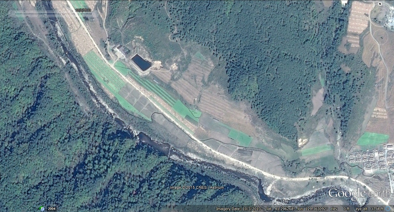
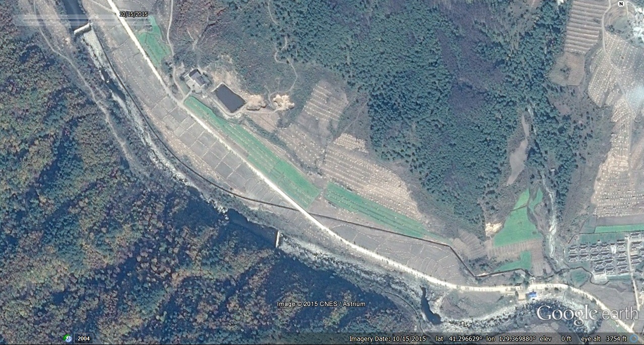
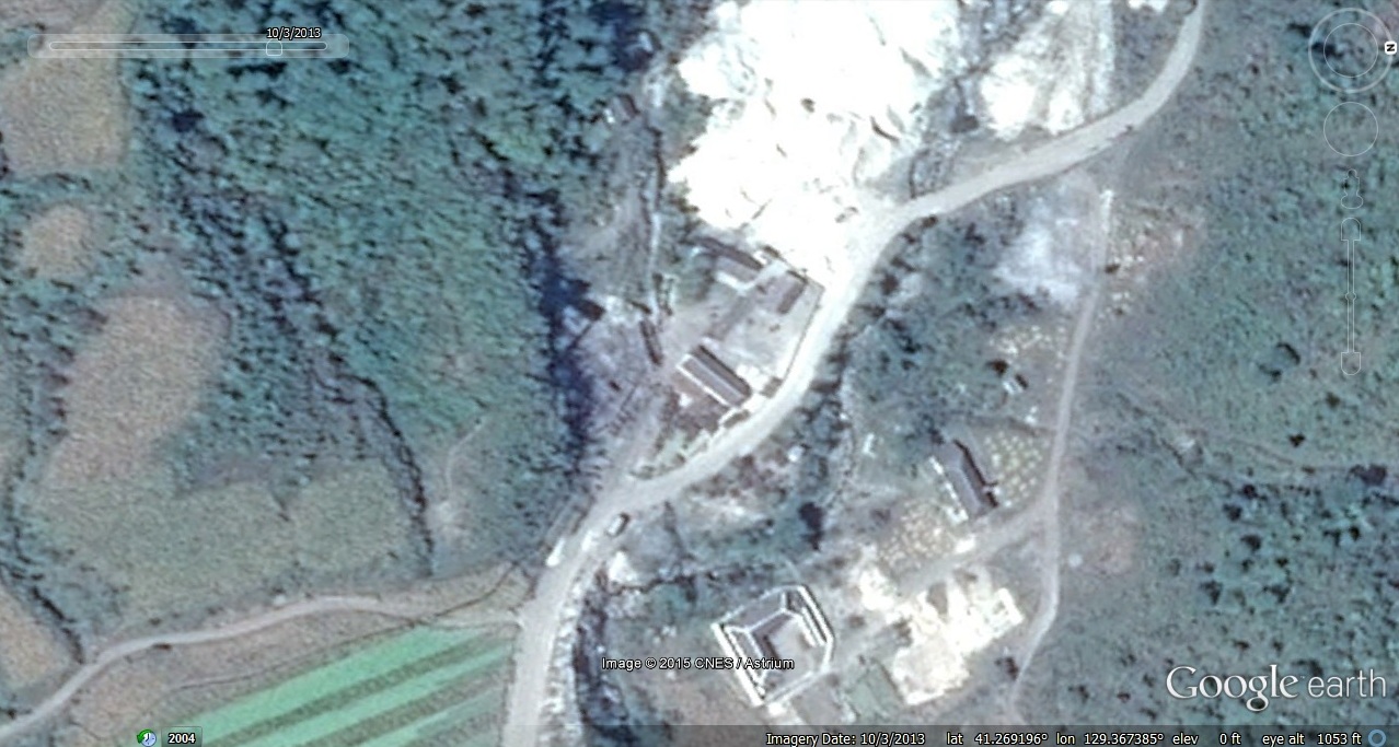
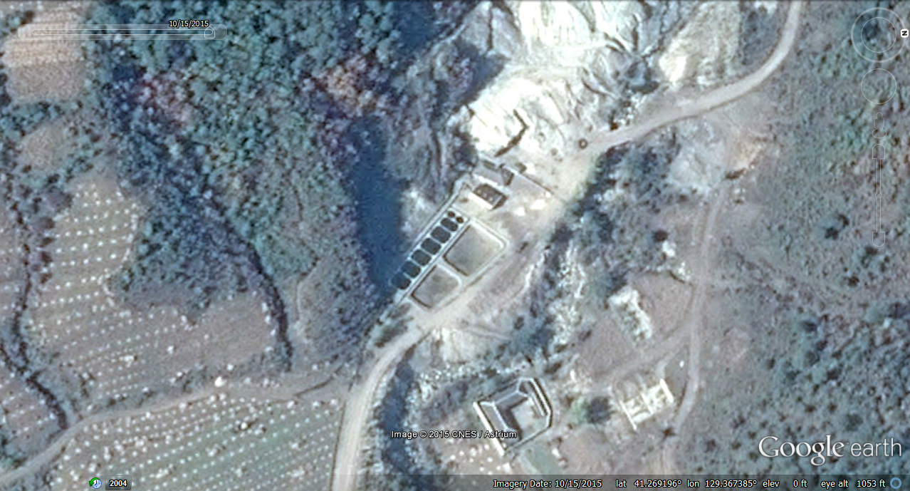
4. Mining area near Taesuk-ri torn down (TBD if it will be renovated):
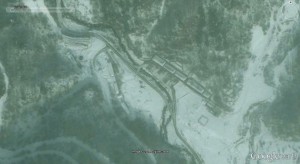
Image Date (Google Earth): 2008-12-12
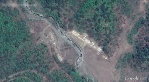
Image Date (Google Earth): 2014-5-5

Image Date (Google Earth): 2008-12-12
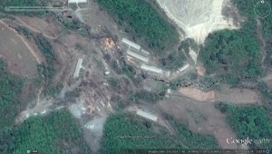
Image Date (Google Earth): 2014-5-5
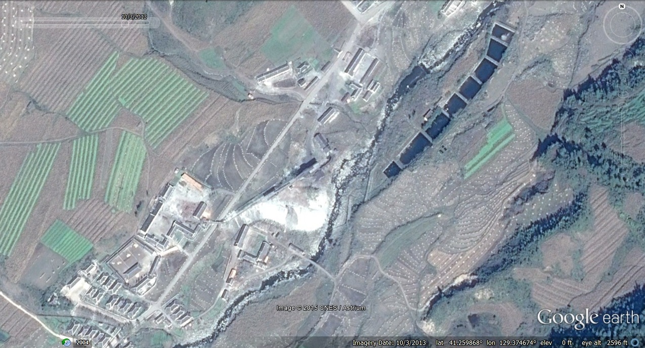
5. A mine in Ripsok-ri was also torn down (TBD if it will be renovated):
Image Date (Google Earth): 2008-12-12
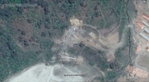
Image Date (Google Earth): 2014-5-5
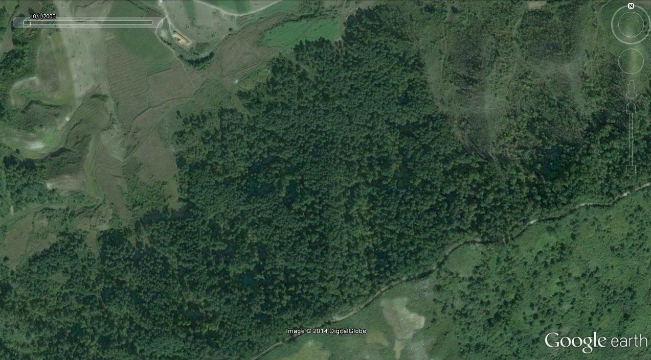
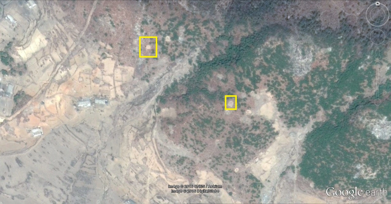
5. Mining activity in Phyongjon-ri has also apparently come to a halt:
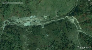
Image Date (Google Earth): 2003-10-1
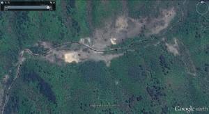
Image Date (Google Earth): 2014-5-5
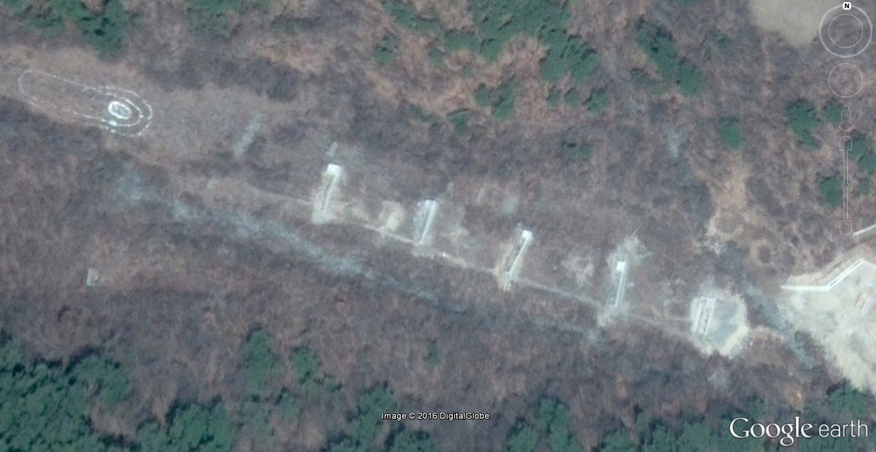
6. The camp initiated a logging site:

Image Date (Google Earth): 2003-10-1
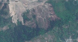
Image Date (Google Earth): 2014-5-5
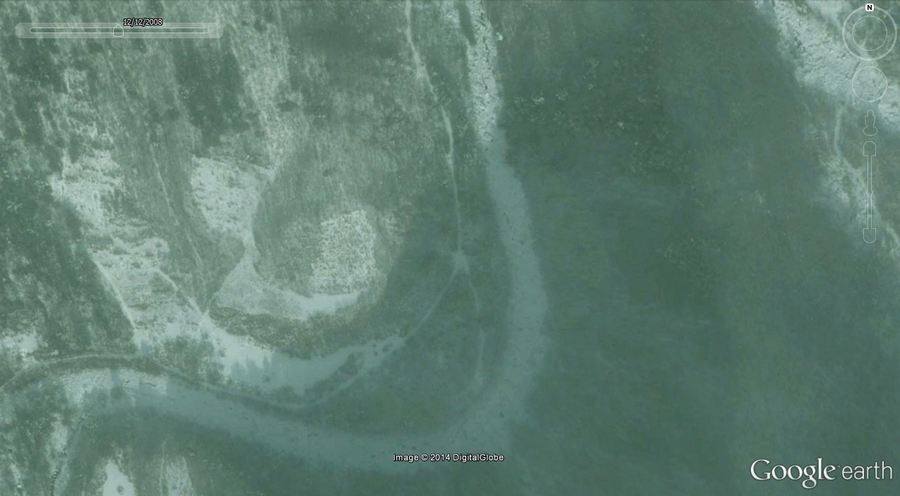
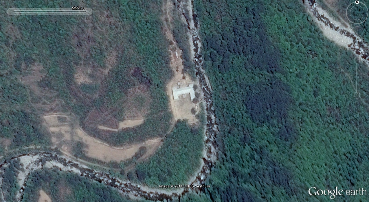
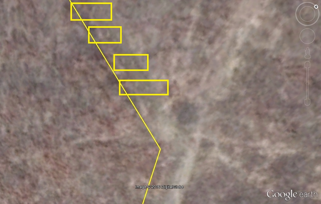
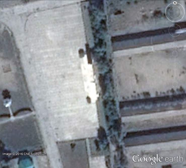
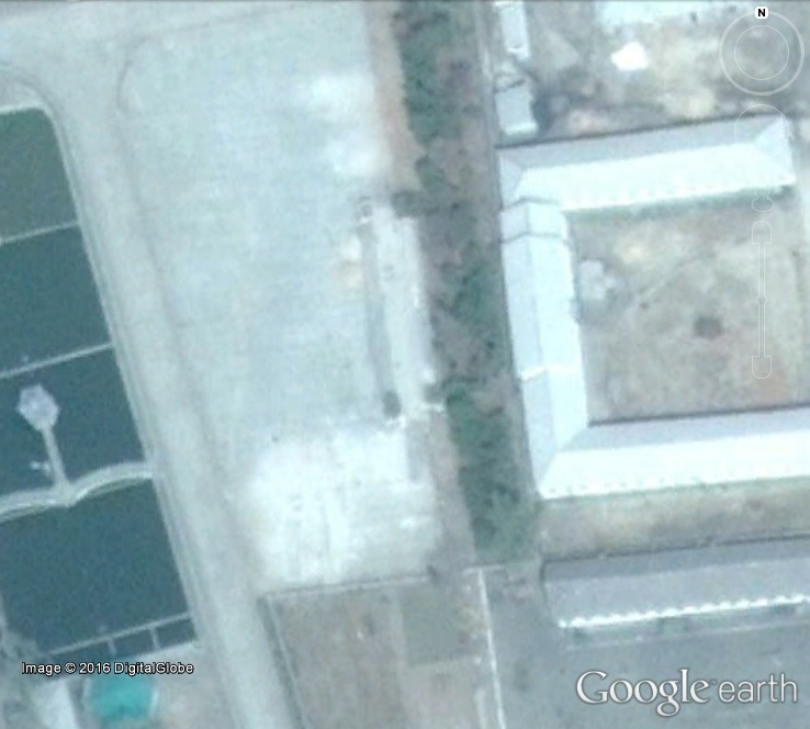
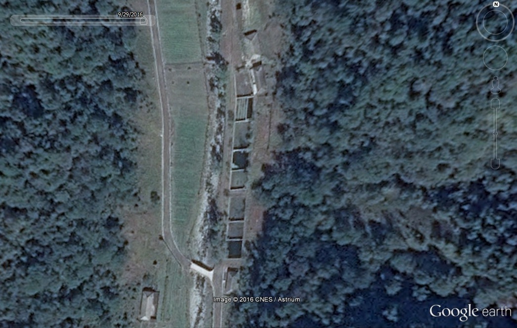
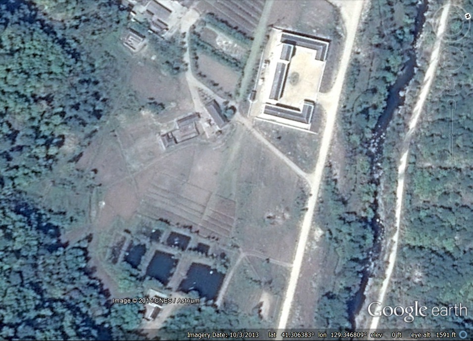
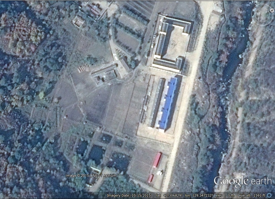
7. Two new security units have been built:
Image Date (Google Earth): 2008-12-12

Image Date (Google Earth): 2014-5-5
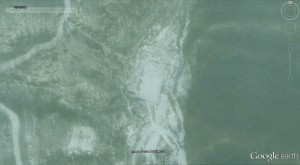
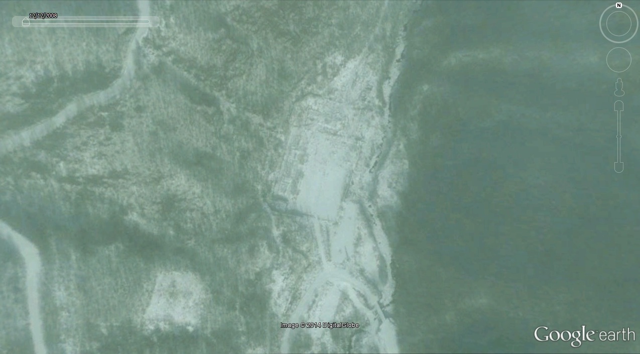
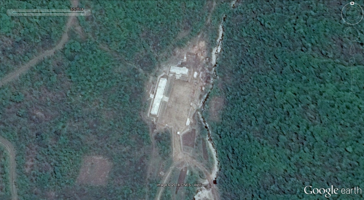
Image Date (Google Earth): 2008-12-12

Image Date (Google Earth): 2014-5-5
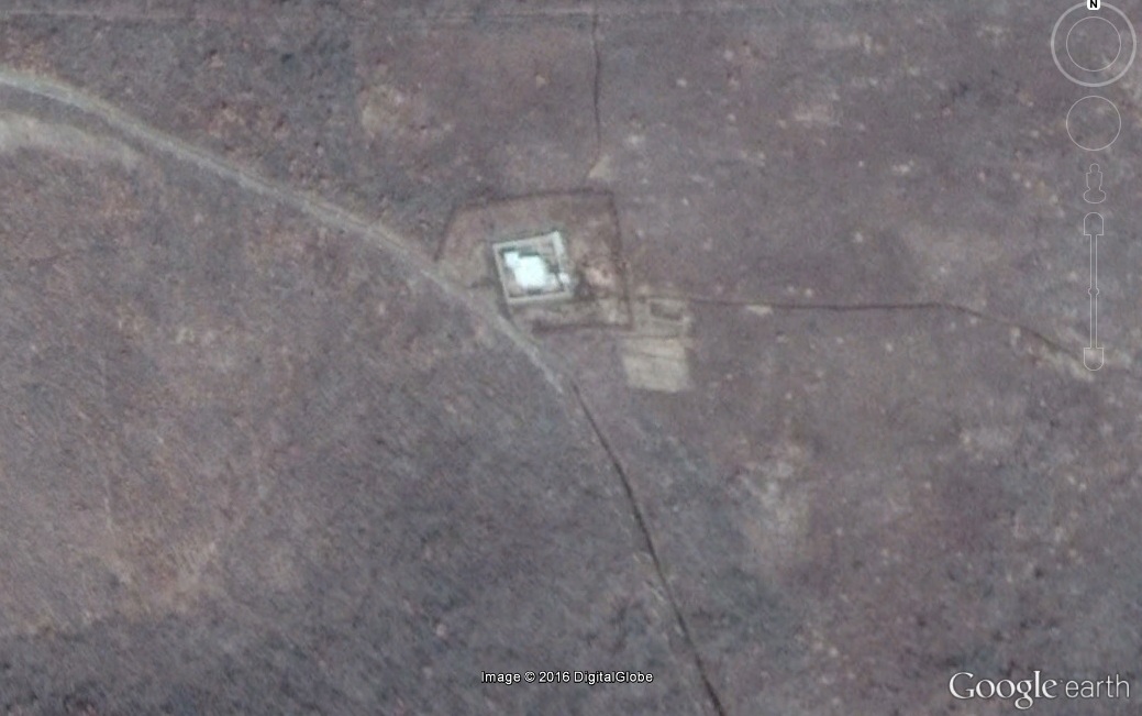
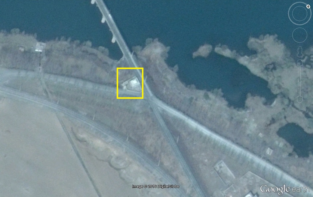
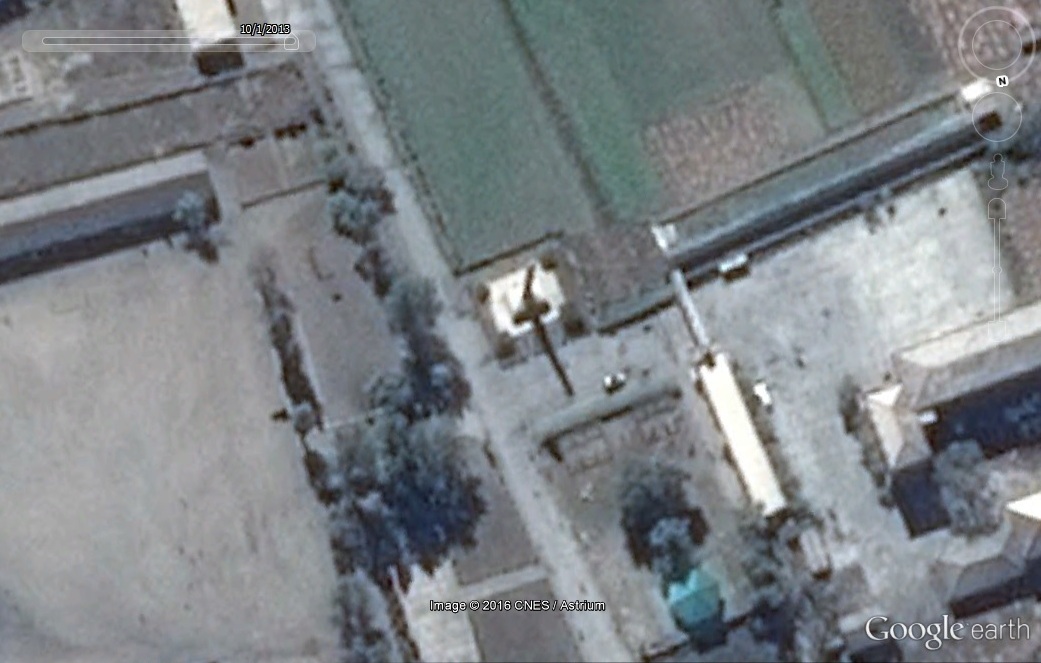
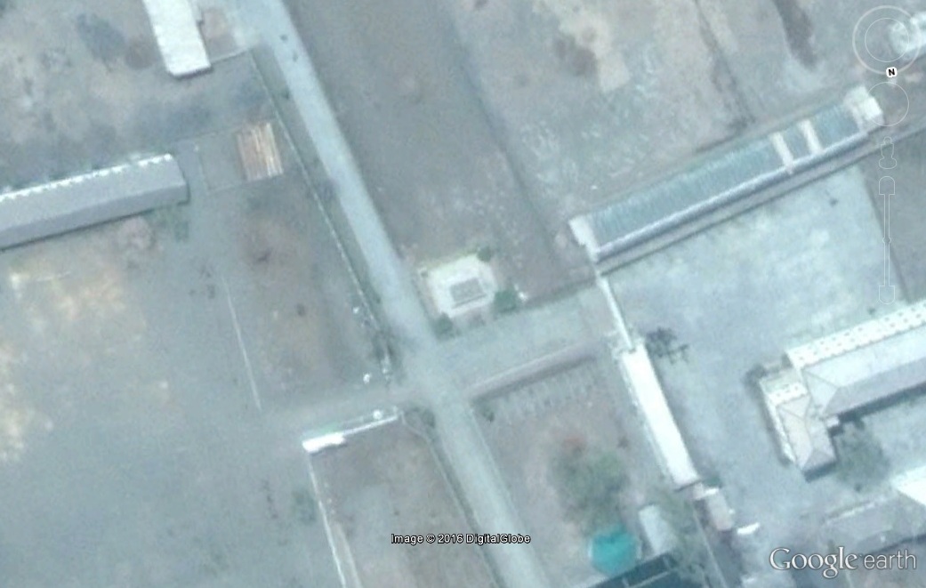
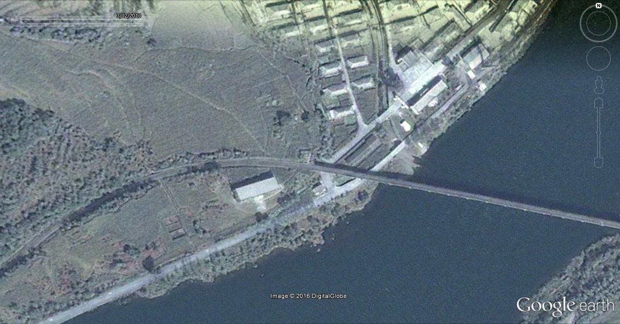
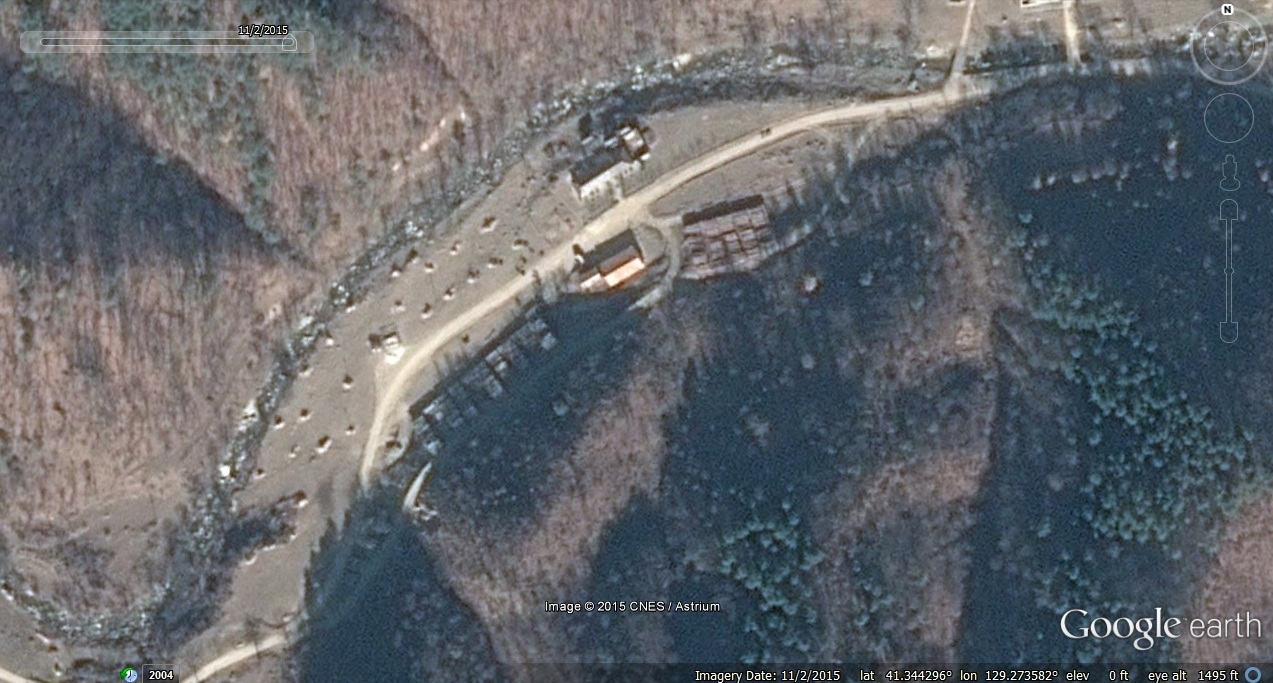
8. A new checkpoint building has been built on the northern perimeter crossing:

Image Date (Google Earth): 2008-12-12
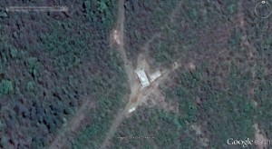
Image Date (Google Earth): 2014-5-5
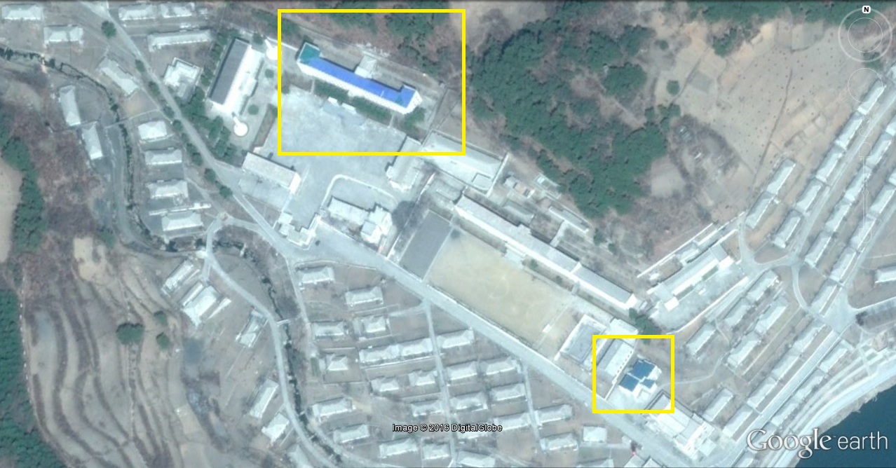
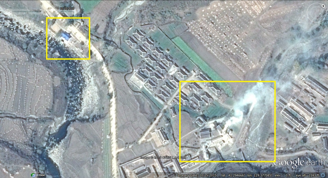
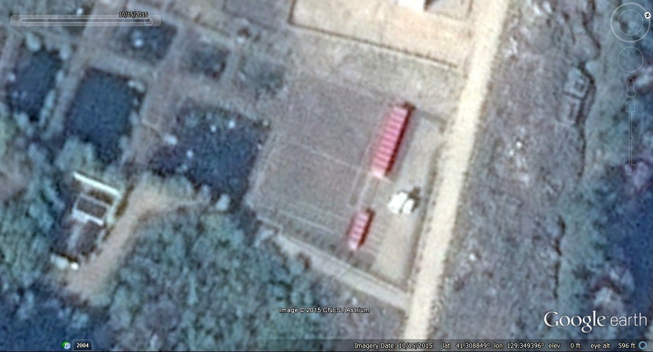
9. A new facility has been constructed in Knup-ri area that appears to be a new factory:
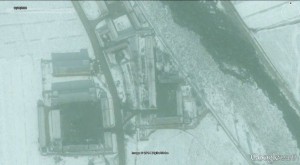
Image Date (Google Earth): 2008-12-12
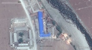
Image Date (Google Earth): 2014-5-5