Archive for the ‘Google Earth’ Category

New statues at Security University of the DPRK (MSS University)

Wednesday, November 19th, 2014

MSS-Uni-Statues-2014-11-19

Pictured above: Security University of the DPRK (formerly “University of KPA Unit 10215″) in Mangyongdae District (39.044446°, 125.633676°)

KCNA has announced the unveiling of new statues of Kim Il-sung and Kim Jong-il at the “Security University of the DPRK”. The bases for these new statues can be seen in the satellite imagery, but the statues themselves can be seen in the official photos below:

MM00227339

MM00227349

According to the article:

Present there were Kim Ki Nam, Choe Thae Bok, Pak To Chun, Kim Won Hong, Jo Yon Jun, and commanding officers of the Ministry of State Security, officials of security organs at various levels and teachers, students and employees of the university and their families and officials and those of meritorious services of units which contributed to erecting the statues.

Kim Jong-il last visited this facility on May 5, 2009. Kim Jong-un has yet to make an official visit.

univ-of-KPA-unit-10125

Share

New satellite imagery of Pyongyang (2014-9-21)

Friday, October 31st, 2014

Google has offered some beautiful new satellite imagery of the Pyongyang area dated September 21, 2014. The imagery shows the Pyongyang region remains an area undergoing tremendous transformation that has taken place over the last decade. Below I have highlighted some of the more interesting changes that have appeared in the last few months.

1. The nearly completed Wisong (Satellite) Scientist Street (위성과학자거리) in Unjong District, Pyongyang: 39.231244°, 125.870377°

Wisong-Scientist-Street-competed-2014-9-21

The Satellite Scientist Street is in Unjong District next to the State Academy of Sciences and inside the newly-announced Unjong Cutting-Edge Technological Development Zone. The area is approximately 900m x 360m and consists of 24 residential blocks (each seven stories, appx 13m x 80m) of alternating green and yellow. There are also approximately eight parks (of one kind or another), nursery, kindergarten, primary school, junior secondary school, standard North Korean retail outlets, hospital, polyclinic, health complex, greenhouses and vegetable gardens. Also constructed nearby is the new Natural Energy Institute of the State Academy of Sciences and a new Paesomjon train station.

After being out of public view for over a month this fall, Kim Jong-un made a notable appearance here on October 14. It was completed and opened on the 17th. Officially the compound is for scientists at the State Academy of Sciences.

2. Pyongyang Baby Home and Orphanage (평양육아원,애육원): 39.042442°, 125.794987°

Pyongyang-Baby-Home-Orphanage-2014-9-21

This new orphanage in Pyongyang is by far the country’s largest and nicest. It sits on a plot of land approximately 110m x 250m. Kim Jong-un visited the completed facility on October 27.

During the construction, many visitors to Pyongyang were unaware of the location of this project (I know because I asked). This is because it lies secluded behind exclusive leadership residencies (Undok Housing Complex and and United Front Department Housing) in northern Taedonggang District.

location-of-orpanage-2014-10-31

3. New luxury restaurant boat on Taedong River: 39.014252°, 125.755015°

Leisure-boat-2014-9-21

A large restaurant boat is under construction on the banks of the Taedong River in central Pyongyang. Not much is known about this boat yet, but it is approximately 118 meters long–nearly twice the length of the largest restaurant boat in the DPRK, the Taedonggang Restaurant Boat. The investors in this project must have high expectations. It will be interesting to see if these boats will all be managed by the same organization, and whether the Pyongyang consumer economy can support two such operations.

NK News was the first to report on this boat back on September 11. You can see a photo of the ship here.

UPDATE: Kim Jong-un visited this boat on 2015-9-28. It is called the “Combined Service Boat Mujigae”.

4. Progress made on Mansudae Underground Convenience Store (만수대 지하편의상점): 39.026505°, 125.749284°

Mansudae-Underground-Convenience-Store-2014-9-21


A Koryo Tours delegation in March of 2013 was the first to report that the Hakdanggol Fountain Park had been torn down to make way for a new facility in the heart of the central district.  The DPRK has yet to announce much information related to the project, but tourist photos indicate it will be an underground shopping center below a park.

Mansudae-underground-convenience-store-vision

5. Progress made on high-rise shopping center near Tongil Market: 38.982815°, 125.733247°

Tongil-shopping-highrise-2014-9-21

Situated just north of Pyongyang’s most popular market (for foreigners), the Tongil Street Market, and just south of the failed investment project KKG Avenue, this large high-rise construction project continues to make progress. The building appears to have an “H” shaped base approximately 110m x 70m. This project is likely being supported by foreign investors, however we do not know who they are or anything substantive about this project.

6.  Progress made on East Pyongyang Shopping Mall (동평양지구 상업거리): 39.030246°, 125.775913°

east-pyongyang-shopping-mall-2014-9-21

The groundbreaking ceremony for this project was held on January 16th, 2014, but little substantive work had been done as late as April. The construction site is approximately 270m x 110m and was unoccupied as far back as 2000. When launched, this shopping center was under the auspices of the State Economic Development Commission (SEDC–the same organization responsible for the nation’s new economic development zones) and a Chinese consortium named “Great China International Group”. Since the launch, the  SEDC, Ministry of Foreign Trade, and the Joint Venture Investment Corporation (JVIC) have been merged into the Ministry of External Economic Affairs (Not to be confused with the External Economic Affairs Commission which was dissolved in the late 1990s).

7. Closure of east Pyongyang tram depot and removal of tracks

FORMER-East-PY-tram-2014-9-21

According to new satellite imagery, one of Pyongyang’s tram lines has been removed. The tracks, which were inlaid into the road, seem to have been completely pulled up and the roads repaved. The tram depot remains in eastern Pyongyang, but it can be easily be re-purposed to serve as storage or manufacturing needs in the future.

East-PY-Tram-depot-2014-1-27 East-PY-Tram-depot-2014-9-21

It will be interesting to see if this has any effect on the Sadong Market which lies directly next to the former tram depot. It would have been relatively easy for customer to travel to the market with such convenient public transport, but will people make the effort when the commute becomes more complicated?

UPDATE: Reader Gag Halfrunt sent in the following helpful information:

Judging by this map from Transphoto.ru the closed tram line is the eastern portion of line 1. Line 1 has another depot at the western terminus in Mangyongdae, which is still open in the latest Google satellite photo.s.

Indeed there’s a note on Transphoto.ru saying the line will be converted to a trolleybus line. Translated by Google, it says:

Tram line 1 of route to the east of the city Songsin and depot at the end of the line are closed. The tram is expected to be replaced by trolley. This line was the only one in the city where the tram followed by the middle of the carriageway and not along the roadside, which is not the North Korean standards. Previously the line had already been shortened to Sintra area-Dong, before the bridge, on the east bank of the river Tedogan, before you reach the town center . Tram Pyongyang also begins to experience significant deficits with operational rolling stock.


Share

Quanhe-Wonjong Bridge: Renovated and to be replaced (UPDATED)

Saturday, June 28th, 2014

 rason-bridge-2016-3-19

 Pictured Above (Google Earth) the Hunchun-Rason Bridge: (L) 2009-5-28 (R)  2016-3-19

UPDATE 6 (2016-3-19): New satellite imagery shows progress being made on the bridge, but it seems to be moving slowly.

UPDATE 5 (2014-6-28): According to Xinhua, the bridge is to be replaced:

China and the Democratic People’s Republic of Korea (DPRK)agreed on Friday to jointly build, manage, and maintain a new border bridge between thetwo neighbors.

An agreement was signed by Chinese Ambassador to the DPRK Liu Hongcai and DPRKVice Foreign Minister Pak Myong Guk, the official KCNA news agency reported.

The Quanhe-Wonjong bridge over the Tumen River, which was built in the 1930s, hasbeen in a shabby condition.

UPDATE 4 (2012-10-26): Rajin-Wonjong Road Opened to Traffic


Pictured Above (KCNA): Photos of the official opening of the renovated road

According to KCNA:

Rajin-Wonjong Road Opened to Traffic

Pyongyang, October 26 (KCNA) — A ceremony took place in Rason City of the DPRK on Friday to open to traffic the Rajin-Wonjong road in the Rason Economic and Trade Zone jointly developed and operated by the DPRK and China.

Attending it from the DPRK side were Jo Jong Ho, chairman of the Rason City People’s Committee, officials concerned and people of the city and from the Chinese side were Zhang Anshun, secretary of the Yanbian Autonomous Region, Jilin Province, Committee of the Communist Party of China, Chen Weigen, vice-governor of the Jilin Provincial People’s Government, Tian Baozhen, consul-general to Chongjin, and other officials concerned.

Congratulatory speeches were made at the ceremony.

Hwang Chol Nam, vice-chairman of the Rason City People’s Committee, said it is very glad that the road has been opened to traffic amid great expectation and interest of the peoples of the two countries at the historic time when the traditional bilateral friendship is growing stronger.

The whole course of the road project served as an occasion in deepening the friendly relations of the DPRK and China and displaying the validity and vitality of their joint development and operation of the Rason Economic and Trade Zone, Hwang added.

The road helps increase the cargo traffic and transport of freight from northeastern China to Rajin Port and promote the development of economic relations between the two regions, including tourism, he said.

Zhang Anshun warmly welcomed the opening of the road on behalf of the Jilin Provincial Party Committee and Government, saying that it is a good start for the progress of the zone to be jointly developed and operated by the two countries.

Zhang hoped that the two countries would develop the economy and their peoples would enjoy happiness under the guidance of the Communist Party of China headed by Hu Jintao and the Workers’ Party of Korea headed by Kim Jong Un.

Members of the platform cut the tape to declare the opening of the road. Then vehicles passed along the road amid display of fireworks.

Here are additional articles that mention the bridge:

1. Recent articles on Rason’s future (2011-5-4)

2. Rason’s Chinese investor tour (2011-4-4)

UPDATE 3 (2011-9-7): A reader send in a photo of the road:

Rajin-China-Road-2011-9-7

Click image to see lager version and source.

UPDATE 2 (2010-6-23): Hunchon Bridge opens.  According to Kyodo (via Breitbart):

China has repaired a bridge in Hunchun at the Chinese and North Korean border, giving it a safer access to North Korea for use of Rajin port to ship coal to Shanghai, according to Jilin Province officials.

China paid 3.6 million yuan ($528,526) to repair the bridge over the Tumen River, a project jointly pursued with North Korea, the officials said Tuesday.

Work was completed June 14.

The bridge serves as a gateway to Pier No. 1 at Rajin port, which a Chinese company has obtained the right to use for 10 years.

In April, the Chinese government approved a plan to transport coal and other items produced in Jilin to Shanghai via Rajin in northeastern North Korea.

China and North Korea have been in talks about financing of a plan to build a 50-kilometer road leading to the port, the officials said.

UPDATE 1 (2010-6-6): DPRK border bridge to reopen this month, highway to border opens in October
By Michael Rank

A bridge on the Chinese-North Korean border that will take traffic to the North Korean port of Rajin is due to reopen at the end of this month, while a highway from the Jilin provincial capital of Changchun to the border city of Hunchun 珲春 will open in October, according to Chinese reports here and here.

As NKEW reported in April, the 70-year-old bridge over the Tumen river near Hunchun  is being rebuilt as part of a reported $44 million plan to modernise the road from the border to Rajin. Built during the Japanese occupation in 1938, the bridge is 535 metres long and 6.6 metres wide, and joins the Chinese border post of Quanhe 圈河 with the North Korean town of Wonjeong 원정.

The highway will open on October 1, China’s national day, and will cut the journey time from Changchun to Hunchun from eight hours to five, the report said. But it indicated that the 60-km road from the border to Rajin, said to be mostly unpaved and prone to frequent accidents during rain, would not be ready by then.

A Chinese company, Chuangli Group, based in Dalian in Liaoning province,  was reported in March to have signed a 10-year deal to lease a pier at Rajin (also known as Rasŏn or Rajin-Sŏnbong), giving China access to the Sea of Japan for the first time since the 19th century when the Qing imperial government signed treaties under duress from Japan and Russia.

ORIGINAL POST (2010-4-13): Bridge on China-North Korea border being renovated
By Michael Rank

A 70-year-old bridge on the Chinese-North Korean border is being renovated to improve transport to and from the North Korean port of Rajin 라진 (Rason [Raseon]/Rajin-Sonbong) which a Chinese company has taken over on a 10-year-lease, a Chinese website reports.

The bridge over the Tumen river near the city of Hunchun 珲春 in Jilin province will be reopened at the end of June after almost five months of work. Built during the Japanese occupation in 1938, the bridge is 535 metres long and 6.6 metres wide, and joins the Chinese border post of Quanhe 圈河 with the North Korean town of Wonjeong 원정. The report gave no details of costs but said it was being renovated under a deal between the cities of Hunchun and Rason 라선. It said the bridge would help to boost trade in both Hunchun and Rajin and in the region generally.

The refurbishment of the bridge is part of a reported $44 million plan to modernise the road from the border to Rajin.

Ahn Byung-min, an expert on North Korean infrastructure at the Korea Transport Institute, was quoted by the Korea Herald as saying a senior Chinese local government official had told him that the governor of Jilin had signed an agreement to invest 300 million yuan in expanding and paving the road to Rajin.

A Dalian-based company named Chuang Li agreed in 2008 to revamp the road in exchange for leasing a pier at Rajin. “Chuang Li isn’t a company big enough to afford the road construction, so the Jilin government took on the direct investment instead,” Ahn said.

Additional Information:
1. The existing 60-km road is mostly unpaved and prone to frequent accidents during rain.

2. The coordinates of the new bridge are  42°34’4.45″N, 130°31’24.16″E. You can see it on Google Maps here. Thank you for the tip, Mr. Cha.

3. There are a couple of more bridges in the area: here (which looks like it has been unused for some time) and here.

4. Photos of the construction opening ceremony are here.

Share

Some new satellite images

Tuesday, January 14th, 2014

Below are the first public satellite images of the new Munsu Water Park and Mirim Riding Park.

Munsu-wading-pool


Mirim-riding-park

Share

New Yalu/Amnok River bridge in south-west Dandong (UPDATED)

Thursday, October 10th, 2013

New-Dandong-bridge-2014-4-2


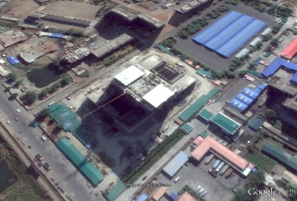
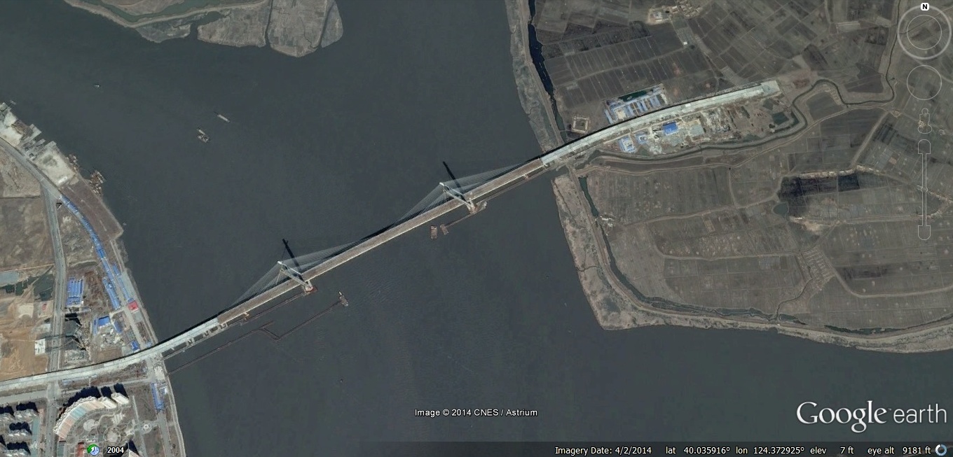
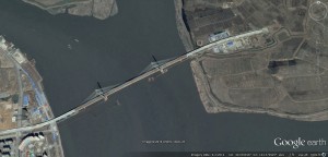
Pictured above (Google Earth): The new Yalu/Amnok River bridge under construction

UPDATE 13 (2014-10-31): Opening of new NK-China bridge delayed indefinitely. According to the Daily NK:

The planned opening of the bridge connecting Dandong in Liaoning Province, China with Sinuiju, North Pyongan Province in North Korea has been delayed indefinitely, according a report by China’s state-run Global Times on October 31st.

According to the report, North Korea has not followed the business plan stipulating that it construct access roads to the bridge, and as such, its opening remains on hold. North Korea was charged with construction on access roads for the bridge, but work at the site has yet to begin, in fact, the area continues to be nothing but swathes of farmland.

On the ground in Dandong, the report conveyed the disappointment by many in the area, “This new bridge that was going to be so magnificently built is finished on one side, and a vegetable plot on the North Korean end.” Many traders and people purchasing homes and opening stores in the area were anticipating to benefit from increased commerce between the two cities, which account for 70% of bilateral trade, after the bridge’s completion.

The construction of the new bridge over the Amrok [Yalu] River, to replace the aging “Sino-Korean Friendship Bridge,” was officially proposed by China’s former Vice Minister of Foreign Affairs, Wu Dawei, when he visited North Korea in 2007. However, it was not until October 2009 that former Premier Wen Jiabao visited North Korea to make the deal official, for which China agreed to take on the construction costs. The two countries then finalized plans for the project in February 2010, with China continually pushing for construction to begin in October, only to see them finally begin in December that year after a series of delays.

Over the past four years of construction, China accelerated efforts to build a four-lane highway and other advanced features amounting to 2.22 billion RMB [approximately 360 million USD].

As to why the project has not moved forward despite China’s completion of its end of the deal, “North Korea demanded more investment from China for the connecting roads and has done no construction,” the report stated.

Daily NK previously reported in July about the advanced construction efforts on the Chinese side and predicted delays in the bridge’s opening due to failure by North Korea to uphold its end of the contract.

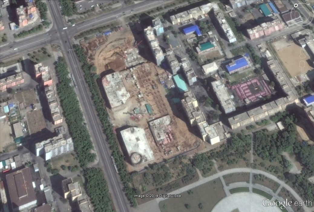
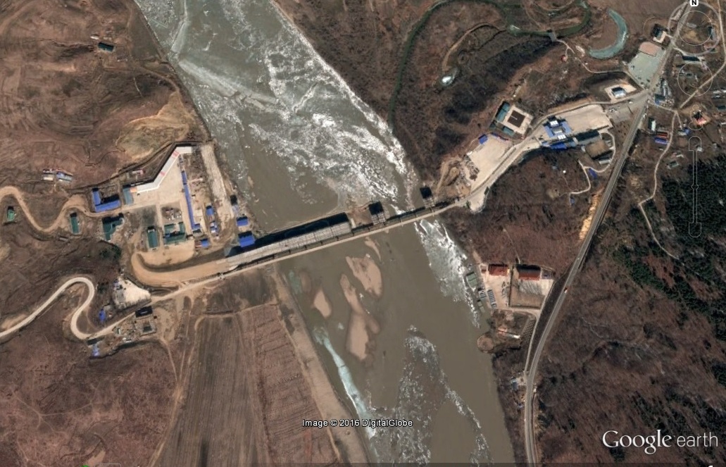
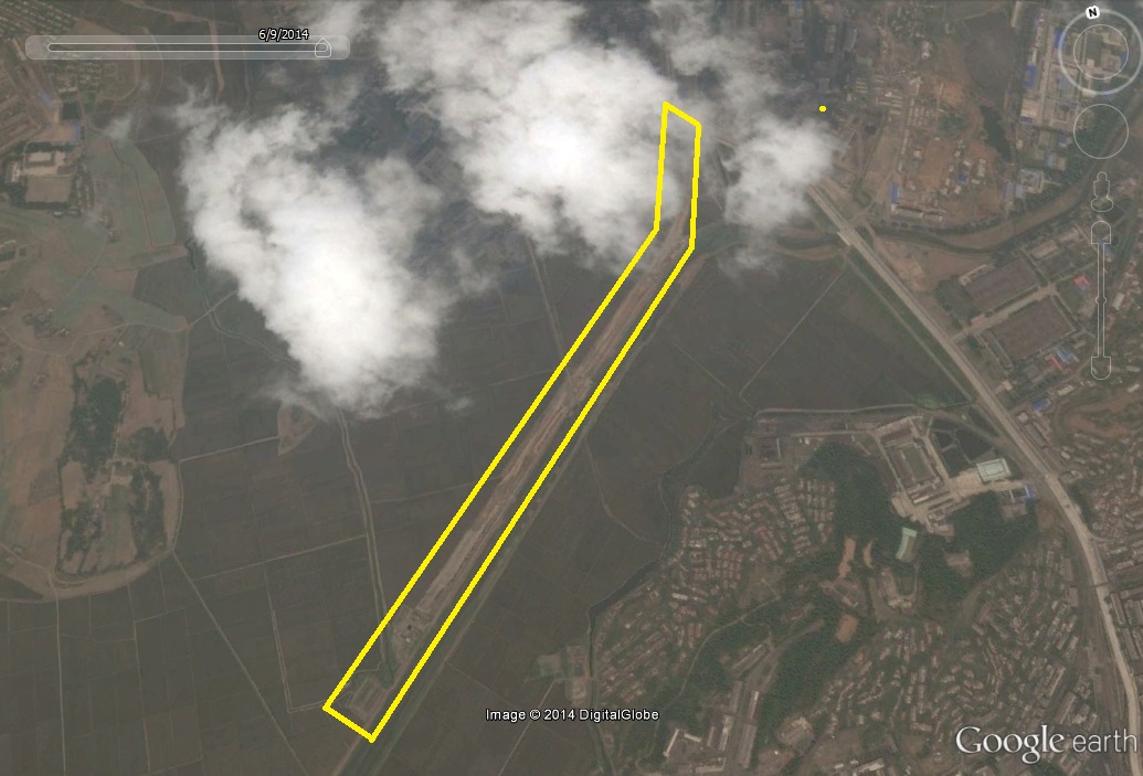
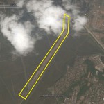
The story is not completely accurate, however, because the North Koreans have at least begun the process of building a road to connect the bridge to Sinuiju. According to Google Earth satellite imagery dated 2014-6-9 we can see the beginning of road construction:

Yalu-river-bridge-road-2014-6-9

Here is more in the Hankyoreh.

UPDATE 12 (2014-7-18): The Institute for Far Eastern Studies (IFES) offers an explanation for the lack of progress on the DPRK side of the bridge:

New Amnok (Yalu) River Bridge – Present Conditions and Future Outlook

According to recent reports, the New Amnok (Yalu) River Bridge may not be finished by its projected date of September 2014 due to delays in the construction of roads and customs facilities.

The bridge, which will connect the North Korean city of Sinuiju with the Chinese city of Dandong in Liaoning Province, has advanced into the final stages of construction following the recent completion of the control tower and the bridge deck.

When the bridge is completed, the existing Amnok River Bridge (located approximately 10km away from the new bridge) will be restricted to railroad traffic only, and general road traffic to-and-from North Korea and China will be rerouted to the new bridge.

The existing Amnok River Bridge has been cited as a bottleneck for the blooming trade industry between North Korea and China for several reasons. The bridge, built in 1911, accommodates both a railway and roadway, but has only one lane. Furthermore, its old age has sparked safety concerns; trucks weighing over 20 tons have been prohibited from using the bridge.

Reportedly, China has begun construction on a new commerce zone costing 2 billion RMB (330 billion KRW) that will connect with the New Amnok River Bridge from the Chinese side.

The new commerce zone is set to be built on a 380 thousand square-meter plot of land and will include various services such as border checkpoints, customs, quarantine facilities, and immigration. Business facilities such as hotels, shopping centers and other residential and commercial buildings are also expected to be built in this area.

Once construction finishes and operations begin, China is expecting that the new area will accommodate for the passage of up to twenty thousand cars and fifty thousand people per day. It is also predicted that the new trade zone will be responsible for up to 60 percent of the total trade volume passing between the two countries.

However, on the North Korean side, it appears that construction has yet to begin on any of the necessary immigration facilities such as checkpoints and customs.

It has been reported that since construction of the New Amnok (Yalu) River Bridge began in 2010, abrupt changes in the state of affairs and weakening international ties between the two countries has left North Korea without a financier. North Korea had originally projected total construction and operation costs of 20 million USD (approx. 20 billion KRW), but has yet to secure the money from foreign investors.

In the past, the Chinese government persuaded North Korea into constructing the New Amnok (Yalu) River Bridge, but appears to have lost its previous fervor.

Back in 2007, China’s former Vice Minister of Foreign Affairs, Wu Dawei, proposed the construction of the new bridge under the condition that China will be responsible for the entirety of construction costs. In October 2009, former Premier Wen Jiabao visited North Korea and finalized the agreement.

From the outset, plans for the creation of the New Amnok River Bridge were not drawn up by North Korea, but rather strongly demanded by the regional governments in China’s Liaoning province and Dandong city. North Korea set its focus on the repair of the original existing Amnok River Bridge in order to set a fixed limit on the exchange of personnel and materials, citing regime stability as a reason. However, China persisted, promising to provide financial support for the construction of not only a new bridge, but also for customs facilities, immigration, and a highway connecting the bridge to Pyongyang.

At first, China was actively engaged in supplying North Korea with the financial resources necessary for construction. However, with the increase in nuclear tests, missile launches and increasingly negative internal public opinion, as well as the execution of Chinese ally Jang Song Thaek, China seems to have slowed the pace and now carefully monitors its involvement with North Korea.

In order to protect its domestic and foreign image, it is expected that China will complete construction of the infrastructure on their side of the New Amnok River Bridge within the year. China is also expected to offer less support to North Korea, showing an increasingly passive response.

According to recent reports, North Korea is currently in the process of preparing the customs and immigration facilities in Sinuiju—connected to the existing Amnok River Bridge—to handle procedures after construction of the new bridge is finished. The existing facilities are expected to be used due to North Korea’s inability to finish construction of the new immigration facilities and other connecting roads on time.

North Korea’s Central News Agency (KCNA) introduced the New Amnok River Bridge on a television program in August 2013, boasting that over 3,000 lorries and cargo ships will pass over and under the bridge per day. In the program, it is said that the bridge will be completed by September 2014

UPDATE 11 (2014-7-2): The bridge opening is likely to be delayed (again). According to the Daily NK:

The planned opening of a large new bridge across the Yalu River connecting Dandong in Liaoning Province with Sinuiju is likely to be delayed, Daily NK has learned. The cause of the delay is thought to be North Korea’s failure to make good on its contractual obligations.

“The Chosun side took on the job of constructing the roads, but they are making painfully slow work of it. Because the roads are still not finished, people are wondering whether their initial aim of increasing trade volumes is on its way down the drain,” a source close to the project told Daily NK on the 1st.

“China provided a lot of materials and machinery to the North, but there is a story that this machinery was sent for use on other projects rather than for the bridge construction. The Chinese traders who did harbor high hopes for [economic] opening brought on by the bridge are showing their disappointment more and more,” the source explained.

The partially complete New Amrok [Yalu] River Bridge is designed to connect Langtou new city with south Sinuiju at a total cost of 2.22 billion RMB (approximately 357 million USD). It lies 8 km downstream from the ageing “Sino-Korean Friendship Bridge” (formerly the Amrok [Yalu] River Bridge).

The old bridge is currently the only one that connects the two cities, but, built in 1943, it is wholly unfit for purpose. Trucks that weigh more than 20 tons are not allowed on it due to safety concerns, and it also has just one lane, which restricts trade volumes. Traders had hoped that the new bridge would speed up commerce between the two cities, which account for 70% of bilateral trade despite these structural limitations.

The construction of the new bridge was officially proposed by China’s former Vice Minister of Foreign Affairs, Wu Dawei, when he visited North Korea in 2007. However, it was not until October 2009 that former Premier Wen Jiabao visited Pyongyang and sealed the deal, under which China agreed to foot the bill for construction. The two countries then finalized plans for the project in February 2010, and the groundbreaking ceremony was held in December that year.

The Chinese side has demonstrated its intent to see the completion of the four-lane bridge, with its accompanying management, security and inspection infrastructure.

“In accordance with the plan, China has already got a customs office in place to administer the flow of goods over the bridge,” the source revealed. “But the North has slowed right down, and the talk of trade expansion from before has gone away.”

This declining enthusiasm is tangible in the property market in Langtou, the region of Dandong that ought to benefit the most from bilateral economic activity across the new bridge. “Apartment prices remain where they were three years ago, at roughly 4000 Yuan per pyeong,” explained the source. Pyeong is a Korean unit of measuring area, and amounts to 3.305785m².

“The number of people wanting to learn Korean in Dandong is still the same,” he admitted, “but that’s only because they want to watch Korean dramas. They have already given up on the idea of booming trade with North Korea since they saw those who had been successful going to the wall after the execution of Jang Song Taek.”

In addition to problems with the bridge, Daily NK established in May that almost no progress has been made on the development of two Special Economic Zones in the Sinuiju area (see linked article).

UPDATE 10 (2014-1-14): Xinhua reports the bridge will open in 2014:

A new bridge over the river border between China and the Democratic People’s Republic of Korea (DPRK) is expected to open this year, local authorities said on Tuesday.

About 80 percent of work on the Yalu River Bridge is complete, according to the Transport Department of northeast China’s Liaoning Province.

Construction began on the 3 km bridge at the end of 2010, and will cost 2.22 billion yuan (356 million U.S. dollars).

A joint project between the two countries, the bridge will have four two-way lanes upon completion, according to an agreement signed in February 2010. The new route is expected to boost communication and economic cooperation.

The only bridge connecting the nations was built in 1937. Trucks weighing more than 20 tonnes are not allowed on the one-way bridge, considerably restricting trade volume.

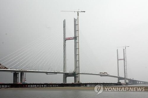
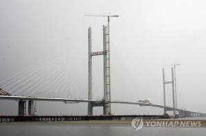
UPDATE 9 (2013-11-8): Yonhap releases a photo of the bridge nearing completion:

Yal-Amnok-2013-10-Yonhap

UPDATE 8 (2013-10-14): According to the Global Times:

A new bridge will link China and the Democratic Republic of Korea (DPRK) by 2014 and greatly boost exchange and trade between the two countries, officials said Monday.

A new border trade complex, complete with customs services, border control and quarantine services, as well as office buildings, hotels and markets will also be operational by 2014, according to Shi Guang, mayor of Dandong city, where the bridge is located.

The whole complex will cover 38 hectares and cost two billion yuan (325.8 million USdollars) to build, Shi said.

The new bridge is 10 kilometers down the Yalu river from the old bridge, which was built in 1937 and has been sole major passage on the China-DPRK border.

The two governments agreed to build the new bridge in early 2010. It will have four lanes and a span of about three kilometers.

The new facilities will be able to handle as many as 20,000 vehicles and 50,000 people a day and Dandong authorities expect that businesses done at the trade complex will account for 60 percent of China-DPRK trade.

UPDATE 7 (2013-10-10): The Institute for Far Eastern Studies (IFES) offers some new information:

The construction of the New Yalu River Bridge, the new suspension bridge over the Yalu River, connecting China’s Dandong city (Liaoning Province) and North Korea’s Sinuiju city (North Pyongan Province) is in its final stages.

Currently, the volume of trade between Sinuiju and Dandong is heavy, and the Yalu River Railway Bridge is saddled with transporting goods. It is hoped that the new bridge will help ease that burden. Several hundred workers are involved in its construction.

According to one Dandong resident, “Despite North Korea’s nuclear test and China’s decision to impose sanctions against the North, construction of the New Yalu River Bridge has been relentless.” The new bridge is considered as an important symbol of Sino-DPRK economic cooperation. Its construction is believed to be well on track.

The total project cost of the construction is estimated to be 2.22 billion CYN (about 390 billion KRW or 3.6 million USD). China is covering the bridge’s construction costs and has reportedly introduced a variety of new technologies to improve the precision and safety of the structure. Once completed, the bridge will be 3 km in length, with the height of its two pylons at 197 meters and the distance between pylons to be about 636 meters.

Travel from Pyongyang to Dandong currently takes 4 hours; that time is expected to be cut in half as the new suspension bridge is located 8 km downstream from the existing railway bridge.

If the construction progresses smoothly, the bridge should open for operation by July 2014. The Korean Central News Agency (KCNA) reported on August 23 that the new bridge should accommodate over 3,000 55-tonne freight cars per day, and 3,000-tonne ships will be able to pass under the bridge.

Along with the new bridge, China and North Korea are also engaged in joint development of a new district in Dandong and the Hwanggumpyong Special Economic Zone (SEZ). Despite the lingering concerns over the development of these areas after the death of former North Korean leader Kim Jong Il, the development has reportedly continued uninterrupted.

Despite the continued international and other sanctions against North Korea, the development of Hwanggumpyeong SEZ is speculated to pick up speed after the completion of the bridge. The Hwanggumpyeong SEZ is a project that North Korea put forth in response to the “May 24 Sanctions” imposed by the South Korean government after the sinking of ROKS Cheonan. These sanctions essentially had brought an end to all inter-Korean economic cooperation and exchanges (with the exception of the operations at the Kaesong Industrial Complex).

Last September, a groundbreaking ceremony for the administrative building in the Hwanggumpyeong SEZ was held. Since then a customs building, security facilities, management office, street lights, and transport inspection office are reported to have been built or are currently under construction.

UPDATE 6 (2013-8-23): New KCTV footage of the bridge can be seen here:

UPDATE 5 (2013-6-4): I wrote an update on the construction of the bridge at NK News.

UPDATE 4 (2012-11-7): The China Daily’s English-language Dandong page reports on the status of the bridge:

Construction on the new bridge, with an investment of 2.22 billion yuan, began at the end of 2011. According to the Dandong government, the main structure of the bridge has been completed. It is expected to become operational in July 2014.

UPDATE 3 (2011-6-25): Adam Cathcart took some pictures of the new bridge construction–so it is progressing!

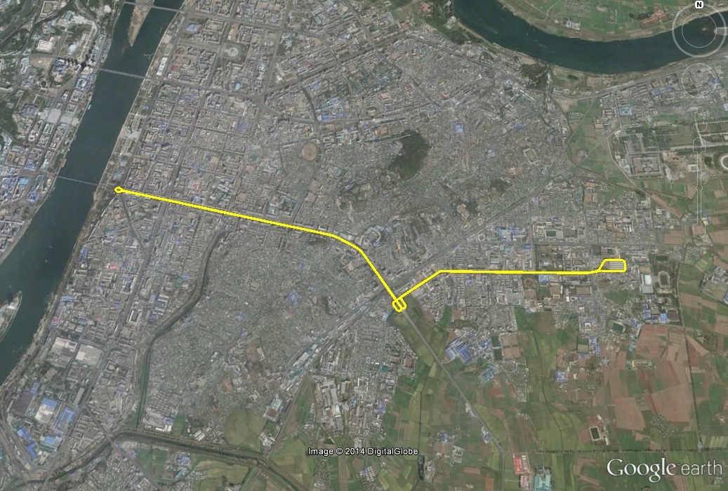
UPDATE 2 (2011-2-2): For some time I have been trying to track down the location of the proposed new Yalu River bridge which will connect the DPRK and China.  Thanks to a story in the Daily NK, I was able to map it out on Google Earth:

Pictured above: Location of the proposed Yalu Bridge (Google Earth) [UPDATE-The bridge was ultimately moved from this location]

According to the Daily NK:

According to someone inside the construction company responsible for the bridge’s development, “The development of Xinchengqu has been on the drawing board for two years. This time, the construction of the New River Yalu Bridge was confirmed between China and North Korea. This is a very good chance for us, from now on Xinchengqu will become the center of China-North Korea trade.

According to Dandong’s urban development plan, the bridge will connect Busan-Seoul-Pyongyang-Dandong and Beijing in the future, implying that future trade and cooperation between a reunited Korea and China is being taken into account.

China is providing the construction costs for the New Yalu River Bridge; an estimated one billion Yuan (approximately $145 million).

This particular location is interesting because it completely bypasses the city and county of Sinuiju–where earlier reports (below) described its location.  The bridge actually crosses from China into Sopuk-ri, Ryongchon County (서북리, 룡천군)—in the middle of nowhere.  There is absolutely no infrastructure at this location for administering trade between the DPRK, China, and prospectively South Korea, so it will all need to be built from scratch or moved from Sinuiju. Either way, this is bad news for Sinuiju which today benefits financially as both the capital of North Pyongan Province and as the gateway for the majority of trade between the DPRK and China.  It looks like Ryongchon may be taking some of their business!

In addition, the North Koreans have been widening  the Sinuiju highway and “beautifying” all of the surrounding residential areas in anticipation of greater loads of traffic coming from China.  See more about this here.  This could all be for naught if the Chinese end up building a trade artery south of all this construction!

UPDATE 1 (2010-12-31): (KCNA h/t Aidan Foster-Carter) The ceremony did take place to mark the launch of the bridge’s construction:

Pyongyang, December 31 (KCNA) — A ground-breaking ceremony for a DPRK-China bridge across the River Amnok took place in Dandong City, China, on Friday.

Present there from the DPRK side were its government delegation headed by Kim Chang Ryong, minister of Land and Environmental Conservation, and from the Chinese side Li Shenglin, minister of Transport, Hu Zhengyue, assistant to Foreign Minister, and Chen Zhenggao, governor of the Liaoning Provincial People’s Government, and other officials concerned of the central and local governments of China.

Speeches were made by Kim Chang Ryong, Kim Song Gi, vice-minister of Foreign Affairs, and Choe Jong Gon, chairman of the North Phyongan Provincial People’s Committee, from the DPRK side and Li Shenglin, Hu Zhengyue, and Chen Zhenggao from the Chinese side.

They said that two rounds of General Secretary Kim Jong Il’s visit to China this year marked historic events of epoch-making significance in developing the DPRK-China friendship on a fresh high stage.

They expressed belief that the bridge would make a contribution to demonstrating once again the great vitality and invincible might of the DPRK-China friendship steadily growing stronger.

The bridge will be successfully built as a symbol of the DPRK-China friendship and a structure of the two peoples, they added.

Then followed a ceremony of the ground-breaking for the project.

The Ministry of Transport, the Liaoning Provincial Committee of the Communist Party and the Liaoning Provincial People’s Government of China arranged a reception in connection with the ceremony.

ORIGINAL POST (2010-12-28): According to Daily NK:

It was reported that there will be a ceremony to celebrate the start of construction of the New Yalu River Bridge linking Shinuiju and Dandong, China, before the end of the year.

Yonhap News yesterday quoted Shenyang and Dandong sources saying that both the North Korean and Chinese authorities decided to hold the ceremony this year and have started preparing for the event.

The source in Dandong said, “Instructions that the start of the bridge construction must not slip to next year were handed down from the Chinese government last week, so the governments of Dandong City and Liaoning Province urgently are trying to set a date. It will likely happen the 30th or 31st.”

The source also explained the reason why the Chinese government is hurrying to start the construction, which was supposed to start early next year. “Both China and North Korea intend to show observers domestically and internationally they have the will to construct the bridge.”

In Langtou, Dandong, where one end of the bridge will be built, a construction board has been set up and says the New Yalu River Bridge will connect to Jangseo in the southern part of Shinuiju.

China and North Korea agreed to construct the bridge in October 2009, and in February, the Vice Minister of Foreign Affairs of North Korea, Pak Gil Yon, and Chinese Assistant Foreign Minister Wu Hailong signed the agreement in Dandong, China.

Dandong City had announced plans to start construction of the bridge in October, but it has been delayed for uncertain reasons. It was rumored there was conflict over the construction of the bridge because North Korea had requested additional aid from the Chinese government.

Researcher Jeon Byung Gon of the Korea Institute for National Unification said in a telephone interview with The Daily NK that, “The ceremonial ground-breaking will be a chance to promote the friendship between China and North Korea again.”

Researcher Jeon explained that, “So far, there have been several impediments to trade such as quotas, outdated facilities for transportation, both countries’ border management, etc. However, when the New Yalu River Bridge is constructed, such limitations can be resolved and trade between China and North Korea can be revitalized.”

He predicted, “Since they are trying to carry out the construction in a hurry, economic cooperation and friendship relations between two countries will be taken to the next level.”

Also, from the Choso Ilbo:

A source in Dandong said Wednesday that North Korea and China will start construction of the bridge as early as Friday. The two sides agreed to build the bridge during Chinese Premier Wen Jiabao’s visit to North Korea in October last year, with work expected to start this October.

China insists on having the bridge connect the newly renovated area of southern Dandong and southern Sinuiju, but North Korea wanted it to cross over Wihwa Island in Apnok River and connect Dandong with the old part of Sinuiju. The North claimed the route preferred by China would necessitate building a long embankment but in fact seems to have been nervous that a direct link to Pyongyang would cause security concerns like making it easier for North Koreans to flee.

But the North seems to have caved in. A source said construction will begin in March but a groundbreaking ceremony will be held before the end of this year.

Meanwhile, transport of goods and products has picked up via the Hunchun- Rajin-Sonbong route as part of an economic cooperation project. Around 500 truckloads of coal from China’s Jilin Province were shipped out of Rajin-Sonbong Port on Dec. 7 and are being transported to Shanghai across the East and South seas.

Read the full stories here:
New Yalu Bridge Groundbreaking This Year
Daily NK
Mok Yong Jae
12/28/2010

N.Korea’s Cross-Border Business with China Picking Up
Choson Ilbo
12/30/2010

Share

Tanchon Port reconstruction completed

Thursday, April 25th, 2013

Tanchon-port-2012-12-19

Pictured Above (2012-12-13): Tanchon Port

UPDATE 2 (2013-4-25): Yonhap reports on the DPRK’s plans for the Tanchon Port:

North Korea is scurrying to develop the resources-rich city of Tanchon on the east coast as part of the country’s efforts to make it a source of foreign currency income, recent news reports from the North showed.

Tanchon will become a key transit point in shipping goods to and from Russia’s Siberia, the northeastern part of China and Mongolia, said the Wednesday issue of the Choson Sinbo, a Korean language newspaper published by North Korean nationals in Japan.

The newspaper, a mouthpiece of North Korea, said the port city of Tanchon should become the source of finance for the country’s broader policy line of pursuing both economic development and nuclear capacities.
In a bid to boost exports, the country completed the construction of a port in May last year in the city with rich reserves of magnesite, zinc and other mineral resources, which sits about in the middle of the country’s east coast line. the Choson Sinbo said the city has about 5.4 billion tons of magnesite deposit, possibly the third biggest reserve in the world.

The news outlet also highlighted the country’s planned ways to increase earnings in the resources-rich city from which the country used to export mineral resources to China for meager profits.

“North Korea will move to manufacture processed magnesite goods in order to make high-value added goods,” the Choson Sinbo noted. “To that end, many plants will be built in the Tanchon region and the areas will become a new industrial zone.”

North Korean leader Kim Jong-un has also underlined the country’s plan to boost profits from the Tanchon development, saying in a national meeting of light industrial workers last month that profits from Tanchon development should be exclusively used to prop up the livelihood of North Korean people.

UPDATE 1 (2012-5-3): KCNA announces the completion of  the Tanchon Port:

A modern trading port made its appearance in the area of Tanchon in South Hamgyong Province on the occasion of the 100th anniversary of President Kim Il Sung’s birth.

The construction of the port with a cargo traffic capacity of millions of tons provides a guarantee for greatly contributing to developing the nation’s foreign trade and improving the people’s living standard.

A ceremony for the completion of the construction was held on the spot Thursday.

Present there were Choe Yong Rim, Kwak Pom Gi, Ro Tu Chol and other officials concerned, officials of the Ministry of Land and Marine Transport, builders and working people of industrial establishments in Tanchon City.

Read out there was a joint congratulatory message sent by the Central Committee of the Workers’ Party of Korea and the Cabinet of the DPRK to the officials and members of shock brigades who performed labor feats in the construction of the port.

The message highly praised them for successfully building another giant structure in the era of Songun greatly conducive to building an economic power true to the life-time desires and last instructions of President Kim Il Sung and leader Kim Jong Il.

It expressed belief that they would perform greater feats in the efforts for the country’s prosperity united close around the WPK Central Committee headed by the dear respected Kim Jong Un.

Minister of Land and Marine Transport Kang Jong Gwan, in his speech made for the occasion, said the construction of the port was a brilliant fruition of the wise leadership of Kim Jong Il who initiated the construction of the port and worked heart and soul to translate the desire of the President into a reality till the last moments of his revolutionary life and the clear-sighted guidance and meticulous care of Kim Jong Un.

Speakers at the ceremony pledged themselves to carry out their tasks including dredging in a short span of time in the same spirit as displayed in the construction of the port.

At the end of the ceremony the participants looked round different places of the port.

You can see video of the port inauguration here. (KCNA)

Just a few days ago, the Choson Sinbo reported the following (via Yonhap):

The North is estimated to have 15 billion tons of anthracite coal, a key mineral Pyongyang uses to produce steel, the Choson Sinbo newspaper said.

The North also has an estimated 5.4 billion tons of magnesite in Tanchon, a home to mines in South Hamgyong province, and other areas, according to the newspaper.

North Korea is set to open Tanchon as a modern trade port, the newspaper said, without giving any specific time frame for the opening.

ORIGINAL POST (2010-12-9): On December 2, KCNA announced that Kim Jong-il visited the port in Tanchon County, South Hamgyong County (40.412522°, 128.917731°) where he gave guidance on the port’s reconstruction.

Judging by the satellite imagery of the area on Google Earth, it appears that the project had already begun by May 13, 2009, where we can see concrete blocks ready to be used to extend the jettys (breakwaters).  I have outlined the proposed port project on Google Earth imagery below and provided a picture of the completed project from KCTV:

After the jettys are extended, the major construction work and dredging can begin.  Below are images of the port’s main construction site as it appears on Google Earth and a prediction of the project’s conclusion from KCNA:

It appears from the picture that the port will be connected to the railway system—likely via the nearby Tanchon Smeltery and Magnesia Plant (both recently renovated) whose products will probably be exported from the port.

Tanchon is also home to the DPRK’s Komdok and Taehung Youth Hero Mines (among others).  As is well known to readers, raw materials exports are the DPRK’s most significant (legal and transparent) source of hard currency.  According to Yonhap’s North Korea Handbook 2002:

Geomdeok [Komdok] Mine is a special company in Bonsan-dong, Dancheon, South Hamgyeon Province, and is very famous for about 300 million tons of deposited leads and zincs. This mine annually produces 52,000 tons of lead, 124,000 tons of zinc, both of which account for 47% of total production in North Korea, and more than twice as much as the production of Eunpa Mine, North Korea’s second largest mine, in Eunpa-gun North Hwanghae Province. Concentrates of lead and zinc produced from Geomdeok Mine are processed into electric zinc at Dancheon refinery. Opened in 1932, this mine produces 14,200 tons of raw ore annually with three ore dressing plants. Annual production capacity can reach up to 11 million tons. The first dressing plant was completed in July 1953, near the end of the Korean War. It now processes a million tons of ore a year. The second dressing plant was opened with a production capacity of 3,200 tons of ore. The third one constructed in September 1983 can process 10 million tons of ore.

Share

Some new retail developments in Pyongyang

Thursday, March 28th, 2013

Instagram is no longer an option for regular tourists to the DPRK, but expats and regular visitors are still allowed access to the service. So Koryo Tours has used mobile access to photograph some recent changes in Pyongyang. I thought I would post a couple of their interesting images below and match them with satellite imagery to give a little more perspective.

Taedonggang Bar No. 3 (대동강제3술집):

Taedong-gang-bar-no-3

Renovation on this bar began sometime after Feb 2012. The interior (pics by Koryo Tours) looks like any of the bars in Dupont Circle:

Taedonggang-bar-3-1 Taedonggang-bar-3-2

According to Koryo Tours, beer costs 1.5 Euros (per pint/half litre). There are seven taps along the bar. I assume they serve various brands of Taedonggang Beer.

Koryo Tours also posted this image of a new shopping center under construction in downtown Pyongyang:

mansudae-shopping-center-construction

Plastered to the wall is a map of what the site will look like when construction is completed, however, it is too small to make out with any specificity with this image.  Currently we do not know any details about this facility (or even its proper name), but hopefully it will appear in the official North Korean media before too long. Here is the location of the new facility:

New-park-mansudae

The construction site sits on the former star-shaped fountain of the Mansudae Fountain Park….between the Mansudae Assembly Hall (Supreme People’s Assembly), Pyongyang Student’s and Children’s Palace, Mansudae Art Theater, and new Mansudae Street housing.

Share

Camp 25 expanded

Monday, February 11th, 2013

UPDATE 2 (2013-2-25): HRNK and DigitalGlobe (Jospeh Bermudez‘s team) have published an update on Camp 25. Download the PDF here.

UPDATE 1 (2013-2-11): This was picked up by the Daily NK, RFA, and the Global Post.

ORIGINAL POST (2013-2-11): A couple of weeks ago I wrote about the possible expansion of incarceration facilities next to Kwan-li-so No.14 in Kaechon.

Unfortunately, Kwan-li-so No. 14 is not the only facility to see growth. New Google Earth satellite imagery of Kwan-li-so No. 25 (Chongjin) show that this facility has expanded as well. Here is an initial overview:

Camp25-2006-8-29-A

Camp25-2012-5-18-A

Pictured Above (Google Earth) are two pictures of Kwan-li-so 25. The top image is dated 2006-8-29. The lower image is dated 2012-5-18.

As you can see, in the lower image, the security perimeter has been expanded on nearly all sides. There are additional guard posts around the perimeter.

There has also been quite a bit of construction within the facility. The entrance to the compound has been moved to the main road. A few of the buildings have been renovated. There also appears to be a new green house.

The largest construction project at the camp remains a mystery to me:

Camp25-construction

As far as I am aware, Joshua was the first person to spot this camp on Google Earth. He has some additional information on the facility which you can read here.

I am sure there is much more to say, but it is 3:20am for me. I am off to bed.

Share

New Google Earth imagery

Wednesday, September 5th, 2012

Google Earth has some new satellite imagery of Pyongyang. Here are some of the new things:

We can see the new Mansudae Area construction (AKA Changjon Street)–visited by Kim Jong-un:

I previously blogged a photo of this area here.

We can see the new Breast Cancer Research Institute located at the Pyongyang Maternity Hospital–visited by Kim Jong-un:

We can see the new Ryugyong Health Complex and outdoor ice skating ring–visited by Kim Jong-un:

We can see the new Rungra Fun Fair, water slides, and dolphin aquarium–visited by Kim Jong-un:

We can also the construction of a new health complex on the site that used to be the Yanggak Golf Course:

I blogged about this here.

We can also see progress on the convention center and hotel space going up behind the Koryo Hotel:

We can see the new KPA Exhibition of Arms and Equipment in Mangyongdae–visited by Kim Jong-un ( h/t reader):

I previously blogged about this here.

And someone in the Ryongsong Kim Family compound is getting a home makeover (h/t reader)!

New Taekwondo Hall:

New National Gift Hall in Mangyongdae which features Kim Il-sung and Kim Jong-il statues:

This gift hall was first mentioned on the North Korean evening news on 2012-9-6:

Share

On the Ungok Area

Wednesday, August 8th, 2012

This week Kim Jong-un made a guidance trip to the Ungok Area (운곡지구) Combined Stock Farm:

Pictured Above (Google Earth:  39.460931°, 125.762052°)

The visit itself did not strike me as very interesting (the animal farm has been around since at least 2002), but the mention of the “Ungok Area” did.

I have many North Korean maps which I have already transferred to Google Earth: A 1997 North Korean atlas (thanks Michael), a 1978 North Korean atlas (thanks Steve),  North Korean atlas software (thanks PSCORE), and a North Korean atlas published by the Chongryon in Japan (thanks Steve).  None of these sources mention the “Ungok Area”.

The only source I have that does mention the Ungok Area is from South Korea and was published in 2005. I used that source to map out the Ungok Area on Google Earth:

The Ungok Area (above in Green) composes nearly all of southern Anju and a small western portion of Sunchon City (Sinhung-ri). It is bordered on the west by Mundok County, on the south west by Sukchon County, on the south east by Sunchon County, and on the North by Kaechon and Anju Cities.

I am, however, unsure as to whether the Ungok Area has its own administrative apparatus or whether it is under the administration of Anju (and Sunchon?). Ungok does seem to be of particular interest to some group of North Korean policy makers.  Judging from satellite imagery it appears to receive a disproportionate quantity of resources aimed at rezoning farm land, reconstructing meat and vegetable farms, as well as building new homes. Looking at the area one is reminded of idealized versions of North Korean village life depicted in official publications. Even the other parts of Anju do not look as “neat and tidy” as the Ungok Area.

If any readers have access to better information than me (my Korean is not very good), I would appreciate knowing more. On a side note, these questions could also apply to Mundok County’s “Chongnam Area” which appears to have been granted many different administrative designations over the years.

On a final note, I plan on publishing all of this geographic data soon. I just need to sort out some politics and programming issues.

Share