The most authoritative map of North Korea on Google Earth
North Korea Uncovered: Version 6
Download it here
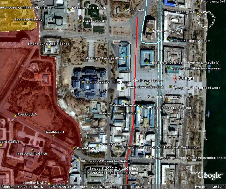
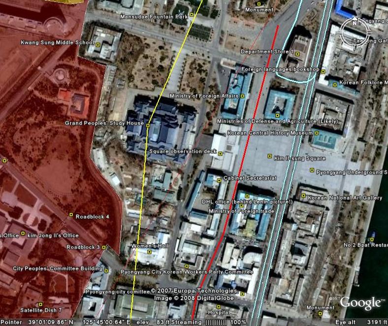 This map covers North Korea’s agriculture, aviation, cultural locations, manufacturing facilities, railroad, energy infrastructure, politics, sports venues, military establishments, religious facilities, leisure destinations, and national parks. It is continually expanding and undergoing revisions. This is the sixth version.
Additions to the newest version of North Korea Uncovered include: Alleged Syrian nuclear site (before and after bombing), Majon beach resort, electricity grid expansion, Runga Island in Pyongyang, Mt. Ryongak, Yongbyon historical fort walls, Suyang Fort walls and waterfall in Haeju, Kaechon-Lake Taesong water project, Paekma-Cholsan waterway, Yachts (3), and Hyesan Youth Copper Mine.
Disclaimer: I cannot vouch for the authenticity of many locations since I have not seen or been to them, but great efforts have been made to check for authenticity. These efforts include pouring over books, maps, conducting interviews, and keeping up with other peoples’ discoveries. In many cases, I have posted sources, though not for all. This is a thorough compilation of lots of material, but I will leave it up to the reader to make up their own minds as to what they see. I cannot catch everything and I welcome contributions.
This entry was posted on Sunday, November 11th, 2007 at 1:07 pm and is filed under Advertising, Agriculture, Architecture, Automobiles, Aviation, Banking, Black markets, Committee for Cultural Relations with Foreign Countries, Communications, Computing/IT, Dams/hydro, Department Store No. 1, Economic reform, Education, Electricity, Energy, Environmental protection, Film, Finance, Fiscal & monetary policy, Football (soccer), Forestry, Gambling, Gasoline, General markets (FMR: Farmers Market), Golf, Google Earth, Hana Electronics Company, Health care, Hoteling, Hwanggumphyong and Wihwado Economic Zones (Sinuiju), Hyesan Youth Cooper Mine, Kaesong Industrial Complex (KIC), Kim Il Sung University, Korea Computer Center (KCC), Library, Light Industry, Mansudae creative Company (art studio), Manufacturing, Mass games, Maternity Hospital, Military, Mining/Minerals, Ministry of Culture, Ministry of Foreign Trade, Mt. Kumgang Tourist Special Zone, Musan Mine, Music, Nuclear, Pyongyang Embroidery Institute, Pyongyang Film Studio, Pyongyang Informatics Center (PIC), Pyongyang International Information Center of New Techn, Pyongyang International Trade Fair, Pyongyang Metro, Railways, Rason Economic and Trade Zone (Rajin-Sonbong), Real estate, Religion, Restaurants, Sea shipping, Special Economic Zones (Established before 2013), Sports, Steel, Supreme Peoples Assembly, Television, Tourism, Transportation, Water, Wind. You can follow any responses to this entry through the RSS 2.0 feed.
Both comments and pings are currently closed.
