Archive for the ‘Google Earth’ Category

The Hwanggang Dam incident (2009)

Tuesday, September 8th, 2009

UPDATE 3 (2009-9-17): South Korea rules out “water attack”.  According to AFP:

South Korea’s new defence chief said Thursday there was no evidence that the sudden discharge of water from a North Korean dam which killed six southerners was a deliberate attack.

“We have no solid information to say the discharge was for a water attack,” Kim Tae-Young, appointed defence minister on September 3, said in a report to parliament.

He said the dam’s floodgates were opened after it was full of water.

The report tallies with accounts by the North, which said a sudden surge in the dam’s water level prompted an “emergency” release. Seoul officials had previously questioned the explanation of the incident which has strained cross-border relations.

In a related development Thursday, North Korea accepted a protest letter sent by South Korea’s parliament speaker Kim Hyong-O to his northern counterpart, Choe Thae-Bok, calling for a “sincere” apology from its neighbour and a full explanation.

He also suggested that Pyongyang should allow South Korean lawmakers to visit the site for an investigation. There was no immediate response from the communist country.

UPDATE 2 (2009-9-12): North Korean soldiers scouted the Imjin area before the water release.  According to the AFP:

North Korean soldiers scouted the inter-Korean border a day before the North released millions of tonnes of water from a dam, killing six South Koreans, news reports said on Saturday.

Military officials have told legislators that about 10 North Korean soldiers left their observation post and came south close to the military demarcation line dividing the two countries, Yonhap news agency said.

“They reconnoitred the area for about two hours before they returned to the North,” a lawmaker told Yonhap.

UPDATE 1 (2009-9-10): According to Yonhap, South Korean  Unification Minister Hyun In-taek said the incident appears to have been deliberate, although it was still not clear whether it was a “water attack.”  South Korea said Thursday that it will soon decide whether to take legal action against North Korea for its unleashing of water from the dam.

ORIGINAL POST (2009-9-8): Several innocent North and South Koreans were tragically drowned this week along the banks of the Imjin River when the DPRK released approximately 40 million tons of water from its Hwanggang Dam.

According to Yonhap:

The Hwanggang Dam, some 40km north of the border, was reportedly completed in 2007 and can hold up to 400 million tons of water. More than 340mm of rain fell on the region in late August, according to the North’s state television.

The victims were about 25km south of the border when the floodwaters came.

South Korea’s alert system was also faulted. The military detected rising water levels but failed to notify the local government, leaving the campers unattended. Flood alert equipment along the riverside also failed to operate.

The Koreas have no formal accord on controlling the floodgates. Seoul has asked for pre-notification at inter-Korean talks in recent years but the two sides have not been able to settle on technical procedures.

There have been no consultations on the matter since the conservative Lee Myung-bak government came to power in Seoul last year.

If Yonhap and the BBC are correct, this is the Hwanggang Dam’s location (Google Maps). The satellite imagery is old.  More interestingly, there is another dam on the Imjin River just above the DMZ.  It is here. This adds an interesting wrinkle to the story. This means that either the second dam down river from the Hwanggang Dam was either overrun or it was also opened.

Share

Association No. 2 – North Korean loggers in Russia

Wednesday, September 2nd, 2009

tynda-bbc.JPG

The BBC ran an interesting video story on North Korean loggers felling trees in Russia.  Of course this has been going on for a long time. However, this is the first video footage of the logging facilities that has appeared in the Western media.

According to the video, North Korea’s logging concessions are managed by a company called “Association No. 2,” which is housed in a compound in northern Tynda, Russia.  According to the story, Association No. 2 receives 35% of proceeds of logging (appx $7m) some fraction of which is repatriated to the DPRK’s Ministry of Forestry.  Using the video, I located the Association No. 2 compound on Google Earth. Here is an image:

assn2.JPG

(Click on image for larger version.  You can see it in Google Maps here.)

Additional Notes:

1. I have not been able to locate the other North Korean logging camps in Russia.  If any readers can find them, please let me know.

2.  The DPRK appointed a new Minister of Forests last October.

3. Bertil Lintner on North Koreans working in Russia.

4. Andrei Lankov on the loggers.

5. Claudia Rosette on the loggers.

6. YouTube video on NKs in Russia.

Share

Land reclamation in the DPRK

Saturday, August 22nd, 2009

The DPRK has long been pursuing a policy of food self-sufficiency by expanding its stock of arable land via reclamation from the sea.  Below are some of the more notable land reclamation projects.

Taegye Island land reclamation project
About 20km south of Sinuiju is Taegyedo.  According to KCNA, the Taegyedo tideland constructors have recently dammed about 14 kilometers of rough sea to acquire 8,800 hectares of land.  The sea wall makes it possible to protect the farmland from salt damage. Rice has already been planted in the paddy field of 2,600 hectares. A great ring road will circle the entire project and fresh water and sea water reservoirs with shellfish and lobster farms and salt fields will be built.  Here is a Korea story about it.  Here is an image from Google Earth:

taegyedo.JPG

(Click on image for larger version. Coordinates: 39°50’43.01″N 124°14’3.12″E)

Sin Island (probably not as much fun as it sounds)
Prior to Taegyedo, the DPRK reclaimed the Pidansom Tideland–reclaiming 5,500 hectares from the water.  This bought Sindo County ito existance. Here is the location on Google Earth:

sindo.JPG

(Click on image for larger version. Coordinates: 39°47’38.18″N 124°28’11.11″E)

Tasado Tideland reclamation
Appx 1000 hectares.  This is my best guess for the location:

tasado.JPG

(Click on image for larger version. Coordinates: 39°49’17.18″N 124°25’52.14″E)

Kwaksan
Image from Google Earth:

kwaksan.JPG

(Click on image for larger version. Coordinates: 39°49’17.18″N 124°25’52.14″E)

Rather than using its comparative advantages  (via international trade and investment) to increase living standards at home, the DPRK has chosen to invest its capital in the production of agricultural goods.  Unfortunately this is yet another case where poor economic policy makes perfect political sense.

Share

The new Majon Hotel

Thursday, August 13th, 2009

UPDATE: With a big hat tip to Korea Beat, I have located the new Majon Hotel in North Korea.  See a satellite picture of it here.  Here are some pictures  of the inside c/o the Choson Ilbo.

ORIGINAL POST:

majon.JPG

According to the Choson Ilbo:

North Korea on Monday celebrated the completion of what it has hailed as a “world-class” hotel in the Majon resort area in Hamhung, South Hamgyong Province, North Korean Central Broadcasting reported Tuesday.

The broadcast said the Majon Hotel “is equipped with top-class accommodation and recreation facilities such as an indoor swimming pool, a steam sauna, a public bath, and even a beach resort.”

Although it did not specify the size, the broadcast called the hotel a “creation that illuminates the era of the Korean Workers’ Party,” suggesting it is relatively luxurious.

The completion ceremony was attended by key leaders of the party, the government and the military, including People’s Armed Forces Minister Kim Yong-chun, party Secretaries Kim Ki-nam and Choe Thae-bok, and Prime Minister Kim Yong-il.

In a congratulatory speech, Kim Ki-nam said the hotel was “another proud creation built thanks to leader Kim Jong-il’s love of the people in the military-first era.”

The Majon resort area where the hotel is located is famous throughout North Korea. It has a sandy beach park 6 km long and 50-100 m wide along the east coast and 16 recreational buildings, 13 public buildings, and a boy scout camp — all on an area measuring some 3 million sq. m.

Here is the official KCNA press coverage:

Majon Hotel Completed

Pyongyang, July 28 (KCNA) — Modern Majon Hotel sprang up at the Majon recreation ground in Hamhung City, a good destination of holiday makers.

The hotel has all modern cultural and welfare facilities such as bedrooms of various sizes and styles, restaurants, indoor swimming pool, saunas and bath facilities. It has also a bathing resort. This is another edifice to be proud of in the era of Songun, a product of General Secretary Kim Jong Il’s love for the people as he has always worked hard to provide people with better conditions for their recreation.

A ceremony for the completion of the hotel was held on the spot on Monday.

Present there were Premier Kim Yong Il, Minister of the People’s Armed Forces Kim Yong Chun, Secretaries of the Central Committee of the Workers’ Party of Korea Choe Thae Bok and Kim Ki Nam, department directors of the C.C., WPK, officials concerned and employees of the hotel.

Kim Ki Nam in his speech at the ceremony underscored the need for the staff of the hotel to steadily improve the service so that Kim Jong Il’s boundless love may reach people as quickly as possible.

At the end of the ceremony the participants looked round the interior and exterior of the hotel.

Here is the location of the beach.  Some travelers have been there, but photos of the area remain scarce.  If anyone comes across a photo of the hotel, or can identify the exact location, please let me know.  Parts of the beach and surroundings are still not in high resolution on Google Earth, so this also complicates the discovery of the hotel’s location.

Read the full stories here:
N.Korea Completes ‘Luxury’ Resort Hotel
Choson Ilbo
7/29/2009

KCNA

Share

Google Earth fun: Kim Jong il and the Rev. Moon

Wednesday, August 5th, 2009

I made some historical satellite discoveries recently:

1. The birthplace of the Rev. Sun Myung Moon, founder of the Unification Church

rev-moon.JPG

Click image for larger version
Click here to see location in Wikimapia
Reference pictures: here and here 

2. The (probable) birthplace of Kim Jong-il in Russia*

kji-brthplace.JPG

Click image for larger version
Click here to see location in Wikimapia
Click here for source material

* This is the location of the Soviet 88th Brigade camp, which housed of Chinese and Korean guerrillas. Kim Il-sung was stationed here as a battalion captain in the Soviet Red Army.  Locals claim Kim Jong-il was born here on February 16, 1941 (Although the DPRK government claim Kim Jong-il was born on Baekdu Mountain in Japanese occupied Korea a year later, on February 16, 1942). Residents of the town claim that his brother “Shura” Kim fell into a well and died, and was buried there; however other sources claim that Kim Jong-il’s sibling drowned in a pool in Pyongyang in 1947.

Share

Traditional Korean burial mounds

Tuesday, July 21st, 2009

When North Korea Uncovered (Google Earth) was featured in the Wall Street Journal last May, one aspect in particular generated some skepticism: the identification of thousands of burial mounds scattered across the DPRK’s mountains.

burial-mounds-am.JPG

(Click on image for larger version)

IHS Jane’s Senior Image Analyst Allison Puccioni, in a blog post for CNN’s Anderson Cooper, confimrmed that this unusual looking landscape is composed of burial mounds.

“It’s sadly ironic that in a time where people can no longer sustain themselves the North Koreans still manage to bury their dead with the painstaking tradition of their culture. The burial mounds are unusually close together probably to save land for agriculture” (Allison Puccioni).

Also, here is a photo of these types of burial mounds in the DPRK from ground level:

dprk-graves2.jpg

(Click on image for larger verison)

The Korean tradition of burying the dead in burial mounds up on mountain tops and slopes goes back many years.  Here is a brief history in wikipedia.

Share

DPRK land rezoning policy

Monday, July 13th, 2009

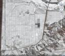
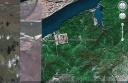
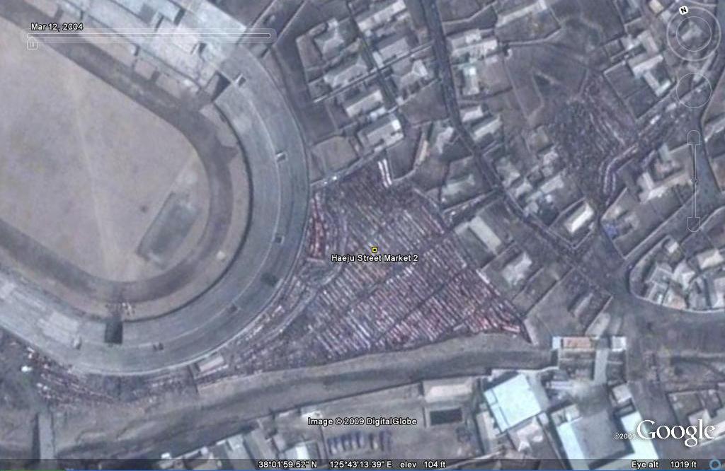
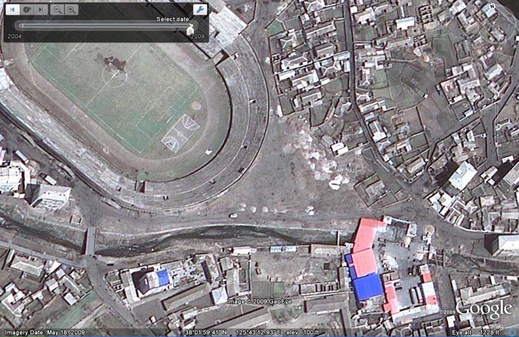
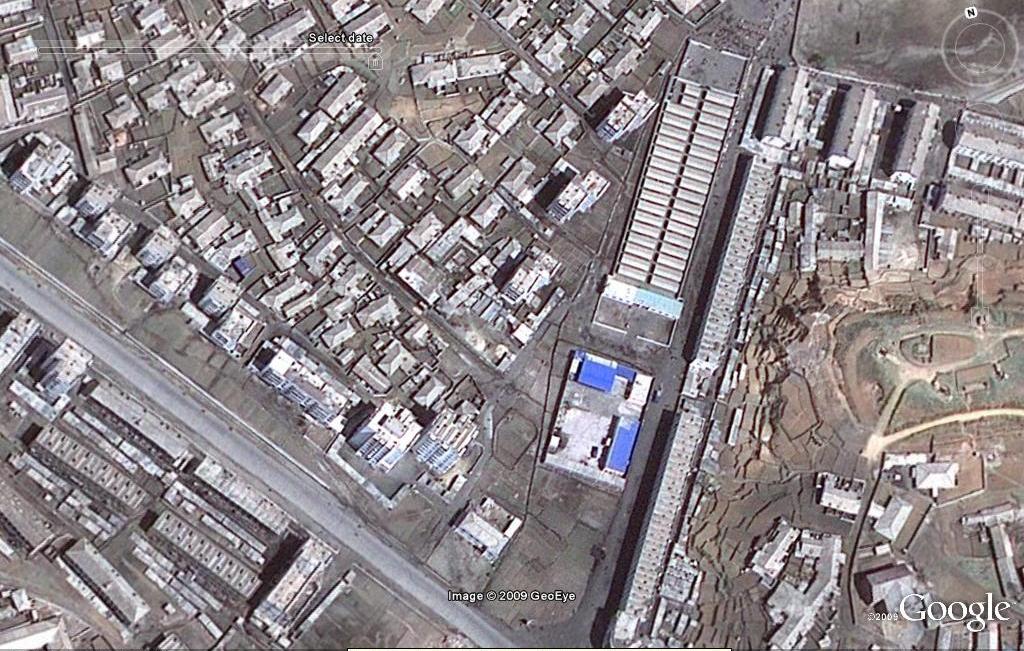
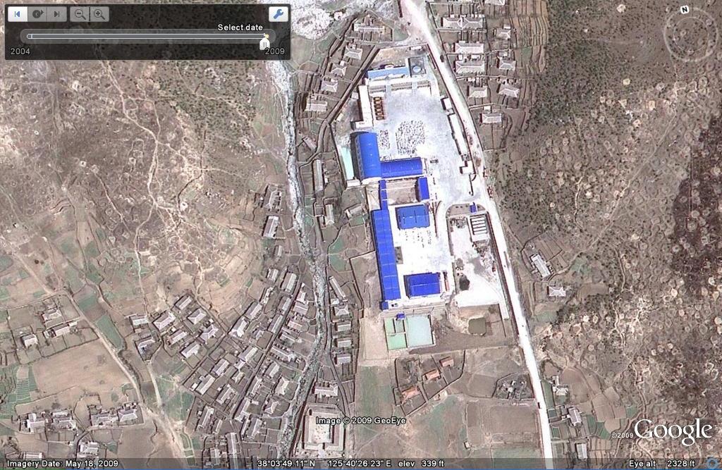
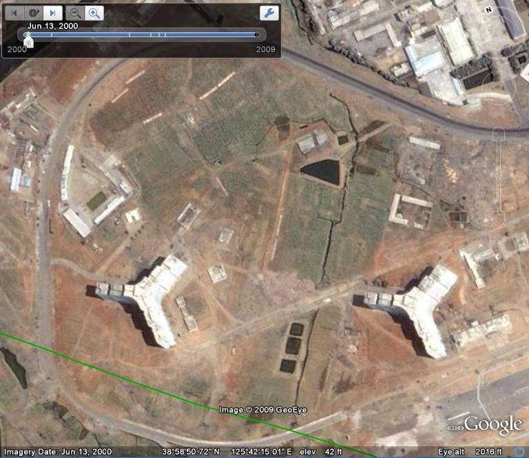
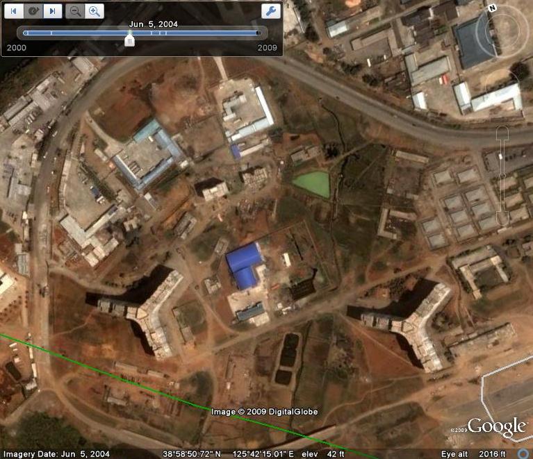
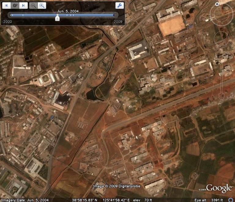
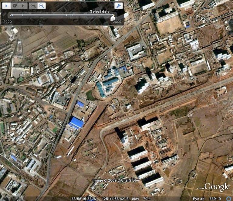
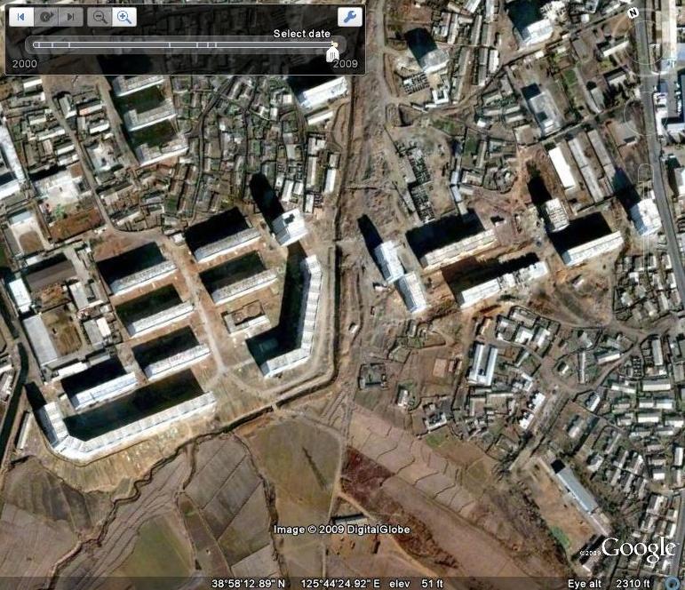
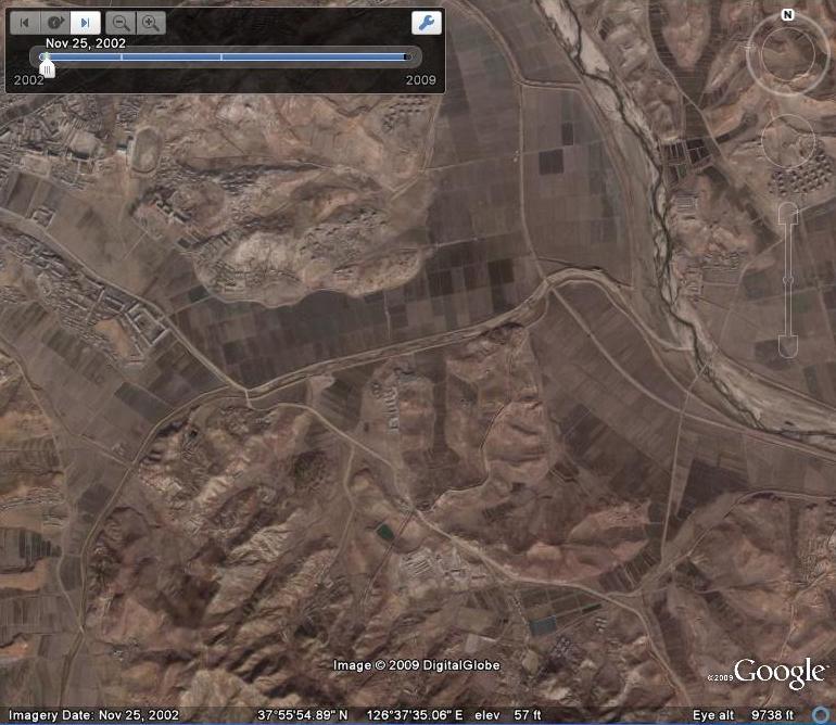
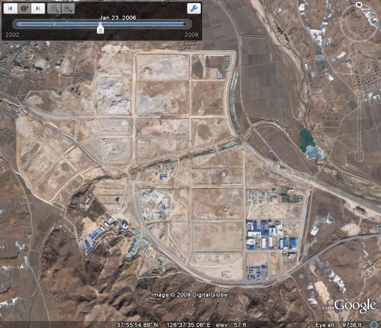
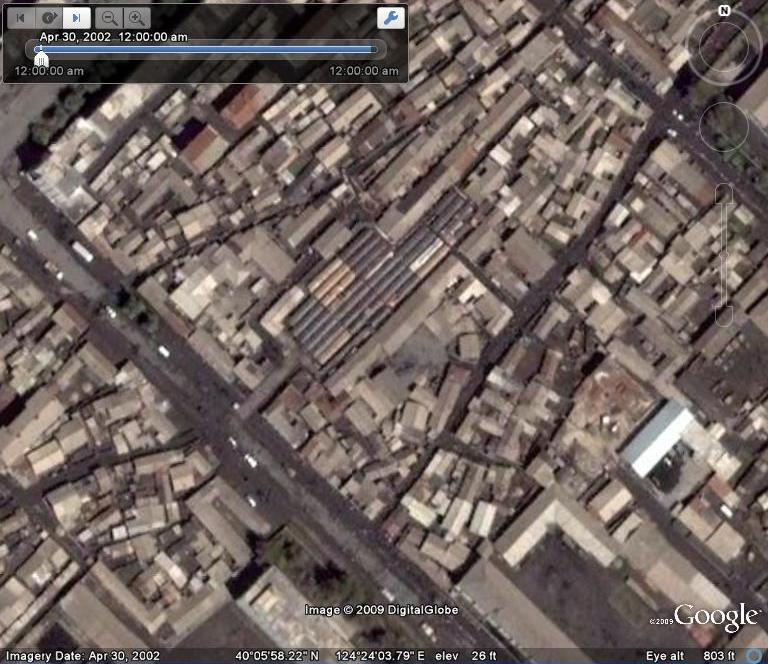
For at least a decade the DPRK has been rezoning state-owned agricultural land into standard grids.  Here is a good example of the policy as seen from Google Earth (Ryokpho, Pyongyang):


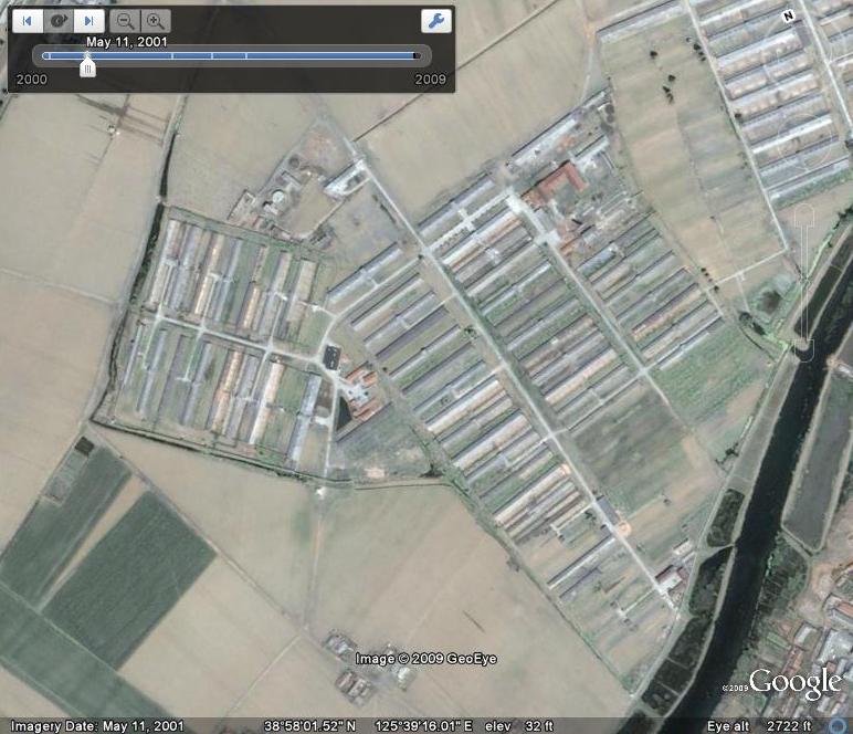
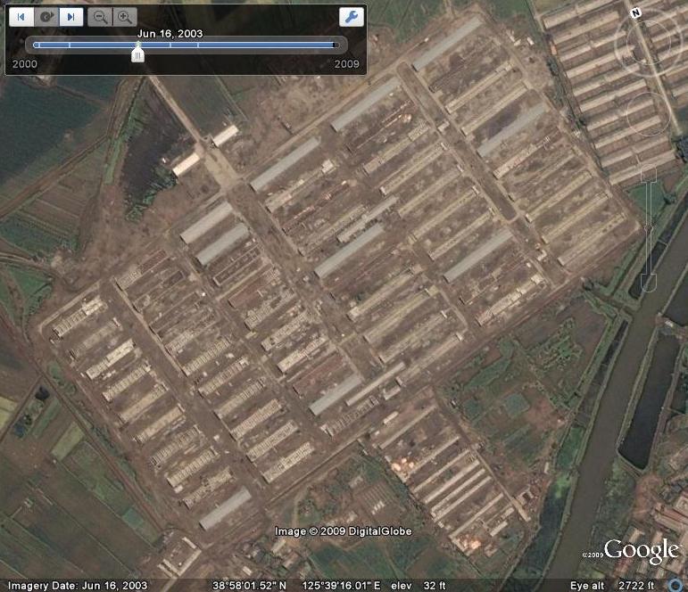
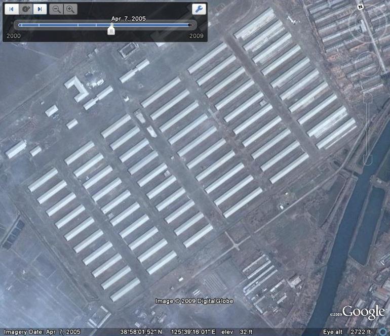
Before (2000-11-5)            After (2005-8-5)

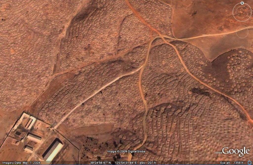
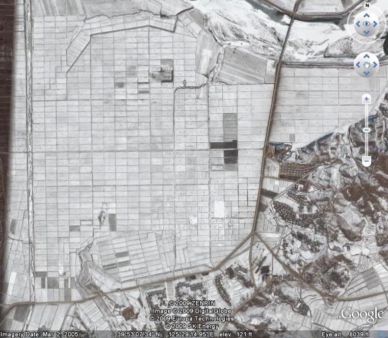
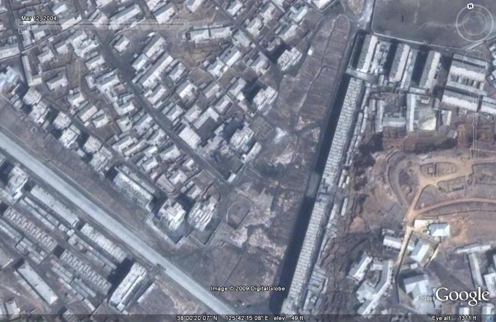
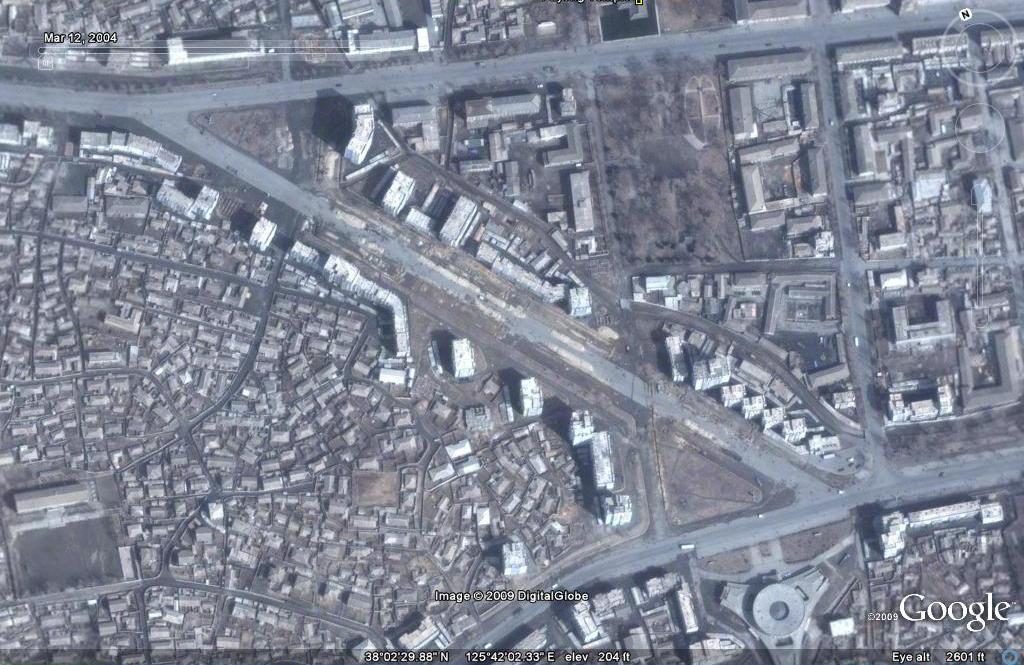
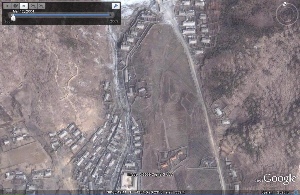
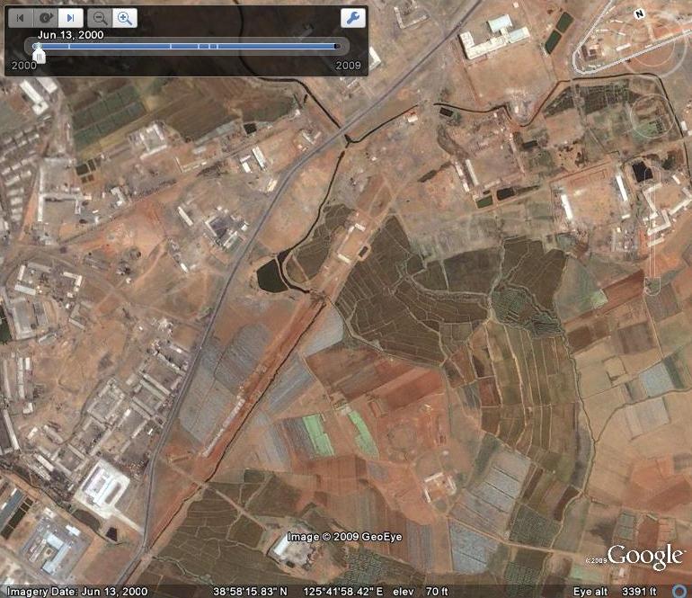
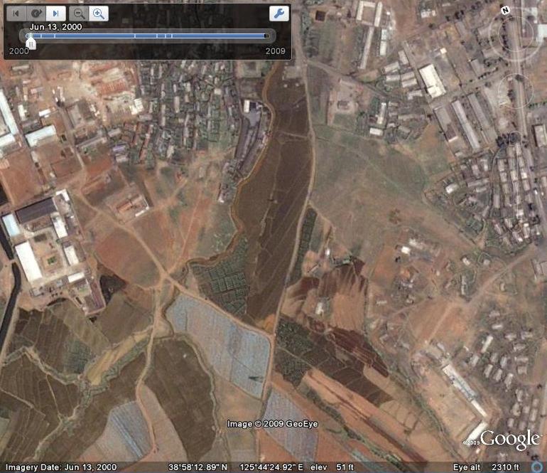
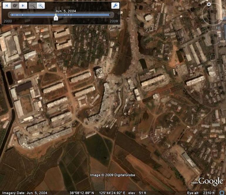
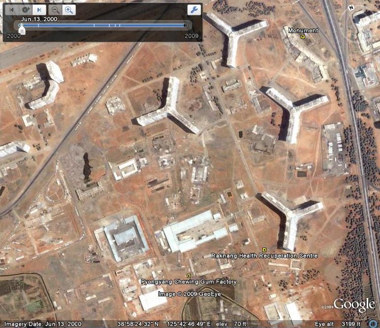
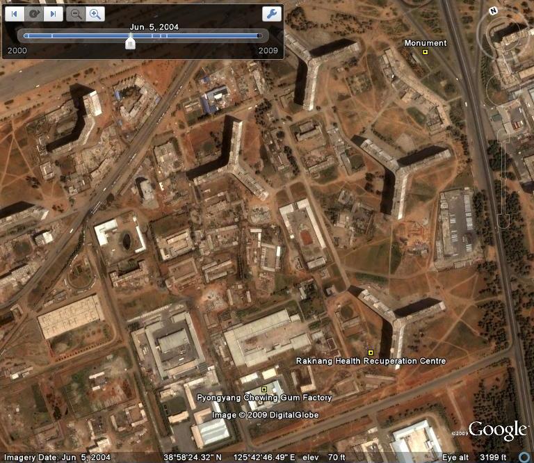
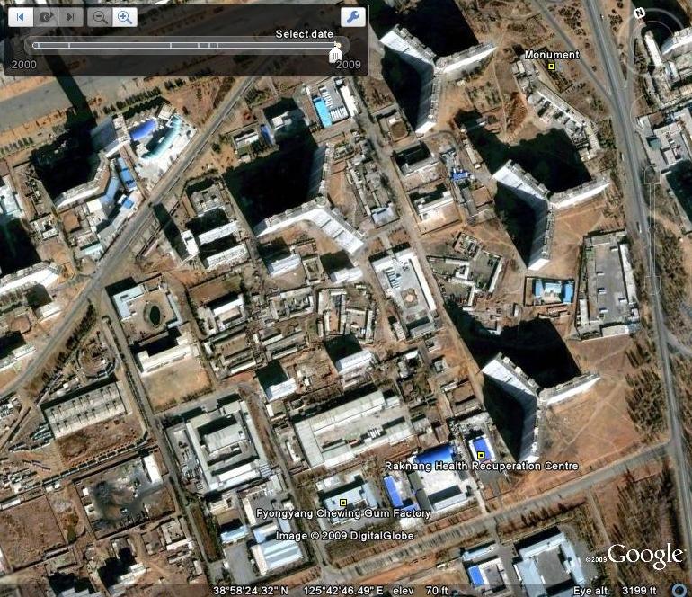
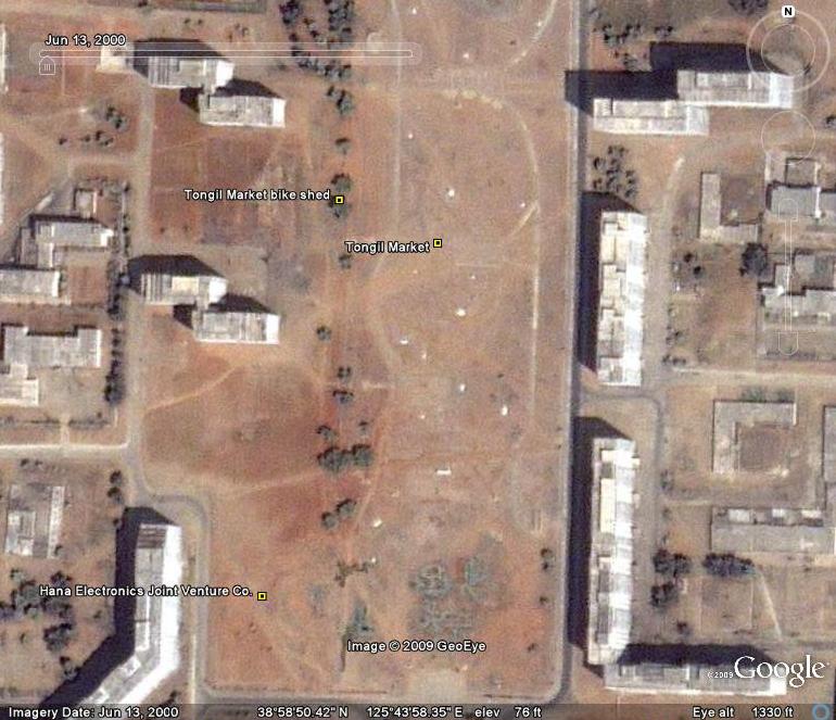
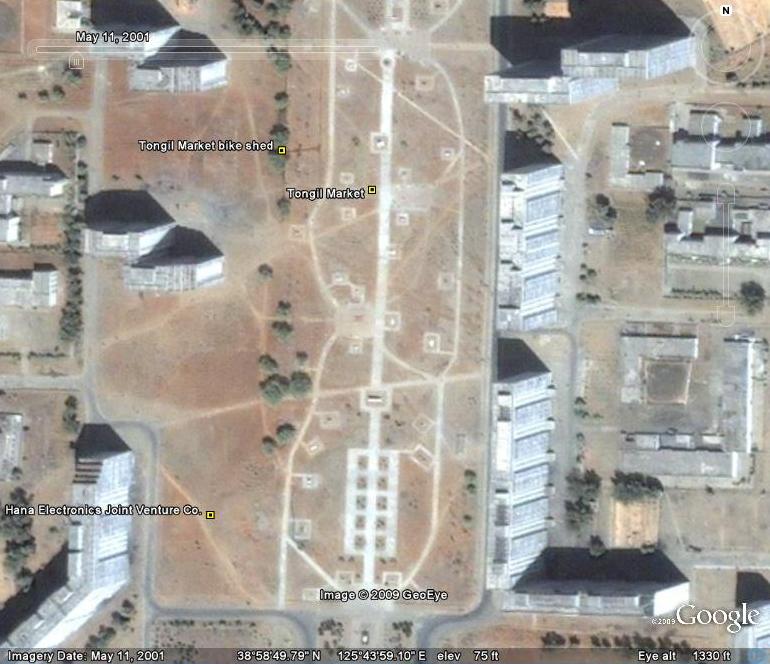
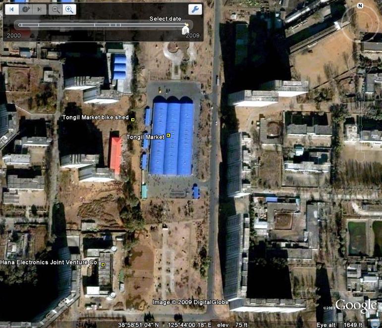
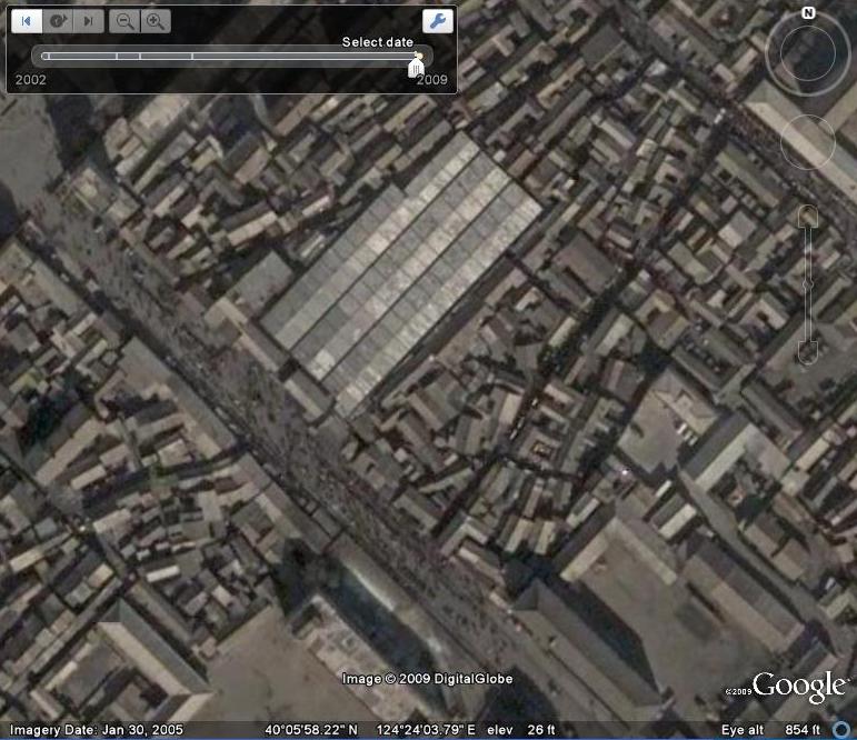
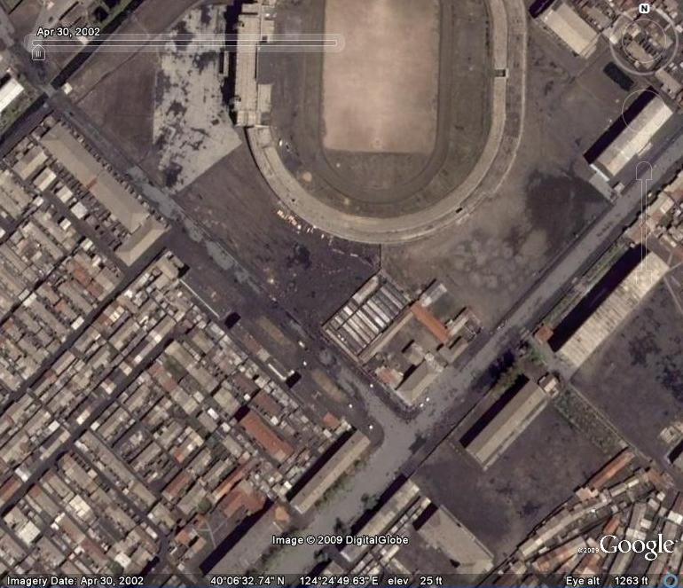
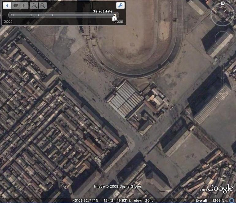
The Handure Plain is one of the most “popular” areas where this policy has been carried out:


handure-plain.JPG

Here are some KCNA stories about the policy:

Rural Community of Korea Conspicuous with True Feature of Socialism
Pyongyang, July 6 [2009](KCNA) — The three revolutions, ideological, technical and cultural, have been pushed ahead and the assistance to and leadership over the countryside by the government stepped up, making it possible to assimilate the peasantry to the working class and industrialize agriculture rapidly and change the looks of the countryside day by day.

The fields under cultivation have been standardized like a paduk (go) board and unique gravity-fed waterways and many dwelling houses have been constructed across the country to convert the countryside into a socialist fairyland good to live in.

Typical of such model farms are the Migok Co-op Farm in Sariwon City, North Hwanghae Province, the Sinam Co-op Farm in Ryongchon County, North Phyongan Province, the Chongsan Co-op Farm in Kangso County, South Phyongan Province and the Samjigang Co-op Farm in Jaeryong County, South Hwanghae Province and others.

The Migok Co-op Farm has constructed dwelling houses in tiers so as to see the vast field and the road leads to each block and each house. A large orchard has been arranged in front of the village and a resting site built on the hill covered with forests.

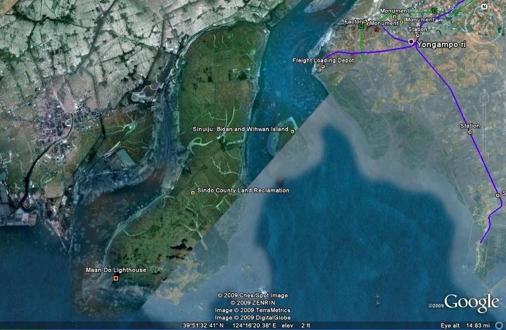
Wonderful is the landscape of the Ryongchon Plain in North Phyongan Province where life-giving water is flowing along the Paekma-Cholsan Waterway and rice plants are growing well in the standardized paddy fields.

Poman-ri, Sohung County, North Hwanghae Province, was once an out-of-the-way place with nothing to show except wild geese flying over it. But it, with a fishing farm in front of it and a forest of fruit trees in the rear, is now called one of the eight beautiful spots in the Songun era.

The horizon in Handure Plain and sea of potato-flowers at Taehongdan are also well known among the Koreans as ones of the above-said beautiful spots.

Electricity finds its way to all parts of the country and methane gas has been introduced to villages. Increasing in number are apricot tree villages and houses with many pear trees and persimmon trees where all sorts of flowers are in full bloom in spring and are pervaded with fruit aroma in summer and autumn.

While giving field guidance to the Tongbong Co-op Farm in Hamju County, South Hamgyong Province some time ago, General Secretary Kim Jong Il said that the farm village with cozy modern dwelling houses built on a sunny hillside and the co-op fields where green crops are swaying and farm machines are working look like a beautiful picture. He stressed that this is the laudable real feature of our socialist rural community.

Today the agricultural working people of Korea are all out to bring about a turn in the agricultural production with the responsibility for being in charge of the main front for the building of a great, prosperous and powerful nation.

Land leveling and rezoning completed
Pyongyang, May 16 [2000](KCNA) — The appearance of the land in North Phyongan Province, the northwestern part of the DPRK, has changed beyond recognition.

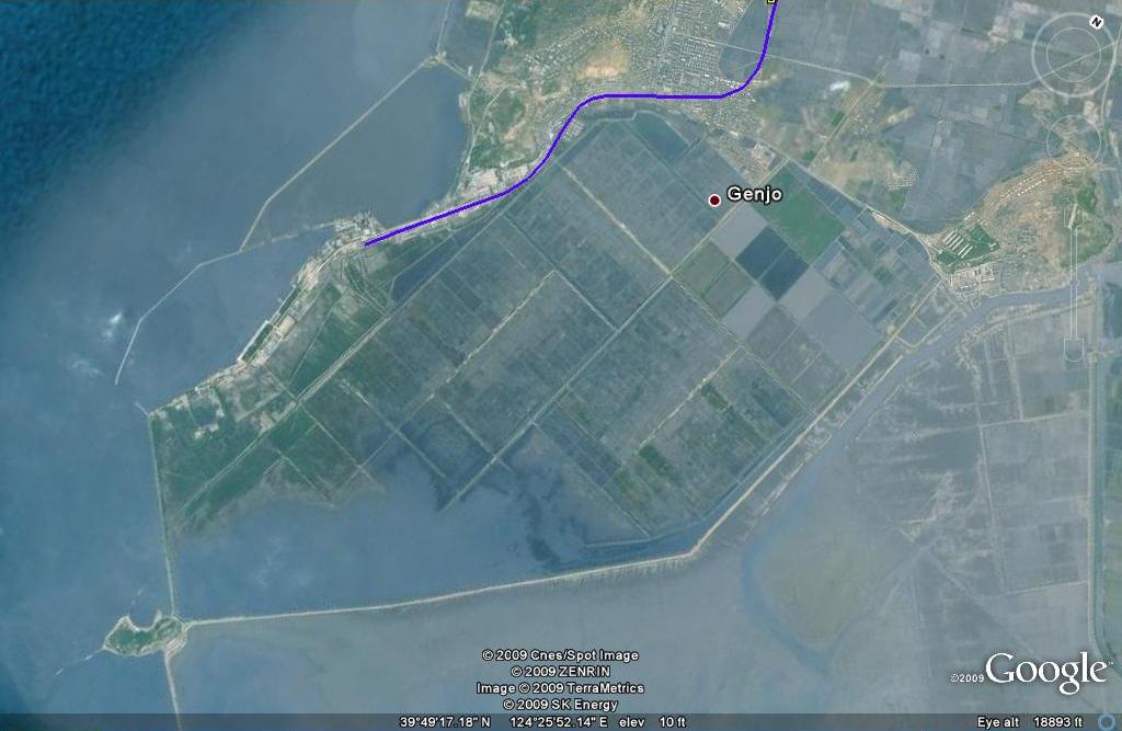
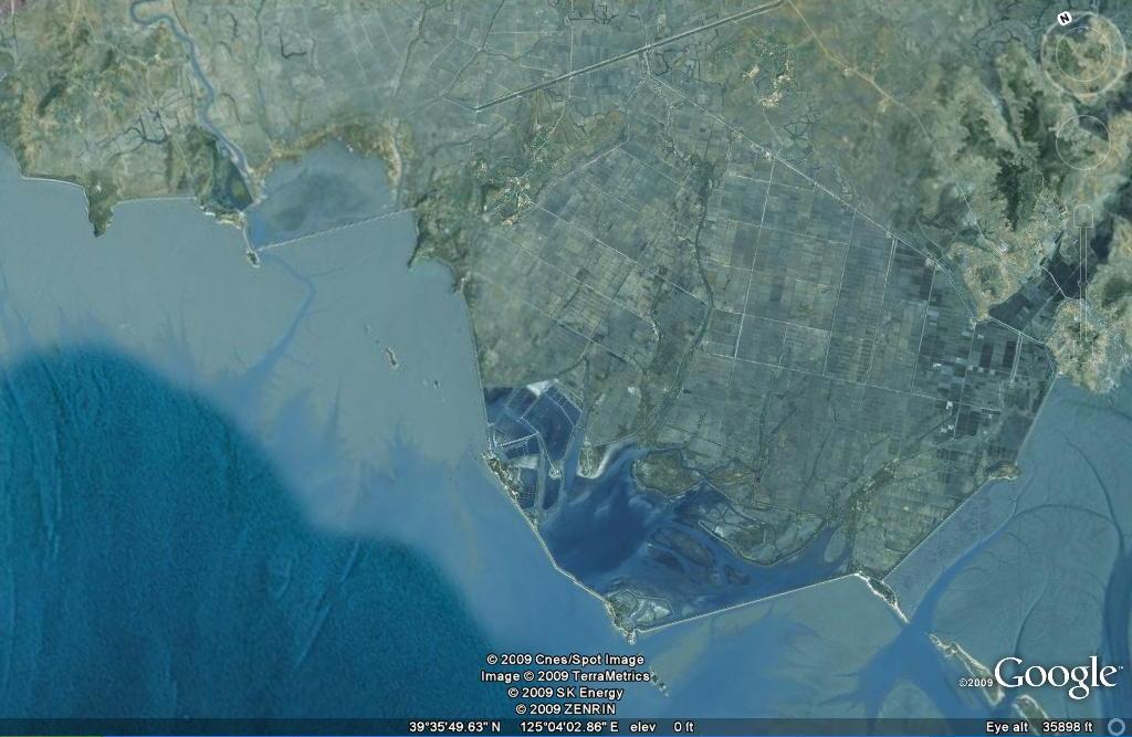
Not only the cooperative fields on the west coast from the 40 km-long Unjon plain and Pakchon plain to Ryongchon plain but the fields in in-between and mountainous areas from Kwanha plain in Nyongbyon and Handure plain in Thaechon to Hongnam plain in Uiju have turned into a vast expanse of fertile rice fields.

At least 50,000 hectares of rice fields were leveled and rezoned into standardized fields, each with a thousand or hundreds of Phyong (one Phyong is six square feet).

Thousands of hectares of land came under plough after the disappearance of a lot of ridges between paddies and swamps.

This great change in the land in north Phyongan province is a shining fruition of the gigantic and bold operation and plan of the great leader Kim Jong Il.

After finding great possibilities of increasing grain production at present in the land leveling and rezoning project, he wisely led the overall project. He set the target and stages of the project and clearly taught details of the project such as order of work to be done, the area of a field and even the issue of increasing the fertility of the rezoned fields. He saw to it that necessary forces and means for carrying out the project were sent there and it was undertaken as a movement involving the entire party and army and all the people.

As a result, the gigantic nature-transforming project was successfully completed under the difficult conditions where the province was hard pressed for everything.

Farming preparations are now in full swing in these fields.

Active land rezoning in North Phyongan Province
Pyongyang, November 30 [1999](KCNA) — Land rezoning is in full force in North Phyongan Province, northwestern part of Korea.

This project is being carried on the basis of the experience of last year’s land rezoning in Kangwon Province with the nation-wide attention and support. Through it, land covering more than 9,000 hectares was readjusted in the last one month.

In particular, the Kangwon provincial workers engaged in land improvement in Tongrim county removed the soil of 1.062 million cubic metres and rearranged 1,100 hectares of land in a short span of time by displaying mass heroism and devotion.

The workers from Pyongyang are now carrying out their daily quota 2 times that in October and have readjusted in the main the Handure plain in Thaechon county covering some 1,600 hectares, in 40 days or 50.

Thus as many as 13,000 fields were reduced to 3,000 fields and scores of hectares of cultivated land obtained.

The workers of Nampho city and North Hwanghae Province in charge of land rezoning in Nyongbyon and Ryongchon counties have achieved successes in their work by introducing working methods suited to the topographical peculiarities and soil conditions.

Thanks to the efforts of the workers from different provinces, the patches are being rearranged into the standardized fields, 1,000-1,500 Phyong each, one after another in every part of North Phyongan Province.

Unfortunately, these types of policies, even if successful, are only a third- or fourth-best option for feeding the people.  These policies will never deliver the levels of food and wealth that are possible through opening up the country to investment and trade.  Even without opening up to foreign investment/trade there are a number of policies the DPRK could enact to increase the efficiency of domestic food markets.  It does not take a nobel prize winning economist to realize that the DPRK does not have a comparative advantage in food production.

UPDATE 1 : A valued reader recently made me aware of this informative article by Aidan Foster-Carter on the topic of land-rezoning (April 19, 2001):

TO ENGAGE or keep your distance? The administration of U.S. President George W. Bush has stirred up the Korean peninsula with its aloof, if confused, attitude to North Korea. But if Bush won’t engage, others will. The European Union, keen to be a player on the peninsula, will send Swedish Prime Minister Goran Persson to Pyongyang and Seoul in early May to discuss missiles and mediate.

The goal of engaging North Korea is to force an end to dangerous behaviour. This matter is not merely military. North Korea is now in its sixth year of a food crisis which has cost the lives of at least one million people. Flood and drought may have been the catalysts, but the root problem remains the doubly disastrous mix of rigid planning and the whim of leaders, where pet projects get the lion’s share of resources while less favoured regions and sectors are deprived.

The projects that paved the way for the food crisis included years of the overuse of inorganic fertilizers, which resulted in physical and chemical damage to soil; poorly planned hillside terracing; and the tearing down of forests to plant maize in the mountains. All this on top of the follies of collective farming, restricting private plots and markets.

North Korea is an ecological disaster, with the policies of Kim Jong Il and his father, late leader Kim Il Sung, to blame.

The follies continue. When Persson meets Kim Jong Il, let him ask about land rezoning, a project, more or less, to bulldoze North Korea flat and turn it into farmland. As the official Korean Central News Agency describes it, this is “a grand nature-harnessing work, to level at least 400,000 patches and remove 30,000 kilometres of ridges between rice fields which had been handed down through generations, and repartition them into standardized fields, each covering 1,000-1,500 pyong” (3,300 to 4,950 square metres). In Kim’s plan, 100,000 hectares are due for flattening; 27,000 hectares have already been flattened, “changing their appearance beyond recognition.”

In a speech to the annual Supreme People’s Assembly on April 5, Prime Minister Hong Song Nam made clear the plan was central to the coming year’s priority to “develop agriculture to resolve the food problem of the people.”

The policy was first carried out in marginal farming areas in Kangwon. Kim delivered a speech on the plan in January last year–from the middle of a field. Standing in shiny shoes amid a sea of mud, Kim saw scenic nooks and hillocks bulldozed flat, and rejoiced.

The policy has now spread to Hwanghae, the rice-basket province in the southwest that is crucial to national food supply. On March 25, Vice-Marshal Jo Myong Rok, the country’s top military official, who met President Bill Clinton at the White House last October, led a rally to promote more levelling before rice transplanting begins in May.

The theory: The creation of larger fields will allow the mechanization of agriculture and “free farmers from backbreaking work,” as Kim said in his speech, repeating one of his father’s favourite mantras. But mechanization is a pipe dream when the most hi-tech tool that most workers are armed with is a trowel, and tractors lie rusting for lack of fuel.

THE PROBLEM WITH KIM’S PLAN

The North Korean leader knows this, and has called for “strenuous efforts to repair [them] . . . as has been instructed before”. He has pledged to supply 160 imported tractors, although North Korea is desperately short of foreign exchange and this could hardly help the whole country, just a favoured few.

Kim admits that rezoning won’t raise yields immediately: “It is natural that the fertility of rezoned fields decreases,” he said. So “the soil must be enriched by the application of rich organic fertilizer through a mass movement.”

In fact, Kim has another motivation, and it has nothing to do with yields or labour-saving. “The fields in the Handure Plain . . . have been laid out well in regular shapes . . . . I am greatly satisfied,” he said in last year’s speech. “The plain has been completely transformed . . . . It would be impossible now for a former landowner to find his land, if he were to come with his land register to take his land back. The Handure Plain now looks like the land of a socialist state.” Intriguing that the Dear Leader thinks the landlords who fled in the 1940s, or their children, might come back and claim their own–as has happened in Eastern Europe since communist rule collapsed. Is he afraid?

Worse, in North Korea’s current conditions, the attempt to mechanize agriculture makes no economic sense. Experts including Marcus Noland of the Institute for International Economics in Washington say that Pyongyang should not even try to grow food. Instead, they say, it should seek comparative advantage in exporting light industrial goods, and import grain with the foreign exchange it earns, like South Korea.

As Persson knows, all who aid Pyongyang–and it’s a long list–have the right to insist that policies and practices which killed a million or more North Koreans cease. The EU has added leverage in that it may soon propose the establishment of diplomatic relations with Pyongyang. The UN World Food Programme has its largest operation in the world there, and though other organizations such as Oxfam have pulled out, the WFP and many other non-governmental organizations look to be there for the duration. Yet rather than voice their concerns and insist on tighter conditionality, they have been coy to challenge the irrational policies which caused the crisis and which still go on.

The solution found in China and Vietnam–the development of family farms and markets–offers a good model. In January, Kim hinted that new times demand new methods. In reality, informal markets are the only thing standing between most North Koreans and starvation. But to openly embrace them seems to be too much for Kim Jong Il.

As for land rezoning, it’s a new nadir. The fields of what is now North Korea were shaped by generations of human labour down the centuries, and bulldozing them is comparable to the Taliban’s irreversible destruction of Afghanistan’s prized Buddhas.

What can be addressed is the fact that seven-year-old North Koreans, according to data analyzed by Nicholas Eberstadt of the American Enterprise Institute, are 20 centimetres shorter and 10 kilogrammes lighter than their southern peers. Persson and Kim should have a lot to talk about.

UPDATE 2: I recently obtained a copy of the North Korean book, Songun Banner of Victory. It referred to the land rezoning program in Kangwon in purely revolutionary terms, stating it had “obliterated the last trace of feudal land ownership”.

Share

North Korea on Google Earth v.18

Thursday, June 25th, 2009

North Korea Uncovered version 18 is available.  This Google Earth overlay maps North Korea’s agriculture, aviation, cultural locations, markets, manufacturing facilities, railroad, energy infrastructure, politics, sports venues, military establishments, religious facilities, leisure destinations, and national parks.

This project has now been downloaded over 140,000 times since launching in April 2007 and received much media attention last month following a Wall Street Journal article highlighting the work.

Note: Kimchaek City is now in high resolution for the first time.  Information on this city is pretty scarce.  Contributions welcome.

Additions to this version include: New image overlays in Nampo (infrastructure update), Haeju (infrastructure update, apricot trees), Kanggye (infrastructure update, wood processing factory), Kimchaek (infrastructure update). Also, river dredges (h/t Christopher Del Riesgo), the Handure Plain, Musudan update, Nuclear Test Site revamp (h/t Ogle Earth), The International School of Berne (Kim Jong un school), Ongjin Shallow Sea Farms, Monument to  “Horizon of the Handure Plain”, Unhung Youth Power Station, Hwangnyong Fortress Wall, Kim Ung so House, Tomb of Kim Ung so, Chungnyol Shrine, Onchon Public Library, Onchon Public bathhouse, Anbyon Youth Power Stations.

Share

Heju market update

Wednesday, June 10th, 2009

Google Earth has recently updated the imagery of the DPRK’s southern city of Haeju.  Here are some of the new attractions (click images for larger version):

Mass rally:
In front of Haeju’s Kim il Sung statue

haeju-mass-rally.JPG

Market update:
The street market near Haeju’s stadium has been closed

haejumarketgone1.JPG haejumarketgone2.JPG

However, a new market opened up in the south of the city:

haeju-new-market.JPG haeju-new-market2.JPG

In fact, they seem to have constructed a new market district in the city:

new-haeju-market-street.JPG haeju-market-street-2.JPG

New factory:
Located in the Haeju’s north west. I am unsure what they manufacture:

haeju-new-factory.JPG haeju-newfactory.JPG

Share

North Korea’s construction boom

Thursday, May 21st, 2009

Using Google Earth’s feature which allows users to view the same location at different points in time, we can see that Pyongyang has experienced quite a construction boom in the 21st century, particularly in the southern Rakrang District.  Below I have posted some of the more interesting discoveries (dates are in the upper right corner of the images). 

Tudan Duck Farm (Pyongyang)
tudan-duck-farm1.JPG tudan-duck-farm2.JPG tudan-duck-farm3.JPG

Rakrang District
rakrang1.JPG rakrang2.JPG rakrang3.JPG

rackranga1.JPG rackranga2.JPG rackranga3.JPG

rackranghousing1.JPG rackranghousing2.JPG rackranghousing3.JPG

rackrangb1.JPG rackrangb2.JPG rackrangb3.JPG

Tongil Market (Rakrang)
tongilmkt1.JPG tongilmkt2.JPG tongilmkt3.JPG

Russian Orthodox Church (Rakrang)
orthodoxchurch1.JPG orthodoxchurch2.JPG orthodoxchurch3.JPG

Kaesong Industrial Zone
kaesongzone1.JPG kaesongzone2.JPG

Sinuiju market growth
sinuijumkt1.JPG sinuijumkt2.JPG

sinuijumkta1.JPG sinuijumkta2.JPG

Many have speculated that the construction boom is related to the DPRK’s plan to achieve a “strong and prosperous state” (Kangsong Taeguk) by 2012—the 100th birthday of the country’s eternal president, Kim il Sung.

UPDATE: Jon Herskovitz writes in Reuters that all this construction is actually making pepole worse off.  According to the article:

The programme to forge a “great and prosperous nation” by 2012 was a central part of the mandate for Kim Jong-il, son of the founding president, when parliament extended his official leadership in March for five years.

The goals for the broken economy are lofty. The North wants to revamp its railways, coal mines, steelworks and electrical supply, end hunger and strengthen its already large military.

“The Korean people will strikingly demonstrate their heroic stamina as socialist workers … and thus fling open the gate to a thriving nation in 2012,” North Korean state media said in a report to mark May Day.

Foreign residents in Pyongyang say streets are being spruced up and buildings refurbished to mark the 100th birthday of Kim Il-sung, who died in 1994 but is still considered president for eternity of Asia’s only communist dynasty.

“The 2012 project fits into these themes: glorification of the past, and if past history is any guide, the wasting of huge sums on useless monumental edifices,” Marcus Noland, an expert on the North’s economy with the U.S.-based Peterson Institute for International Economics, wrote in an email.

“The problem for North Korea will be financing this initiative.”

North Korea’s centrally planned economy has shrunk significantly since the rise to power in 1994 of Kim Jong-il, whose government quickly stepped away from early attempts at economic reform which might have threatened its grip on power.

Money from overseas has been drying up as the prickly North has backed away from an international disarmament-for-aid deal and the impact of U.N. sanctions, tightened after its April 5 test launch of what many saw as a disguised long-range missile.

… 

Those likely to bear the brunt of this shift in internal spending will be the most impoverished in the already destitute state, analysts said.

They will be forced to mobilise for government projects, leaving their local and mostly rural economies to stagnate, which means less food in a country that for years has been unable to produce enough grain to feed its 23 million people.

Read the full article here:
North Korea’s prosperity push could raise poverty
Reuters
Jon Herskovitz
5/12/2009

Share