UPDATE 3 (2014-4-4): Here is the Red Cross report on the Ryongchon explosion (PDF).
UPDATE 2 (2004-4-22): Apparently these buildings have not aged well.
UPDATE 1 (2009-11-6) : This post was picked up by Yonhap:
N. Korea’s Ryongchon blast site reborn with Soviet-era complexes
Yonhap
Sam Kim
ORIGINAL POST (2009-10-28): In 2004 much of the town of Ryongchon was tragically destroyed in a large explosion. Here is the Wikipedia page on the disaster if you would like a quick reference.
I compiled a couple of images to construct this “before” picture of Ryongchon:
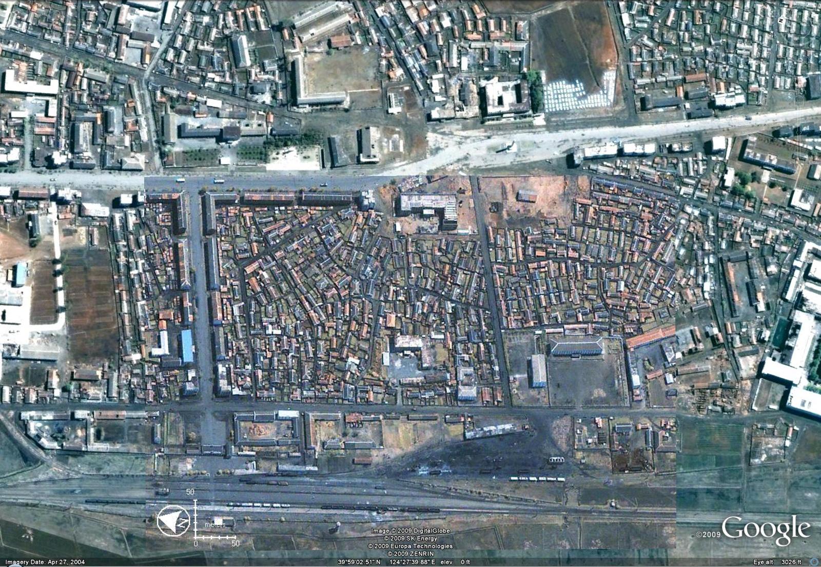
(Click image for larger version)
Notice that the center of town is composed largely of traditional houses.
Here is the first “after” image (which is the default image on Google Earth):
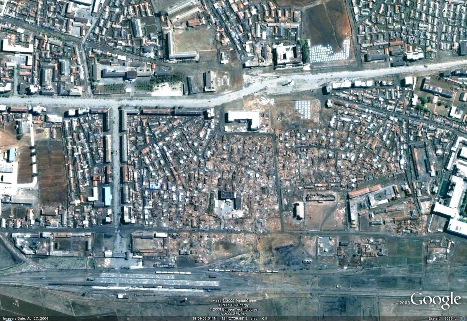
(Click image for larger version)
As you can see a large number of traditional houses were destroyed as well as a school.
Below I have compiled more recent images to show how the city was reconstructed. Gone are the traditional homes. They have been replaced by typical Soviet-style apartment blocks:
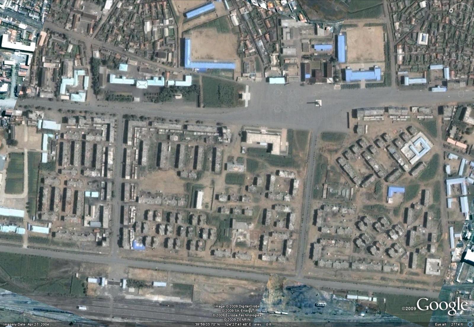
(Click image for larger version)

What is that statue in the middle of the road in a plaza like area? Seems like if you’re not careful you might run into it while driving. I’m also curious about the 7 circles painted on that same area, left of the statue.
Anyone know where I can get a decent on the ground photo to add to that Wikipedia article?
Here’s a photo of the reconstructed town by kernbeisser:
http://www.flickr.com/photos/kernbeisser/2420693612/
how did you get this ? my google earth doesn’t show it… it only shows the old picture
are you sure you’ve got Google Earth version 5 or better? It allows you to see historical imagery past and present.