Google Earth has posted new high-resolution imagery of the DPRK. I have not finished going through all of it, but here are some special points of interest:
1. Here is a fantastic image of Lake Chon atop Mt. Paektu—now in high-resolution:

Click image for very large version of the picture.
In Google Earth’s 3-D environment it really is stunning (particularly if you have a large monitor). It is understandable why Kim Jong-il would like everyone to believe he was born here! Actually, his official birthplace is visible just south-east of the lake at 41.863137°, 128.159740°. His actual birthplace in Russia (48.737285°, 135.740998°) is still not available in high-resolution imagery.
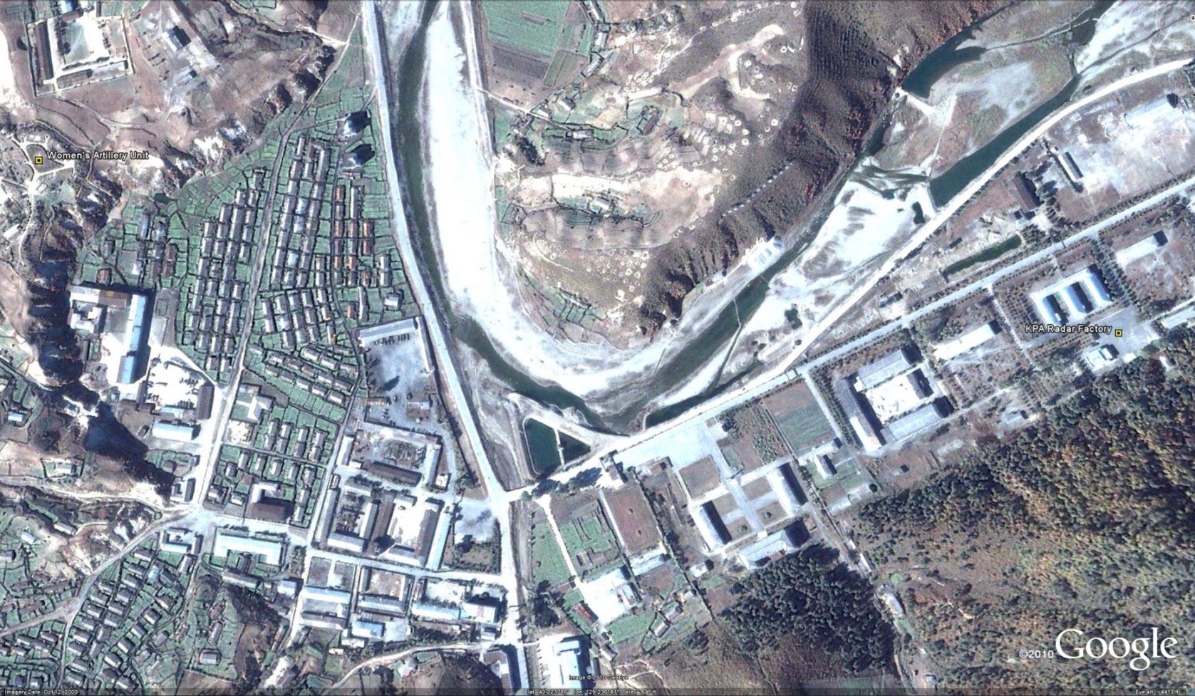
2. Previously, I posted a story about a Myanmar military delegation visit to the DPRK. Among the many locations visited by the delegation were stops with a women’s artillery unit and KPA “Radar Factory” in Taegwan. Since Taegwan is now in high resolution, I have identified these locations (40.228782°, 125.237944°).
You can learn more about the military delegation here.
3. Taegwon is also home to a leadership train station for Kim Jong-il complete with security perimeter, tunnel exit, and underground storage facility (40.305198°, 125.205716°):

I have one minor quibble with the new imagery, and that is that I cannot access the “newer” (by date) low-resolution imagery that has been covered up by the “older” (by date) high-resolution imagery. For example, just south of the Taegwan leadership train station mentioned above it appears the DPRK has upgraded the roads and is in the process of building a new train station (or runway). I was able to go to Wikimapia and download the “old” image before it vanished down the memory hole. Below are the visuals I am discussing:


The image on the right, in low resolution, has been replaced by the older, high-resolution image on the left. As we can see from the image on the right, there is a new train station or runway in this location. The reason I am able to conclude that the picture on the right is newer (by date) is because the road has been upgraded. This means they are building up, rather than building down, the facility in question.
4. Kangryong county, which contains the peninsula and islands from which the DPRK shelled Yonpyong Island, are now all in high resolution on Google Earth. Check out how militarized these pieces of real estate are.

