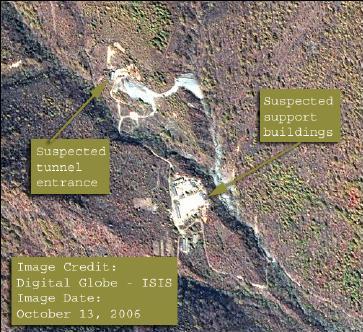
This is an “after the explosion” satellite image taken from The Institute for Science and International Security (ISIS).
Click here to download it onto your own Google Earth.

This is an “after the explosion” satellite image taken from The Institute for Science and International Security (ISIS).
Click here to download it onto your own Google Earth.