No sooner do I publish an article on the Sinuiju International Economic Zone (read it here at 38 North) than the DPRK releases more information on it.
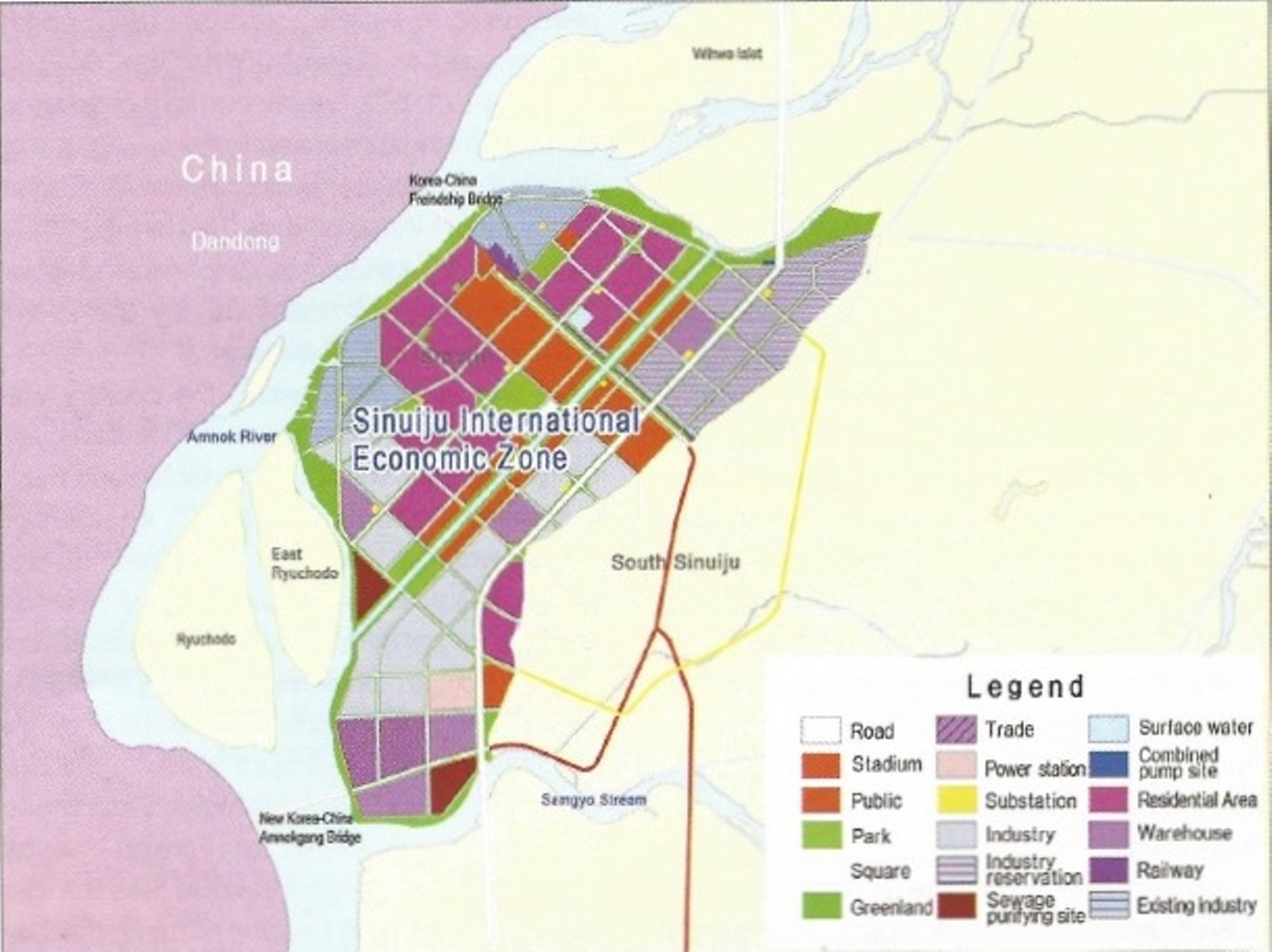
In the December issue of Foreign Trade (2015 No.4), the DPRK includes information on the zone, including this map:
UPDATE: Dr. Haggard uploaded a nicer version of the image which you can see here.
The map indicates that the downtown area of Sinuiju and the western coast down to the new Amnok River Bridge will constitute the first phase of development. Space has been allocated for trade, industry, sewage, warehousing, and other designated areas. The map also indicates a new road is to be built linking the Wihwado Economic Zone (to the north east of the Sinuiju SEZ) with the new Yalu River Bridge (which has yet to be opened for business) and Ryongchon County.
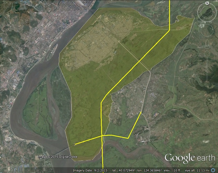
Here is a satellite image of the specific areas being designated for the first phase of the zone with proposed roads added for visual effect:
This is what the article had to say about the zone:
Sinuiju International Economic Zone
Located in a border area, the zone has a bright prospect for the development of water and marine transport. Its development area is 40km2.
The Zone is a flat area composed of deposits of organic fine sand in the mouth of the Amnok. The average height of ground inside the bank is 45m, geomorphology is 0-.7% and the average height above the sea level is up to 100m.
Its annual average duration of sunshine 2,427 hours, annual percentage of sunshine is 58% and annual average precipitation is 1001.5 mm.
The first and second annual main winds are northeast and and north winds respectively. It has the northeast and north winds in winter and southwest wind in summer in the main.
The Sinuiju International Economic Zone will provide opportunity for bonded processing, bonded transportation, trade and financial business, tourism, hi-tech industry, and various other business activities.
To this end, it is planned to develop the zone into a comprehensive economic zone with a large-sized latest IT industry area, competitive production area, exports processing area, cargo area, trade and financial area, public service area, tourist area and a bonded port, and into an international city with an airport and trade port.
Encompassing the whole of Sinuiju and two ri surrounding it, the zone is already furnished with infrastructure. However, it is necessary to upgrade the existing infrastructure and expand its capacity and build in its suburbs on a preferential basis.
The items of the construction of infrastructure include port, airport, railways, roads, power station, heating, and gas-supply system, telecommunications (international, domestic, mobile and computer network), and water supply, sewage-treating and garbage disposing systems.
As the zone has rich and good workforce whose education level is higher than secondary education, and many competitive heavy- and light-industry factories and enterprises around it, the investment by foreign business will be cost-effective and conducive to its development.
Previous posts on the Sinuiju International Economic Zone can be found here. Previous posts on the Sinuiju Special Administrative Region can be found here.
The JoongAng Ilbo has additional information here.
