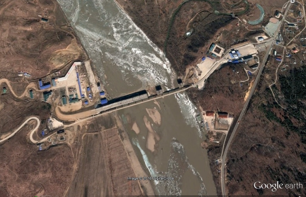
Pictured Above (Google Earth) the Hunchun-Rason Bridge: (L) 2009-5-28 (R) 2016-3-19
UPDATE 6 (2016-3-19): New satellite imagery shows progress being made on the bridge, but it seems to be moving slowly.
UPDATE 5 (2014-6-28): According to Xinhua, the bridge is to be replaced:
China and the Democratic People’s Republic of Korea (DPRK)agreed on Friday to jointly build, manage, and maintain a new border bridge between thetwo neighbors.
An agreement was signed by Chinese Ambassador to the DPRK Liu Hongcai and DPRKVice Foreign Minister Pak Myong Guk, the official KCNA news agency reported.
The Quanhe-Wonjong bridge over the Tumen River, which was built in the 1930s, hasbeen in a shabby condition.
UPDATE 4 (2012-10-26): Rajin-Wonjong Road Opened to Traffic


Pictured Above (KCNA): Photos of the official opening of the renovated road
According to KCNA:
Rajin-Wonjong Road Opened to Traffic
Pyongyang, October 26 (KCNA) — A ceremony took place in Rason City of the DPRK on Friday to open to traffic the Rajin-Wonjong road in the Rason Economic and Trade Zone jointly developed and operated by the DPRK and China.
Attending it from the DPRK side were Jo Jong Ho, chairman of the Rason City People’s Committee, officials concerned and people of the city and from the Chinese side were Zhang Anshun, secretary of the Yanbian Autonomous Region, Jilin Province, Committee of the Communist Party of China, Chen Weigen, vice-governor of the Jilin Provincial People’s Government, Tian Baozhen, consul-general to Chongjin, and other officials concerned.
Congratulatory speeches were made at the ceremony.
Hwang Chol Nam, vice-chairman of the Rason City People’s Committee, said it is very glad that the road has been opened to traffic amid great expectation and interest of the peoples of the two countries at the historic time when the traditional bilateral friendship is growing stronger.
The whole course of the road project served as an occasion in deepening the friendly relations of the DPRK and China and displaying the validity and vitality of their joint development and operation of the Rason Economic and Trade Zone, Hwang added.
The road helps increase the cargo traffic and transport of freight from northeastern China to Rajin Port and promote the development of economic relations between the two regions, including tourism, he said.
Zhang Anshun warmly welcomed the opening of the road on behalf of the Jilin Provincial Party Committee and Government, saying that it is a good start for the progress of the zone to be jointly developed and operated by the two countries.
Zhang hoped that the two countries would develop the economy and their peoples would enjoy happiness under the guidance of the Communist Party of China headed by Hu Jintao and the Workers’ Party of Korea headed by Kim Jong Un.
Members of the platform cut the tape to declare the opening of the road. Then vehicles passed along the road amid display of fireworks.
Here are additional articles that mention the bridge:
1. Recent articles on Rason’s future (2011-5-4)
2. Rason’s Chinese investor tour (2011-4-4)
UPDATE 3 (2011-9-7): A reader send in a photo of the road:
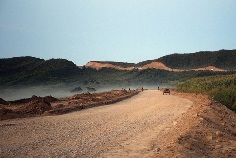
Click image to see lager version and source.
UPDATE 2 (2010-6-23): Hunchon Bridge opens. According to Kyodo (via Breitbart):
China has repaired a bridge in Hunchun at the Chinese and North Korean border, giving it a safer access to North Korea for use of Rajin port to ship coal to Shanghai, according to Jilin Province officials.
China paid 3.6 million yuan ($528,526) to repair the bridge over the Tumen River, a project jointly pursued with North Korea, the officials said Tuesday.
Work was completed June 14.
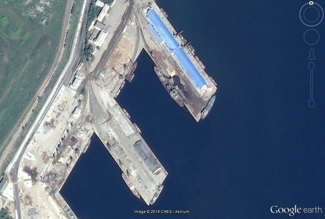
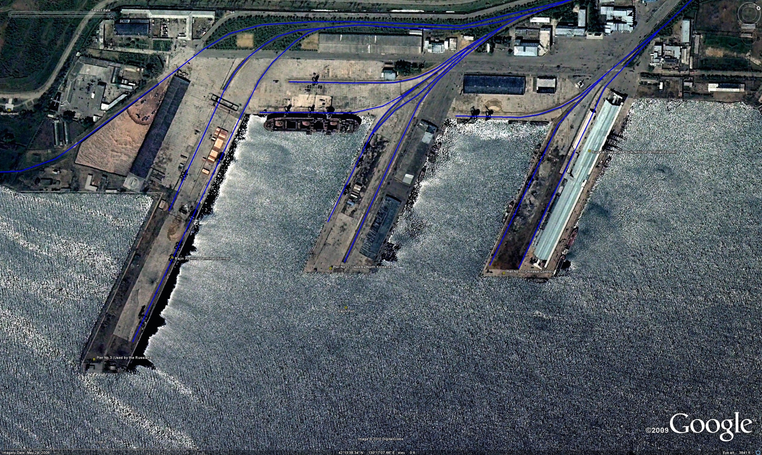
The bridge serves as a gateway to Pier No. 1 at Rajin port, which a Chinese company has obtained the right to use for 10 years.
In April, the Chinese government approved a plan to transport coal and other items produced in Jilin to Shanghai via Rajin in northeastern North Korea.
China and North Korea have been in talks about financing of a plan to build a 50-kilometer road leading to the port, the officials said.
UPDATE 1 (2010-6-6): DPRK border bridge to reopen this month, highway to border opens in October
By Michael Rank
A bridge on the Chinese-North Korean border that will take traffic to the North Korean port of Rajin is due to reopen at the end of this month, while a highway from the Jilin provincial capital of Changchun to the border city of Hunchun 珲春 will open in October, according to Chinese reports here and here.
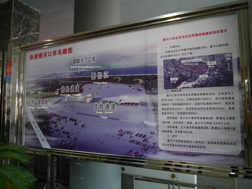
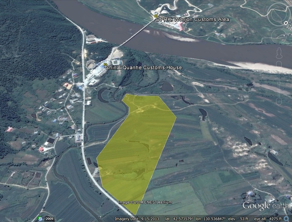
As NKEW reported in April, the 70-year-old bridge over the Tumen river near Hunchun is being rebuilt as part of a reported $44 million plan to modernise the road from the border to Rajin. Built during the Japanese occupation in 1938, the bridge is 535 metres long and 6.6 metres wide, and joins the Chinese border post of Quanhe 圈河 with the North Korean town of Wonjeong 원정.
The highway will open on October 1, China’s national day, and will cut the journey time from Changchun to Hunchun from eight hours to five, the report said. But it indicated that the 60-km road from the border to Rajin, said to be mostly unpaved and prone to frequent accidents during rain, would not be ready by then.
A Chinese company, Chuangli Group, based in Dalian in Liaoning province, was reported in March to have signed a 10-year deal to lease a pier at Rajin (also known as Rasŏn or Rajin-Sŏnbong), giving China access to the Sea of Japan for the first time since the 19th century when the Qing imperial government signed treaties under duress from Japan and Russia.
ORIGINAL POST (2010-4-13): Bridge on China-North Korea border being renovated
By Michael Rank
A 70-year-old bridge on the Chinese-North Korean border is being renovated to improve transport to and from the North Korean port of Rajin 라진 (Rason [Raseon]/Rajin-Sonbong) which a Chinese company has taken over on a 10-year-lease, a Chinese website reports.
The bridge over the Tumen river near the city of Hunchun 珲春 in Jilin province will be reopened at the end of June after almost five months of work. Built during the Japanese occupation in 1938, the bridge is 535 metres long and 6.6 metres wide, and joins the Chinese border post of Quanhe 圈河 with the North Korean town of Wonjeong 원정. The report gave no details of costs but said it was being renovated under a deal between the cities of Hunchun and Rason 라선. It said the bridge would help to boost trade in both Hunchun and Rajin and in the region generally.
The refurbishment of the bridge is part of a reported $44 million plan to modernise the road from the border to Rajin.
Ahn Byung-min, an expert on North Korean infrastructure at the Korea Transport Institute, was quoted by the Korea Herald as saying a senior Chinese local government official had told him that the governor of Jilin had signed an agreement to invest 300 million yuan in expanding and paving the road to Rajin.
A Dalian-based company named Chuang Li agreed in 2008 to revamp the road in exchange for leasing a pier at Rajin. “Chuang Li isn’t a company big enough to afford the road construction, so the Jilin government took on the direct investment instead,” Ahn said.
Additional Information:
1. The existing 60-km road is mostly unpaved and prone to frequent accidents during rain.
2. The coordinates of the new bridge are 42°34’4.45″N, 130°31’24.16″E. You can see it on Google Maps here. Thank you for the tip, Mr. Cha.
3. There are a couple of more bridges in the area: here (which looks like it has been unused for some time) and here.
4. Photos of the construction opening ceremony are here.